|
Initial Spanish version: Tuesday April 28th, 2009
ROMAN AQUEDUCTS IN HISPANIA
English version's last updating: Sunday April 28th, 2024
Note: In this work we use the word "aqueduct" in the strict etymologic sense of the word, meaning "water duct", and not necssarily meaning canal over a succession of more or less impressive arcades.
Signs, notes & abbreviations: The sign §, usually reserved to indicate paragraphs, is used here to indicate the number of the hydraulic structure inside each chapter; the traditional English spelling Saragossa (in Latin, Cæsaraugusta) is preferred to Zaragoza; TM abbreviates 'municipality'; PK, kilometric point; EF, 'railway station'; "comarca" is translated as 'district'; "acequia", a canal or ditch generally destinated to irrigation is kept in Spanish, being rather specific; "azud" is translated as 'weir'; "albufera" is translated as 'lagoon'.
Transcriptions from Arabic: ŷ transcribes the consonant "ŷin", phoneme inexistent in modern Spanish, but very similar to French or English "j"; the superindex "c" transcribes the consonant "cain", phoneme inexistent in Indo-european languages; long vowels are shown super imposing a trait over the corresponding short vowel. The alif maqṣūra is transcribed "à", as usual.
Coordinates: in the Iberian Peninsula has just been introduced a new cartographic Datum for the coordinates UTM (Universal Transverse of Mercator), which means new formulæ to convert the geographic spherical coordinates to UTM cartesian coordinates. As in this website UTM coordinates of many points were included, now I aggregate to each coordinate of datum ED50, valid at the date of the first redaction, the equivalent coordinate in the new Datum ETRS89.
Extract
Deliberately omitting, as well known and amply studied, the aqueducts of Tarraco, Segovia, Emerita Augusta, Sexi/Almuñécar, here are treated, with varying depth, 43 other hydraulic structures, of which three are waterwheels of a later age, while the also later artifice of Juanelo is unique in its design. The Roman origin is not contrasted in § 7, § 13, § 15 and § 17.The § 13 and the § 18 refer to water reservoirs, with no aqueduct known. The same can be said from Chapter III, § 1.
The § 12, the § 15 and the § 17 are catchment weirs. In the § 15, although the canal is modern, an ancient one must clearly have existed. From § 17 is preserved the medieval mill it fed. If the weir is Roman or not, that’s to be proven by archaeology.Furthermore, in my opinion, given the magnitude of the aqueduct of Peña Cortada, § 19, in the Comunidad Valenciana’s district of Los Serranos - also omitted in (1) -, it deserves more widespread knowledge.
For an overview of the entire Roman Empire the reader is referred to the excellent book cited in the literature (1), a work which, however, includes only eight Roman aqueducts in Hispania: Tarraco, Segovia, Emerita Augusta, Sexi/Almuñécar, Segobirices/Segóbriga, Calagurris/Calahorra, Toletum/Toledo and Gades/Cádiz.
In May 2013, I found the existence of an advance of the doctoral thesis of Juan Carlos Castillo Barranco and Miguel Arenillas Parra Las presas romanas en España. Propuesta de inventario (Roman Dams in Spain. Inventory Proposal). The text can be seen in the website
www.seprem.es
My articles are rather informal, though always trying to be accurate. No help from any institution was received. They span to the entire Roman Hispania.
Index
Aqueducts will be grouped by Conventvs Ivridici, focusing on new or lesser known aspects:
I-Conventvs Ivridicvs I Lvcensis
§ 1.- Water supply to Lvcvs/Lugo
Go to Chapter I
II-Conventvs Ivridicvs II Astvrvm
§ 1.- Water supply to a Astvrica Avgvsta/Astorga
Go to Chapter II
III-Conventvs Ivridicvs III Bracaravgvstanvs
§ 1.- Water supply to Bracara Avgvsta/Braga (Portugal)
Go to Chapter III
IV-Conventvs Ivridicvs IV Clvniensis
§ 1.- Water supply to Clvnia Svlpicia § 2.- Acueducto del Chorrillo en Flaviobriga/Castro Urdiales
Go to Chapter IV
V-1-Conventvs Ivridicvs V Cæsaravgvstanvs: Water supply to Cæsaravgvsta/Saragossa
§ 1.- Canal Alavn/Alagón-Salduie/Saragossa) § 2.- Weir, canal and inverse siphon of Cæsaravgvsta/Saragossa § 3.- Dam of Muel (Saragossa).
Go to Chapter V-1
V-2-Conventvs Ivridicvs V Cæsaravgvstanvs: Other hydraulic infrastructures
§ 1.- Aqueduct of Alcanadre (La Rioja) or Puente de los Moros § 2.- Aqueduct of San Julián or of Calagvrris § 3.- Rivvs Hiberiensis (Añón, Saragossa) § 4.- Aqueduct of Tarraca/Los Bañales (Layana, Uncastillo, Saragossa) § 5.- Water suplly to Bilbilis Avgvsta (Calatayud, Saragossa) § 6.- Arco de la Mora and Acequia de Candevania (Zuera, Saragossa) § 7.- Acequia de Belchite (Saragossa) § 8.- Acequias de Sástago y Escatrón (Saragossa) § 9.- Norias en el Ebro (Velilla de Ebro and Monasterio de Rueda, Saragossa) § 10 y 11.- Weir and y canalizations of Rané, and dam of Las Azubias (Saragossa) § 12.- Aqueduct of Quicena (Huesca) § 13.- Weir of Abrisén or weir of Fañanás (Huesca) § 14.- Aqueduct Albarracín-Cella (Teruel) § 15.- Weir of Agiria (Villafranca del Campo, Teruel) § 16.- Dam of Monforte de Moyuela (Teruel) § 17.- Aqueduct of Peña Cortada (Valencia) § 18.- Aqueduct of San José (La Vall d'Uixó, Castellón) § 19.- Aqueduct of Andelos (Mendigorría, Navarre).
Go to Chapter V-2
VI-Conventvs Ivridicvs VI Tarraconensis
§ 1.- Water supply to Tarraco/Tarragona
Go to Chapter VI
VII-Conventvs Ivridicvs VII Carthaginensis
§ 1.- Aqueduct of Carthago Nova § 2.- Aqueduct of Toledo § 3.- Artifice of Juanelo (Toledo) § 4.- Dam and Aqueduct of Consabura (Consuegra, Toledo) § 5.- Aqueducts of Baeza (Jaén) § 6.- Aqueduct of Valeria (Las Valeras, Cuenca).
Go to Chapter VII
VIII-Conventvs Ivridicvs VIII Emeritanvs
§ 1.- Aqueduct of Augustóbriga of the Vettoni (Bohonal de Ibor, Cáceres).
Go to Chapter VIII
IX-Conventvs Ivridicvs IX Scallabitanvs
§ 1.- Aqueduct of Conimbriga (Condeixa-a-Velha, Portugal) § 2.- Acueducto de San Sebastián o Arcos do Jardim Botânico (Coimbra, Portugal).
Go to Chapter IX
X-Conventvs Ivridicvs X Pacensis
§ 1.- Aqueduct of la Plata (Évora, Portugal).
Go to Chapter X
XI-Conventvs Ivridicvs XI Hispalensis
§ 1.- Aqueduct of Hispalis - Išbīlīa / Sevilla § 2.- Acueducto de Itálica (Sevilla) § 3.- Aqueduct of Onvba AEstvaria - Awnaba Huelva,
Go to Chapter XI
XII-Conventvs Ivridicvs XII Cordvbensis
§ 1.- Aqueduct of Valdepuentes § 2.- Acueducto de Domiciano § 3.- Acueducto de la Fuente Dorada § 4.- La noria Albolafia.
Go to Chapter XII
XIII-Conventvs Ivridicvs XIII Gaditanvs
§ 1.- Aqueduct of Gades/Cádiz § 2.- Acueducto de Bælo Clavdia(Bolonia, Cádiz).
Go to Chapter XIII
XIV-Conventvs Ivridicvs XIV Astigitanvs
§ 1.- Aqueduct of Egabrvm (Cabra, Córdoba).
Go to Chapter XIV
The attached map shows the division of Hispania attributed to Augustus, with the estimated surfaces of the fourteen Conventvs Ivridici, which lasted for centuries. Their grouping into provinces, however, was modified over time.

Hispania divided by Augustus (some authors attribute it to Tiberius) in fourteen Conventvs Ivridici,
grouped into three provinces
---oOo---
Conventvs Ivridicvs I Lvcensis
I-AQUEDUCTS IN THE CONVENTVS IVRIDICVS I LVCENSIS
In this Conventvs was found the Finis Terræ, that is the Northwestern end of Hispania, ans also, near Brigantivm, the most imposing lighthouse of the Roman West: the so called Tower of Hercules.
Its capital city, Lucvs, today's Lugo, was surrounded of a wall only in the Third Cantury AD.

Lugo: an stretch of the wall's topway
Its place name reappears in diverse points of Western Europe, for example, in Luco de Jiloca (Aragon), in Lugdunum Batavorum (Leyden, the Netherlands), en Lugdunum Gallorum (Lyon, France), en Lugdunum Convenarum (Saint-Bertrand-de-Comminges, France), en Ravena (Italy) ... always alluding to the Celtic god Lug. Romanization asked providing thermæ, and though a balneum existed in Lvcvs outskirts, by river Miño, -still visitable- an urban aqueduct remained indispensable.
§ 1.- Aqueduct of Lvcvs Avgvsti/Lugo
Outline of the aqueduct
It took water from several springs in the Agro do Castiñeiro and, with an specvs scarcely 30 cm wide, it described a turn when arriving at present day's Rúa Mazaira. Following the said rúa, it crossed today's street whose name remembers Queen Juana de Aragón y de Castilla, and followed straigtforward to the point
of coordinates: z=466; 43.920329º N; 7.571673º O; X=614 668, Y=4 864 016 (Datum ETRS89). There, the mentioned Rúa Mazaira, and also the aqueduct, performed a new eastwards turnabout, corssing present day Camino Real in z=464; 43.020426º N; 7.568058º O; X=616 677, Y=4 764 078 (Datum ETRS89), and followed the same outline till arriving to Rúa da Milagrosa, punto: z=466; 43.020879º N; 7.567528º O; X=616 720, Y=4 764 129 (Datum ETRS89).
In brief: the aforementioned geographical coordinates, reduced to coordinates UTM (Datum ETRS89) are, respectively:
X=614 668, Y=4 864 016
X=616 677, Y=4 764 078
X=616 720, Y=4 764 129
The aqueduct turned again in this crossroad so as to follow the said Rúa da Milagrosa, passing before the church of this Marian advocation, and followed straighforward till crossing calle Julia Minguillón. A short elevated stretch was required for saving the slope in taday's plaza de la Milagrosa Foundation slabs have been found measuring 1.20m saquare, separated 2.70 m,; therefore, the existence of of stone arcades was supposed. It is indeed a likely supposssition, but nothing bars that the modes flow passed in wooden stretches, as in Tarraca (tady's Los Bañales in Layana, Aragon); see in thei ssame study Cahpter V-2, § 4). The maximum height of the waterbed over the land in Rúa da Milagrosa was estimated in scarcely 4 m.

Outline of the aqueduct according an informative poster
Since crossing calle Minguillón, there is an outline cahnge pointing to Rúa Seoane, and prolonging its straght direction we should reach the city's walled enclosure by the gate called Puerta de San Fernando or Puerta del Príncipe Alfonso (alluding to the son and successor of Queen Isabel II). A great inscribed slab remebers the visit of King Juan Carlos with occassion of circa the bimillenary of the foundation of Lvcvs Avgvsti, datable ~15 a BC, just at the end of the Cantabrian wars.

Puerta de San Fernando
Under the arcade, to the left, can be seen the white façade and the tower of San Froilán

Great inscription by the Puerta de San Fernando remembering the visit of King don Juan Carlos I.
ANNO·CIRCA·BISMILLESIMO·POST·CIVITATEM·A·CAESARE·AVGVSTO·CONDITAM
IOANNES·CAROLVS·HISPANIARVM·REX·ET·SOPHIA·REGINA
MOENIA·LVCENSIA·A·ROMANIS·EXSTRVCTA·
PVBLICIS·IMPENSIS·NVPER·RESTITVTA·FELICITER·INVISER-(VNT?)
IVLII·A·D·MDCCCCLXXVI
(At about the year two thousandth after the foundation of the city by Cesar Augustus,
Juan Carlos, King of the Spains, and Queen Sophia,
inspected
the fortifications of Lugo by the Romans constructed,
with public money recently restaurated most happily.
July, Anno Domini 1976.)
Hallazgos en la plaza de San Marcos: consecuencias
Al remodelarse en 2011 la referida plaza, que se extiende delante del pazo o palacio de la Diputación Provincial, se descubrió un tramo de acueducto en buen estado de conservación, cuya alineación prolongaba con gran exactitud la que acabo de referir. Dicha alineación, que forma un ligero ángulo con la fachada del palacio, solamente puede alcanzarse desde la puerta de San Fernando intersectando el sólido edificio del antiguo Hospital de San Juan de Dios y su iglesita anexa de San Froilán

Plaza de San Marcos
At the right of the picture, the Palace of the Diputación Provincial

Plaza de San Marcos: Visor of a fragment of the aqueduct
Could this building be founded over the ancient castellvm acqvæ? If so, it would occupy a position similar to the castellvm aqvæ of Conimbriga (present day's Condeixa-a-Velha, Portugal; see in this same study Chapter IX, § 1). I consider preferable this proposal to supposing the castellvm acqvæ in today's Plaza de Santo Domingo, where a water cistern has been found, its dimensions rather meager for the said purpose.
Till here, the Roman aqueduct would reach a length of ~2.200 m.
Biy I think that there was more aqueduct. To this effect, further on from the buildings block closing the SE side of Plaza de San Marcos, the straight outline passes through (or under) the door nº 9 of Plaza de Santo Domingo, only to follow soon the long Rúa do Progreso (o Progresso).

Continuation of the aqueduct under Rúa do Progreso?
This street inflects at its end when leaving at its left (that is, Esatwards) the Rúa das Noreas (Waterwheels's street). Given this place name, and given the geometric -and thus incontesatble- fact that the said Rúa do Progreso performs in the network street of Lugo the function of a hip line in a rrof, audemus dicere (we dare to say) that the aqueduct would probbaly follow along all the said Rúa do Progreso. And from it would derivate branches to reight and left sides, thus being able to supply r¡the totality of the walled precinct.
The athanors of Bishop Iquierdo Tavira
This prelate occupied Lugo's see since 1748 until his death in 1762. Notable urbanistic improvements he promoted, but our interest is here in the rehabilitación of the Roman aqueduct. To this purpose he ordered some athanors to be made, inspired in much older ones, that we shall see in Flaviobriga/Castro Urdiales (Chapter IV) and in Gades/Cádiz (Chapter XIII). He was thus in line with similar rehabilitation iniciatives already done in several Portuguese cities, as in Æminivm/Coimbra and in Pax Ivlia/Beja, realizations to be seen in this Article, in the Chapters dedictaed to their respective Conventvs Ivridicvs.
Remains of an Iseum
Few meters from the cathedral's apse, a visor allows a sight of a little pool, discovered by archaeologists at shallow depth. Initially, it was supposed to be a baptisterium. Nevertheless, camparing it, for instance, with the Iseum of Bælo Calvdia<, and with other well known ones, we are are no doubt before the pool of another Iseum: there was in Lucvs then, a temple to goddess Isis. Linkig these data to the Egyptian remains found out years ago in the cript of the Basilica of Our Lady del Pilar, in Saragossa, we can imagine the extension attained in Hispania by the cult to Isis, already attested in Pompeii as well as in Rome itself, in the Camp of Mars.

Visor near the apse of Lugo's cathedral
showing the pool of the ancient Iseum
Another notable Iseum ws recently reconstructed in Hungary. Man's names as common even today in the Hispanic world as Isidoro and Isidro (worshipper of Isis), are also remembrances of that cult, whose main sanctuary stood in the island of Filæ, in Asswan (Egypt).
Return to Index
---oOo---
Conventvs Ivridicvs II Astvrvm
II-AQUEDUCTS IN THE CONVENTVS IVRIDICVS II ASTVRVM
The imposition of the Pax Romana was followed in this Conventvs Astvrvm by the massive exploitation of the gold of Las Médulas in the benfit of Rome. Legion VI Victrix settled - since about year 29 BC - nearby, and its fortified camp originated the city of León. But the main receptor of the gold extracted from Las Médulas was Astvrica, that became capital of the Conventvs Astvrvm, apparently sometime between the reigns of Claudius and Vespasianus. Its decadence derived from the exhaustion of the gold of Las Médulas.
§ 1: Water supply to Astvrica Avgvsta/Astorga
Nothing is known of the Roman water supply.
Return to Index
---oOo---
Conventvs Ivridicvs III Bracaravgvstanvs
III-AQUEDUCTS IN THE CONVENTVS IVRIDICVS III BRACARAVGVSTANVS
The doubtlessly Celtic Bracara became soon the most Romanized city of Northwestern Hispania; that is why it enjoyed the since ~14 BC the rank of capital of the IIIrd Conventvs Ivridicvs. Furthermore, when at the end of the IIIrd Century, Emperor Diocletianus reorganized the Empire, he dismembered from the enormous Provincia Tarraconensis its three most Western Conventvs Ivridici, creating with them the new Provincia Gallæcia, and granting the rank of capital city to Bracara, that was endowed with the corresponding Provincial Forum and all the rest of the capitaline infrastructures. And when, centuries later, in the Middle Ages, was born the Kingdom of Portugal, this Conventvs belonged to it from the very first moment, and till our days. The limits of the modern Galicia, in Spain, are quite different to the ones of the Roman province of the same name.
§ 1.- Water supply to Bracara Avgvsta/Braga, Portugal
A Roman therma has been found, that would have not functioned without an aqueduct.
Braga's subsoil is rich in water, and in the Middle Ages the supply did not present main problems. An important advance in the matter of water supply is owed to Dom José de Braganza, archbishop of Braga (1741-1756), who intended to follow in this the example of his brother, the King of Portugal Dom John V, whoe order the construction in Lisbon of the Aqueduct of Aguas Livres. The watertaking promoted by the Archbishop tokk water from the Sete Fontes. The 'cuniculi', the convergent galleries and all the framework of these fountains is doubtlessly Roman. The syistem supplied yet in 1934 nothing less than half a million of liters daily. The Roman ancestor of this aqueduct would be the supplier of the public thermæ found in the Alto da Cividade. In this site of high archaeeologic interest have been found, apart of the said thermæ, and the ruins of the Roman theater, the remains of a settlement of the Final Bronze.
Outline of Aqueduct of the Seven Fountains
The Seven Fountains have circular shape, coverd by a vault, all that carefully executed in carved stones. The main waterduct comes from the first spring (in Portuguese, mãe d'agua) in 'cuniculus', and comes receiving differente affluents, also in 'cuniculus', till arriving to Arial, where there was another spring. Sorrily, this one and part of the 'cunículus' were destroyed, the victims of a building operation. The little canal goes on parallel to Via A18 of the Itinerary of Antonino along Rúa do Arial, Largo do Monte de Arcos, Rua de Sao Vicente, Rua dos Chãos, till present day Largo de San Francisco. From there it was distributed to all the city of Braga. The system supplies yet, for example, the fountain of the Largo do Paço, and to the fountain of the Largo Carlos Amarante.
Probable aqueduct procedent from river Ave
Indeed plausible is the hipothesis of this second watertaking, that would catch water in a weir on river Ave, placed where was built, already in the XXth c., the dam of Ermal, as well as a hydroelectric. Archaeology has not found up to date remains of this second aqueduct, but is suggestive the hipothesis of an underground duct as the one that supplied Conimbriga.
Granite athanoras were found in Braga, similar to the ones of Lvcvs/Lugo, Flaviobriga/Castro Urdiales y Gades/Cádiz (See the respective Chapter I §1, Chapter IV §2 and Chapter XIII §1) - just to mention only aqueducts in Hispania -, as well as ceramic athanors.
Connexion of Bracara Avgvsta/Braga with Cæsaravgvsta/Saragossa
In the time of the Tetrarchy, a noble maiden of Bracara Avgvsta, called Engratia, accompanied of her uncle Lupertius and of a brilliant retinue, set to travel (no doubt that the beginning of her trip would follow Via A18 of Antoninus) towards Gallia Narbonensis to marry there her bethroten. At her passage for Cæsaravgvsta she angrily reproched to pretor Dacianus the pityless way in which he persecuted Christians. She was tortured in barbaric way, and her companios were sacrificed.
Aurelius Prudentius Clemens, distinguished official of the Empire under Theodosius I, Augustus of the East (378-392), and also of the West (392-395), and apparently born in this last city, described in the 200 verses of Chant IV of his poem Peristephanon the terribles tortures applied to Engratia, enumerating the names of her companions of martyrdom.
Here is the first stanza:
1 Bis novem noster popvlvs svb vno
2 martyrvm servat cineres sepvlcro,
3 Cæsaravgvstam vocitamus vrbem,
4 res cvi tanta est.
(Our people keeps under a sepulcher
the ashes of twice nine martyrs,
we call Cesaraugusta the city
in which such case is).
Verses 53 to 60 again set as 18 the number of martyrs:
53 Tv decem sanctos reveres et octo,
54 Cæsaravgvsta stvdiosa Christo,
55 verticem flavis oleis revincta,
56 pacis honore.
(You ten saints reveres and eight,
Cesaraugusta studious of Christ,
temple of guilded oils girded,
in honour of peace.)
57 Sola in occvrsvm nvmerosiores
58 martyrvm tvrbas Domino parasti,
59 sola praedives pietate mvlta
60 lvce frveris.
(Alone you prepared numerous
mobs of martyrs at the passage of the Lord,
alone you, rich in piety, with much
light will enjoy.)
These verses allude to the noble Engratia:
109 Hic et Encrati recvbant tvarvm
110 ossa virtvtvm, quibvs efferati
111 spiritvm mvndi, violenta virgo,
112 dedecorasti.
(Here, oh Engratia! rest of your
virtues the bones, with which to the furious
world of the spirits, violent virgen,
you decorated.)
The 3rd of November of year 592 the II Council of Saragossa instituted the festivity of the Innumerable Martyrs (thus was interpreted by the Council the expression numerosiores martyrum turbas of verses 57 and 58). The crypt of the Basílica ofe Santa Engracia, in Saragossa, keeps up to day the memory of these facts, preserved in the Mozarabic liturgy each 3rd of November. (Ver www.basilicasantaengracia.es)
Return to Index
---oOo---
Conventvs Ivridicvs IV Clvniensis
IV-AQUEDUCTS IN THE CONVENTVS IVRIDICVS IV CLVNIENSIS
Celtiberian Clunia
Clunia was an important Celtiberian city, from the group of the Arevaci. Sertorius was besieged there by Pompeius the year 75 BC, but the Celtiberians of the area forced the lifting of the siege. Three years later, after the assasination of Sertorius, Pompeius would destroy this city, like he did with so many others, and he did so thoroughly that the Celtiberian city was forgotten. It probably spreaded over the Alto del Cuerno, that overlooks the confluence of rivers Arandilla and Espeja, in front of Roman Clunia, by Peñalba de Castro (TM of Huerta de Rey).
Coins of the Celtiberian Clunia
This city minted bronze and silver coins, whose reverse displays always the doriphorous rider and the legend KoLOUNIAKu in Celtiberian script. In the obverse they display a manly beardless face. It is astonishing the obstinacy in defining these coins as 'Iberians', and as 'Iberian' its rider.

KoLOUNIAKu in Celtiberian signary. The first and last signs are syllabic.
Más detalles numismáticos en Capítulo V-2, § 2.- Acueducto de San Julián o de Calagurris, y más ampliamente, en mi blog http://salduie.blogspot.com, artículo «Mediana ¿ceca celtíbera?».
Roman Clunia
The Roman Clunia, written Clvnia, was built over a 'muela' that, from its more than 1,000 m over sea level, is a natural fortress that dominates the surrounding landscape, reason why it was never endowed of walls. It was the capital of the Conventvs Ivridicvs of its name, enjoying an spectacular theatre. At the end of Nero's reign (68 AC), Sulpicius Galba, then pretor of the Provincia Tarraconensis, was appointed Emperor by the Senate, what caused great enthousiasm in Clunia, that adopted the surname of Sulpicia in his honor. But the succession process degenerated, and Galba did not survive to it. The infaust year of the four Emperors concluded with the assumption of the Empire by Vespasianus, whose capacity and qualities were very praised. But the Colonia Clunia Sulpicia lost its supporter.
Clunia, destitute of walls, suffered terribly, in the second half of the IIIth century, the invasion of Franks and Alamani, that caused barbaric damages in all the Provincia Tarraconensis. From this time are the hiding of coin hoards found in the ruins of the city.It went on under the Low Empire, and it existed yet under the Wisigoth domination, but it did so as a city without bishop, without mint and without relevance. The Moslems occupied it since year 714 finding no resistance, the Arab fountains mentioning its destruction by Tarik, in his way to Amaya.

General view of the 'muela' over which the Colonia Clunia Sulpicia was built
The village of Peñalba de Castro spreads by the skirts of the 'muela', not far from the Roman theater. In its buildings is evident the use of numerous stones from the ruins of the Roman city. Nevertheless, the place name is kept, transformed, in the village of Coruña del Conde, to the South.
§ 1.- Water supply to Clvnia/Coruña del Conde y Peñalba de Castro, Burgos, Comunidad Autónoma de Castilla y León
Clunia's underground displays a karstic aquifer that guaranteed inexhaustible water supply to the city, by means of wells. this made useless an aqueduct that, anyway, has not been found. It is very interesting, though, the aquifer spredaing itself under the city. In a cavern was found a priapic little idol and, in different points of the cavity, written over the clayish mud, the names of several urban magistrates. This cavern or caverns ara not open to public visits.
Descending to this underground world through wells, and sailing along some stretches, it is being object of investigation by a scientific team of the University of saragossa. Under the patronage of the Diputación Provincial de Burgos, the specialists surevy and scan the cavity, so as to establish correspondences with the wells that, outside, appear closed after centuries of oblivion.
§ 2.- Aqueduct of El Chorrillo in Flaviobriga/Castro Urdiales, Comunidad Autónoma de Cantabria
The name Flaviobriga, whose ending -briga is quiet Celtic, being also kept, for example, in Arcobriga or in Munébrega, both in Aragon, was granted to it by Emperor Flavius Vespasianus, once consolidated in in power after the crisis of the Four Emperors.
In Castro Urdiales it is known with the name of El Chorrillo an old water duct, built with dovetailing stone athanors. The athanors were made out of parallepipedic blocks of about 45 cm of base and 33 cm high, with a rounded edge, and a central longitudinal hole of about 11 cm of diameter. The dovetailing, sealed with mortar, prevented any water loss. Today someones are missing. This kind of duct was also used in the aqueduct of Cádiz (See Chapter XIII), where the the stretches built with atanors, that are bigger there, were reserved to the sections under pressure. There were also some athanors in the initial stretch of the aqueduct of Bælo Clavdia (31).
Due to the strong leaning landscape, losing pressure chests (spiramina) were built along the aqueduct. Twelve of them have survived, though maybe there were more.

Phisical surroundings of Castro Urdiales
The port P would have been in the past the Portvs (S)amanvs cited by Plinius
In green, layout of the aqueduct, indicating the numerals of the chests
In blue, the course of the creek nearby
Outline description
What we see today (2014) are the remains of the 1806 reconstruction, careful indeed but not perfect, in which the original athanors were reused, laying them over a bed of bricks, and wrapping the whole in a mortar embedding little stones. It seems that some athanors were set turned over their axis, if we compare them to the ones used in Cádiz. The whole is refurbished as a promenade, with abundance of explanation posters, not all of them in good state.

Water duct of Eel Chorrillo: athanor turned over

Water duct of El Chorrillo: Fountain of 1806

Water duct of El Chorrillo: chest (arqueta) X, vista desde aguas abajo

Water duct of El Chorrillo: chest (arqueta) XII
It took quite probably its water from a spring still esxisting al about 200 m of the confluence of creeks Aranzal and Miranda. It crosses through a concrete tunnel under the building Flavia XXI, of peculiar semicircular layout. Chest I coincides with a turnover of the lining. Chest II, very nearby, is a decantation cistern. By it there is a little arcade beginning an old looking tunnel, for a creek that flows parallel to the aqueduct, and by its left side. The outline of the aqueduct is not a straight line, rather describing several turnovers. The tunnel is not a long one, and the creek reappears soon. Then it s crossed by the small bridge of San Lorenzo, of the XVIIIth Century, according to the possters, but it looks older. The last chest of the aquedcut is number XII, placed already near the junction of Bajada del Chorrillo with Calle Leonardo Rucabado. The total length, from chest I to the lower point still extant, is of ~280 m, including the ~7 m downstream chest XII.
Legal protection
The infrastructure is protected by Decree of the Government of Cantabria, published in the BOC of Tuesday 21 of March of 2006.
Return to Index
---oOo---
V-WATERWORKS IN THE CONVENTVS IVRIDICVS V CÆSARAVGVSTANVS:
ENDEMIC WATER SHORTAGES
Solid proof of the secular low rainfall in most of the area outlined, are the numerous ancient irrigation infrastructures, as well as the peculiar urban supplies.
Proof also of the scarcity of water flows is the profusion of legal texts intended to optimize the management of the few available flows. Paraphrasing the Latin expression corrvptissima republica, plurima leges we could say: most scarce water, proliferation of rules. The abundant legiferation pretends to control and optimize shortages.
V-1-Conventvs Ivridicvs V Cæsaravgvstanvs: Water supply to Cæsaravgvsta/Saragossa
V-1-Conventvs Ivridicvs V Cæsaravgvstanvs: Water supply to Cæsaravgvsta/Saragossa
§ 1.- Canal Alavn/Alagón-Salduie/Saragossa
Information about this acequia (in Latin, rivvs), about eighteen kilometres long, indeed in many ways an interesting work, including the oldest document concerning Hispania's water supply, can be found in Spanish in (6). A second edition in colour, also in Spanish, in:
http://traianvs.net/.
And an English version in my blog:
http://salduie.blogspot.com
My basic proposal in all these texts is that the canal (rivvs) alluded to in the bronze written in Latin and dated in the Ides of May of the year 87 BC, initially known as Tabula Contrebiensis, then as Botorrita-2, cannot differ much in its layout from the Acequia de la Almozara, still in service.
The bronzes Botorrita-1, Botorrita-3 and Botorrita-4 are all written in Celtiberian language, using a Celtiberian variant of Iberian signary. All three of them were found in the whereabouts of Contrebia Belaisca, on the banks of the Huerva, very close to present-day Botorrita. In (5), focusing in Botorrita-3, are also reviwed the previous two bronzes. Recently, it has been published (7) a well-documented translation into Spanish of the Celtiberian text of Botorrita-1, translation proposed by Patrizia de Bernardo.
Since centuries ago are known numerous Celtiberian coins minted in this city, with a manly face in the obverse, and a rider called "Iberian" -indeed, Celtiberian- and with the text CoNTeBaKoM·BeL in the reverse.
---oOo---
§ 2.- Weir, canal and inverse siphon of Cæsaravgvsta/Saragossa
I already included information en (6) over this notable yet quite unknown infrastructure in § 1 of this Cahpter V-1. A quite enlarged edition, though twice extracted by reasons of space, was published in (6) bis.
I intend to include soon the complete, non abbreviated, Spanish text.
---oOo---
§ 3.- The Acequia of Muel, towards Contrebia/Botorrita?
In Muel, by the Huerva, at about 30 km upstream from Saragossa, there is a Roman dam, whose vessel is totally earthened since centuries ago. Upon its top stands a chapel to Our Lady, with paintings by Goya.
, sobre la Huerva")
Roman dam on the Huerva in Muel (Saragossa)
By its vertical downstream face, just cleared displaying its stone blocks of typical Roman making, there is a pond and a nice park. Then, downstream in the left bank, still stand up the ruins of a former watermill, whose details were published by Carlos Blázquez (fascicles edition in El Periódico de Aragón).
The acequia is carved in the rock in its first meters, and its layout and real purpose are still unknown, as no continuity to Contrebia Belaisca/Botorrrita has been found. Therefore, the exclusive purpose of the dam might just be the regulation of waters of the Huerva, so as to guarantee an adequate supply to Cæsaravgvsta.
See more about the possible purpose of this water infrastructure in (12).
Return to Index
---oOo---
V-2-Conventvs Ivridicvs V Cæsaravgvstanvs: Other hydraulic infrastructures
V-2-Conventvs Ivridicvs V Cæsaravgvstanvs: Other hydraulic infrastructures
§ 1.- Aqueduct of Alcanadre (La Rioja)
The place name Alcanadre, also applied to Alcanadre River, a tributary of river Cinca, in Aragon, comes from the Arabic al-Qanatir, plural of al-Qantara, "the bridge", and means "the bridges", "the arches", "the aqueduct", according to Materiales para el estudio de la toponimia árabe (Materials for the study of Arabic place names), by Elías Terés; Madrid, 1986; pág. 217. The Rioja's town of Alcanadre owes therefore its name to the aqueduct that ran in its vicinity, known as "Puente de los Moros" (Moors' Bridge). It indeed crossed the Ebro, and the place name is as Arabic as the ancient street layout of Alcanadre, formerly round-shaped.
Moreover, just as the Roman roads marked often the boundaries between municipalities, this aqueduct disclaims here TM of Alcanadre from TM of Lodosa, and therefore La Rioja from Navarre.
Object of the canal
The grand Iberian river’s crossing was part of a work of extraordinary ambition, designed to transfer flows from the left bank of the Ebro to the right bank, as the Romans did also in Cæsaravgvsta, and how recently was done between Pradilla and the Loteta reservoir in Aragon.
Tentatively it was justified for the water supply to Calagvrris (1), although its level invalidates this hypothesis.
Now, after the discovery of San Julián’s canal (See § 2), an agricultural purpose is proposed, given its considerable section (specvs of 1.50 m), and the resulting flow capacity (2.88 m3/s, according to (2).
Origin of the canal, and its display on the left bank of the Ebro
Flows from river Odrón were catched shortly downstream of its confluence with river Linares, near Lazagurría (Navarre), where the term "El Charcal" (The Puddler) seems suggestive. In addition, ancient stones have been discovered embedded in the concrete of a modern weir. (See (2)).
The canal ran parallel to the northern margin of present day road NA-134, entering La Rioja, where the road becomes the LR-134. After some hectometers, to reach the point X = 573 106, Y = 4 696 743 (Datum ED50); X=572 999, Y=4 696 534 (Datum ETRS89), the channel describes a 90º turn to the right, crosses the LR-134, and points towards the Ebro, to where now lies the left abutment of the weir of modern Canal de Lodosa.
Thirteen arcades are still standing along about 80 m, and the pillars of the ruined arches along another ~ 320 m define a straight alignment from the road above, to the shore of the Ebro in X = 573 487, Y = 4 696 490 (Datum ED50); x=573 380, Y=4 696 281 (Datum ETRS89), at about 520 m of the aforementioned turnabout of 90 °.
According to (2), an unknown number of arches were blown up in this last stretch, its stones to be reused in the works of Canal de Lodosa.

Arcades of the aqueduct upstream the "Puente de los Moros" (Moor's Bridge)
The crossing of the Ebro and the layout on the right bank
Based on data from archaeologist Don Blas Taracena, the crossing of the Ebro was studied and published in (2) by María-Ángeles Mezquíriz, who excavated at both abutments of the disappeared waterbridge, dating it between c. I to c. II AC. The complete disappearance of the arches over the Ebro is most unlucky. I was unable to find the date or the cause of their ruin, the first suspect being Ebro river itself, not excluding an earthqake.
On the right bank of the Ebro are left the remains of an arch of the aqueduct in the point X = 573 646, Y = 4 696 389 (Datum ED50); X=573 539, Y=4 696 180 (Datum ETRS89), which permits an estimate of their total number in one hundred and eight, supposing them all of the same span (4.80 m).
I join thus the proposal to call this colossal work "Aqueduct of the Hundred Eyes".
The height of 5 m of this arch would be, according to (2), the necessary one to make up with the structure of the left bank of the Ebro. At the foot of this remains is the modern catchment weir of Canal de Lodosa (canal being built between 1915 and 1935, but whose extension to Aragon dates after the war 1936-1939), on the right bank of the Ebro. But the Roman canal ran to a quite higher level, so it would have dominated areas that Canal de Lodosa (length: 127 km; flow in the catchment increased recently to 29 m 3/s) can not serve by gravity.
The remains of the aqueduct south of the Ebro were affected by the construction in 1863 of the railway stretch Castejón-Bilbao, from the itinerary Saragossa-Bilbao that between EF Alcanadre and EF Lodosa, located in Navarre, describes a closed curve, sandwiched between the Ebro and the escarpment of the right bank of the great Iberian river.
Archaeological findings in different sections of the aqueduct, which followed a path substantially parallel to that adopted later on for the railway, were published in (2).
Mrs. Mezquíriz dug about 30 m of canal near PK 37 of today’s road NA-123 between Lodosa and Calahorra. The name Murillo de Calahorra suggests, according to the author, the remains of a wall, perhaps Roman. Her hypothesis that the pillars found in the Sorbán area, near Calahorra, would belong to this canal was not confirmed eventually: they would rather belong to the canal studied in § 2.
An untested hypothesis
The place name Alcanadre, and the names Calle de (los) Pilares (Pillars), Calle Trasera de Pilares and Travesía de Pilares, clearly allude to pillars once standing. They are not visible today, but remains could survive hidden inside existing houses between the three mentioned streets.
These pillars could be explained in two ways: first, if once in the right bank of the Ebro, the canal today visible in the left bank had been split in two, and a second branch of the same would turn to the southwest, supporting itself on the side of the small plateau crowned by Fuente del Berro (409 m). Then, and this is pure hypothesis, it would go on demarcating in subsequent sections the present day TM of Alcanadre (La Rioja) and TM of Lodosa (Navarre), until at least the intersection of the boundary with the AP-68 Saragossa-Bilbao.
A second hypothesis: that these pillars belonged to a certainly minor aqueduct, taking waters from the rivulet that flows to the west of Alcanadre.
Possible layouts are pending study.

Far left in the picture, at the other bank of the Ebro, arcades of the «Puente de los Moros»
In the center, the Ebro with the weir of modern Canal de Lodosa
To the right, the railway under its protecting roof
Dimensions
In summary, dimensions are: total estimated length of the canal: 30 km; aqueduct of 108 arches of 4.80 m span; specvs of 1.50 m wide and tellers 0.65 m high; building type: opvs cæmenticivm; estimated flow, assuming a slope of 1 ‰ (one per thousand): 2.88 m 3/s.
---oOo---
§ 2.- Aqueduct of San Julián or of Calagvrris (La Rioja)
Discovery, catchment and layout
It was discovered by Don Hilario Pascual González in the early 1980's.
It catched mountain waters of excellent quality in the Sierra de la Hez, on a spot close to the chapel of San Julián, at a heigth of about 900 meters. The catchment weir and the adjacent sections were swept away by flood waters long ago. These waters supply nowadays the Balsa de Ocón, 1.5 miles from Ruedas de Ocón.

Upper section of the canal, with the gorge below
UTM coordinates: X = 570 303, Y = 4 696 477 (Datum ED50); X=570 195, Y=4 696 268 (Datum ETRS89)

Detail of the upper part of the canal
The canal, underground and covered, outcrops at several points, making it possible to reconstruct the original layout with good approximation.
With a length of about 30 km, it runs about eastwards, passing south of Carbonera, then crosses first the LR-123 road and then the LR-134, nearby La Maja. It then surrounds by the east a hillock, to stick then to the aforementioned LR-134 (Calahorra-Arnedo) to reach the Sorbán rest area. There, next to the site of that former city (VII-V century BC) are preserved several piers of the disappeared aqueduct. The structure is estimated to have had about 3,000 m in length, and would reach Calagvrris at sufficient level to supply by gravity the ancient city (now Raso).

Remains of the old aqueduct to Calagvrris along a modern acequia

Poster showing the layout of the canal of San Julián to Calagvrris
Importance of Calahorra
A project of this magnitude is justified by the importance of this ancient city. There can be no confusion with Calagurris Fibularia, which was nearby Huesca, in Aragon.
KaLAKoRRIKoS coins show on their reverse the Celtiberian doryphoros knight, riding to the right over the aforementioned text.

Text of the Celtiberian coins of KaLAKoRRIKoS
On the obverse, a varonile head, its beard shaved, decorates his neck with a Celtic torque. One dolphin on the left and one on the right classify these coins in the group of “the two dolphins”. Its uniqueness lies in the waning moon with a star.
The city suffered a terrible destruction at the end of the Sertorian wars (70 B.C.), any longer minting in Celtiberian script. It received Baske settlers loyal to Rome, later on adopting the name of Calagvrris Ivlia. The aqueduct would date from imperial times. Calagvrris was home of the famous scholar Quintilianus.
The city was again razed in the fourth century by the invasion of the Barbarians who sacked the provincial capital Tarraco and other cities in the province of Tarragona, such as Cæsaravgvsta.
Then might have happened the destruction of the aqueduct, its remains later reused for other buildings.
During the Andalusi period, the city received, by homophony, the name of Qacala Horra, meaning single or exempt fortification, hence its modern name. That same term also appears in other parts of the Spanish geography, for example, in the isolated fortress that protects the southern abutment of the Córdoba's bridge over the Guadalquivir.
Final incognita
It's left thus to clarify what actually targeted the construction of the imposing Aqueduct of the Hundred Eyes that we have seen in the previous section.
---oOo---
§ 3.- The rivvs Hiberiensis
Background
In 1993, Don Javier Pellicer Benito discovered in the area of Gañarul, (TM of Agón), about 50 km northwest of the city of Saragossa, the fragments of a bronze written in Latin. They were recomposed, then studied and recently published by Francisco Beltrán Lloris, whose authority we refer to (3). The recovered fragments allowed to reconstruct two-thirds of the bronze plate, written in three columns.
The comprehensive edition of the Latin text, with an English translation, is a major contribution to the history of Roman irrigation systems. It includes a map of the central section of the Ebro with the so far known Roman canals, which encourages studies in various scenarios.
Dated under the rule of Emperor Hadrianus, it establishes, with the rank of Lex, rules for the operation of an acequia or irrigation canal named rivvs Hiberiensis between pagvs Gallorvm (Gallur), pagvs Belsinonensis (El Convento, in Mallén?), and pagvs Segardinensis (so far unknown), whose layout remains a question mark until now.
We will address this point here.
First possibility: a catchment from the Ebro
Although it is doubtful that the Roman technique was able to build and maintain an economically bearable weir or diversion dam on the mainstream of the Ebro, that possibility cannot not be ruled out a priori. It seems, however, unlikely that such a technical (and political) feat had not left any literary or historical vestige.
Second possibility: a catchment from river KeILEZ/Queiles
Cascante, along the Queiles, irrigates its pagvs by acequias running on both sides of this river, catched upstream, thus creating an strip of fertile land at each margin.
We knew that Cascante annexed Ablitas, which is too little indeed, and that under this old town runs an acequia. Might it been possible that such a canal had reached Belsino/Mallén? Examining the ground, such a thing would be possible only by drilling a tunnel, from which not vestiges at all have been found.
Third possibility: catchment from the Huecha
Its flow and its heigth are so scarce in the vicinity of Belsino/Mallén?, that a catchement of Lower Huecha seems simply not feasible.
The answer: Segarde
The only flows available are the ones supplied by the Acequia de Sorbán, which comes from the upper reaches of the Huecha and cross by a tunnel the city of Borja; it receives sporadically additional flows collected by the ravine of Arbolitas, and accrued with ravines such as el Lobo, la Albardilla, el Pasmo. They all converge in La Estanca (level 400), where they are stored in winter for use in spring and summer.
La Estanca of Borja
Although the beautiful Mudéjar building was the work of the master builder Antón de Veaxa, from Borja, who built it between 1539 and 1542, it stands over blocks that, by their appearance, might be of Roman origin.

Casa de Compuertas (Watergates House): to the right corner, see old stones
They are also Roman and maybe pre-Roman the foundations of the main building (dating from XVIIth Century) of the Santuario (Shrine) de Misericordia, very dear to the people of Borja.
The Celtiberian character of these sites point to a Celtic sacred forest in full.
On the northern surroundings of La Estanca runs the way Borja-Tudela [1], which saves the ravine Vulcafrailes (Longitude 1º 31' 43" or 1.528611º W; Latitude 41º 54' 15" or 41.904167º N) through an Eye or Arch that stands over blocks of quite a clear Roman appearance.

Ojo or Arch of the Borja-Tudela way over the ravine of Vulcafrailes
This road intersects the alternative way Tvriaso/Tarazona to Cæsaravgvsta, which ran eastwards, judging by the evidence, roughly following the terrestrial parallel (Parallel 41º 54 '30 "; Ordinate Y = 4 540 000) and passing through Cunchillos and also at the north of El Buste and the Muela de Borja. In that stretch, the path would run approximately over the current boundary between the TM of El Buste and TM o Tarazona over more than 3 km.
Both La Estanca and its spillway are at a level close to 400 m, allowing them to cover an area that could never be irrigated directly from the Huecha.
In the photograph, taken in full August, you can see how desertic is the landscape, hence the value it has and has always had water for irrigation.
The Acequia of La Estanca
After a hiatus of about 7 km, the Acequia de La Estanca or Acequia de Villaré, which also follows the same geographical parallel that the said Tarazona-Zaragoza route, marks roughly - even today - the municipal boundary between Fréscano (to the South) and Mallén to about 1 km to the east of the modern Canal de Lodosa.
At that point, distant about 3 km from Mallén, instead of continuing eastwards, both the canal and the inter-municipal boundary make a bend to the southeast, pointing to the hills of Burrén and La Burrena, saving them by the north, heading to Gallur.

Acequias of La Estanca up to the Huecha aqueduct near Fréscano
TM boundaries in dashed
Thus, the southern section of the "Acequia de Villaré" runs leaving to the west the Morredón, after making the boundary between Fréscano and Mallén as described ut supra.
An ancient site was excavated in the hill of El Morredón (level 353), and is documented in the Burrén hill at the other side (433).
However, this whole area has seen modified its network of canals by the impact of the new (from a historical perspective) and great Canal de Lodosa (finished in 1948) that provides flows much more important than those never known by territory analyzed, although at a lower level (around 280). That is why some pumping elevations have been authorized.
This results in a complicated network of canals: some capture of the Huecha, other ones from La Estanca, others from the Canal de Lodosa. This is the only one that provides significant flows, primarily served by gravity, but also to some extent by pumping. (Pumping water, given the systems of energy prices and of agricultural prices, results in excessively expensive production costs.)

Ancient Aqueduct on the riverbed (dry in August) of the Huecha nearby Fréscano
The beautiful aqueduct on the Huecha, a single arch -the river deserves no more-, though now obsolete, must have driven flows in the above-mentioned acequias. Today, these flows pass through a steel siphon under the bed of the Huecha that, as we see, may completely dry in Summer.
---oOo---
§ 4.- Aqueduct of Tarraca/Los Bañales in Layana, near Uncastillo (Saragossa)
Known and repeatedly described from João Baptista Labanha (XVI-XVII centuries).

Panoramic view of the remains of Los Bañales aqueduct

Detail of some pillars of Los Bañales aqueduct
In the hill of el Pueyo there are relevant remains, among them enormous stone blocks from a pre-Roman city. The Roman city that stretches at its feet would date from the second half of the first century AD, and was abandoned by mid III century.
"El Periódico de Aragón" of Friday August 6th, 2010 anticipates the news that in the excavations at this site has just been discovered a public building still unidentified, "located in the southern part of what should be the public square of the city" as well as a new section of the aqueduct dug into the rock
The Dam of Cubalmena (TM of Biota) has also been related to the Roman aqueduct, whether as its source or, according to (14), as an intermediate step of regulation and distribution. We look forward to the relevant publication.

Dam of Cubalmena, near Biota (Saragossa)
---oOo---
§ 5.- Water supply to Bilbilis Avgvsta (Calatayud, Saragossa)
Story of three cities
There was a Celtiberian BiLBiL in Valdeherrera, at the confluence of the Jiloca with the Jalón. Just beneath the city of Calatayud, foundation of Muslim era, have just been discovered and recently published the baths of another Roman city called Platea, name as Greek as the city of the same name, famous for the battle in the Medic Wars (See their respective locations on the map at the end of my article Ruta 31 del Itinerario de Antonino, in Spanish, in this same website). And finally, 6 km away in the hillock of Bámbola, there was a Mvnicipivm Bilbilis, since ever known and described, and from 1965 investigated and excavated by Prof. Manuel Martín Bueno, University of Saragossa.
Access to the water
It seems not credible that "complete thermal baths, with hot and cold rooms, with their pools, ... occupying an area of over 500 m2 ... and a source (labrum)" depend only on rainwater, even with supplemental water carriers hauling it from the Jalón, that encircles the foot of the hill.
Yhe city of Municipium Bilbilis, with up to 30 hectares in extent, is stepped down the steep hillside, with the top at elevation709. Across the Jalón, on the right bank, is Huérmeda, whose abundance of springs contrasts with the dryness of Bilbilis, no doubt brought abandoned when its water supply decayed.
I propose that the water supply of Bilbilis could only proceed from Marivella area (next to the former N-II), only with sufficient flow and enough elevation. In that area of Marivella there are numerous villas with swimming pool, and other buildings, all with abundant water. A hypothetical lead piping would certainly have been robbed over the centuries. Would there be left any vestiges?

Bilbilis Avgvsta. To the right of the photo, under the date, see a steep straight path,
where could have been a water pipe

Possible trace of a pipe. Chest first. To the bottom, the Anchis Flats

Detail of an opvs cæmenticivm casket

Portal in Huérmeda on the way to Calatayud. Upstream face

Large stones by the Jalón in point X=617 295, Y=4 581 977, Z=507 Datum ED50); X=617 186, Y=4 581 768 (Datum ETRS89)
Possible layout of a pressure pipeline
To reach the heigth 618, a hypothetical pressure piping had to start from a level not less than 643, estimating, in a first trial, a pressure drop of 25 m, at a rate of 10 m water column per kilometer of pipe (25 m = 10 m × 2.5 km).
The lead pipeline would be initially parallel at the northwest to the N-II-a (azimuth 255 °), and would top the PK 241-a and after having run from the head about 900 m, would turn to the northwest (azimuth 315 °) heading to Bilbilis, always descending (level 621 to level 614).
After passing (level 605) over the tunnel of the LAV (Línea de Alta Velocidad) in Marivella, keeping the same azimuth, would descend gently through the Plana de Anchís (elevation 600 to elevation 550) till the escarpment on the Jalón.
It would cross the river (elevation 510) half a kilometer upstream of Huérmeda, at the point of coordinates
X = 617 295, Y = 4 581 977 (Datum ED50); X= Y= (Datum ETRS89).
Between the change of azimuth and the Jalón, the distance is about 1,100 m.
The venter of the inverse siphon would be in a hypothetical bridge over the river. There, the hydrostatic pressure would not exceed 150 m of water column, about 15 bars, a technically acceptable pressure for lead pipes (fistvlæ plvmbeis) of the time.
The path from Huérmeda has there a curious gate, perhaps reminiscent of a Roman arch that hypothetically would have been in the vicinity.
At the opposite shore, large stones are stockpiled.
From there, continuing a straight alignment, the pipeline would have traced its way up to Bilbilis, reaching its Thermal Baths at level 618, under the principle of communicating vessels.
In the upper stretch, at the point of coordinates X=617 051, Y=4 582 259, Z=570 (Datum ED50); X=616 942, Y=4 582 050 (Datum ETRS89), there is a water collection chest.
The total length of the pipeline, now fully rebuildable, would be only of about 2,500 m.
All dimensions and azimuths are approximate, having been obtained just with an iPhone.
Such an inverse siphon - were its existence be confirmed-, with a height less than the Hellenistic siphon of Pergamon (190 m), would nevertheless exceed the 135 m heigth of the Giers siphon, the largest of the four water ducts to Lvgdvnvm/Lyons, in Gaul (1). (This structure inspired the reverse of the banknote of 5 euros).
It could be analyzed, as was done in Pergamon, if the soil is contaminated with lead compounds, along the hypothetical route of the pipeline.
Were its existence be confirmed, such inverse siphon would merit maybe an special issue of 5 euros banknote!

Ruinous strong house in the foreground (elevation 532).
In the background above (level 629), across the Jalón, the esplanade of the temple of Bilbilis Avgvsta.
Access to the Roman road
Descending the port of Cavero, the Alio itinere ab Emerita (Augusta) ad Cæsaravgvsta, in the direction from Saragossa to Mérida, converges toward the Jalón while leaving Bilbilis Avgvsta to the right.

The via comes down from Marivella by the Planas de Anchís towards the strong house;
in the background, the city of Calatayud.

In the center, saving the pit, the narrow access to the strong house.
In the background, the steel railway bridge of the line Calatayud-Saragossa.
In the background, Calatayud and its orchards, the whole dominated by the castle (Qacalat) of cAyud,
"the strongest fortress of eastern al-Andalus", according to (15), p. 318.
To access Bilbilis from here, a bridge over the Jalón is required

Starting the descent from the strong house to the now missing bridge over the Jalón
On the left bank of the Jalón, in the point X=616 714, Y=4 581782 Datum ED50); X=616 605, Y=4 581 573 (Datum ETRS89), still seen from its right bank boulders, remnants of an old bridge over the river, dominated here by the strong house. This, datable in the XVIIth - XVIIIth c., defends the western entrance with the escarpment of he river, and its eastern entrance by a pit.
It may have been built on the foundations of a Roman fort that once guaranteed the security of this key pathway. Could archeology trace the foundations of the missing bridge, and find out its age?

Strong house dominating the Jalón (hidden behind the reeds)

Large stones, possible remains of the bridge over the Jalón
---oOo---
§ 7.- Arco de la Mora and Acequia of Candevania in Zuera (Saragossa)
Very nearby Zuera, spans an out of service aqueduct, interesting for its rarity, and restored with muito amor.
Initially, I did not include it among the relevant Roman aqueducts, being work -as the sign reads- from the Thagree (Zagrí) - Andalusi period (XIth Century).
However, the existence of possible Roman remains in its environment, justify its inclusion here.

Colorless signpost
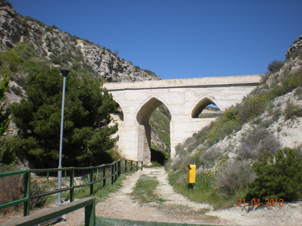
Arco de la Mora seen from downstream
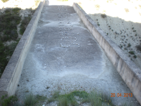
Concrete deck, showing its considerable width,
and a nice personal message
The place name Zuera
The place name Zuera comes from the Arabic çuhayra, diminutive of hayyar, stone, rock; therefore, the word means little rock. From there would come "Çuhaira" or "Çuhera", that with the unhappy suppression of the letter Ç, clumsily replaced by Z, became Zuhera, Zufera, Zuera.
It would have reoccupied a former Roman settlement, located in La Recueja (Zuera).
Location
The Arco de la Mora is adjacent to a rest area on the road access to Zuera, crossing the Huerta Chica, just south of exit 316 Zuera-Ejea of motorway A-23, about 25 km north of the city of Saragossa. It spans over a narrow valley cutting the western escarpment of the Gállego valley towards the Qibla.
Deck's UTM coordinates are X=683 576 Y=4 638 591 (Datum ED50); X=683 468, Y=4 638 382 (Datum ETRS98).
Dimensions
The width (4.14 m) of modern concrete deck (not flying over the oldest work) is such that it is not conceivable that the canal occupied it in full. The excessive width would be designed for a service road. This width does not equal a whole number of feet of Aragon of 25.6 cm, nor Aragon's cubits of 38.4 cm. However, it turns out to be almost exactly 14 Roman feet of 0.296 m.
Its length is of 31 steps (about 22 m), and no excavation in the mountain is apparent upstream or downstream. Perhaps, though, an exam with GPR, an economic and non-intrusive technique, might provide surprises.
The deck's elevation is 292 (± 3 m).
Paralelism of this Thagree (of the Islamic Kingdom of Saragossa) aqueduct with a Caliphal one
The disposition, general aspect and dimensions of this aqueduct are very similar - except that the three arches are pointed and not horse-shoe shaped - to the ones of the caliphal aqueduct of Valdepuentes, near Medina Azahara. See Chapter XII-Aqueducts in the Conventvs Ivridicvs XII Cordvbensis § 1.- Aqueduct of Valdepuentes.
The Acequia of Candevania
Parallel to the Arco de la Mora, and between it and the road, i.e. downstream of the valley, runs the big Acequia de Candevania (Can de Bania, Can de Banya, Can de Baña, where "Can" means "house", and "baña" means "bathing", a place name related to Los Bañales), which irrigates all these terms with flows uptaken from river Gállego in the same weir (although in opposite shore) than the Acequia de Candeclaus or Acequia Camarera, at about 8 km upstream, at the height of Ontinar del Salz. However, Candevania runs at a level about 13 m below the deck of Arco de la Mora.

Ancient arch like a "gallipuente", over which passes the Acequia de Candevania
In the background, the Arco de la Mora
Although the Acequia de Candevania has always been considered medieval, some say that this arch or gallipuente could be Roman or even pre-roman (Celtiberian). A second ancient arch, similar to this one, spans itself downstream, near the village, in the Canalillo. It is also reasonably believed that the Arco de la Mora and the windows in the escarpment would be dated later, and that the work remained unfinished at the time. See
www.ayunzuera.com

Acequia of Candevania; in the background, Zuera; on the right, windows on the escarpment

Windows carved into the rock of the escarpment
At a short distance downstream, and at a similar level to the aqueduct deck, can be seen from the road two non-small windows open on the escarpment, which could illuminate a carved tunnel extension of the Arco de la Mora.
Further downstream, it reaches Zuera's houses, where Calle Arenales respects the eventual tunnel alignment and stands substantially horizontal, at a level of 289 (± 3 m), ie, about 3 m (the GPS error margin of ± 3 m, can not be more precise), lower than the deck of the aqueduct.
Aspect before restoration
Historical photographs with the state prior to the restoration of the Arco de la Mora, and the criteria used in this restoration can be seen in
http://sites.google.com/site/zagralandalus/arcodelamora
The authors state a curious and intriguing detail: the existence of a 'mataesquinas', a corner-killer, under the main keystone of the Arco de la Mora. A magical function, anti-demons, is attributed to this feature, which would be further proof of this being a Thagree work, perhaps with Fatimid reminiscences.

Timber corner-killer in the Arch
The photograph contributed with the initial state of the work seems to show a parabolic arch somewhat larger than the vertical piers on which it rests. This widening was ment to ease the setting of the framework.
The parabolic arch and the pointed arch
The parabolic arch of Ctesiphon in Mada'in, about 30 km south of Baghdad, which is actually not an arch, but the vault of the Throne Hall of the Sassanid Kings, a still remaining pre-islamic feature, is the perfect anti-funicular, and may have inspired the pointed arch, which I refuse to designate with the absurd name of "Gothic", since this art has absolutely nothing to do with the Goths.

Arco de la Mora: façade upstream
An unfinished work
In the aforementioned website, the authors wonder about the causes of the stoppage of the work, whose construction date at the time of the Kingdom of Saraqusta/Saragossa (1031-1118). The Numismatic evidence proves that Saraqusta's mint suspended the emissions of dirhems (in Arabic, darahim) since 489/1096 (the year of the Battle of Alcoraz and subsequent loss of Huesca to Aragonese Christian hands) until the year 497 AH, equivalent to 1104 AD (Peter I of Aragon reigned 1094-1104). This suspension points to a silver shortage and economic crisis, circumstances that, as we unfortunately know, tend to cause the stoppage of public and private works.
Possible uptake of a canal feeding the Arco de la Mora
It now remains to find the point of the Gállego where this remarkable and abandoned canal could have had its uptake.
As the deck of the Arco de la Mora is at level 292 (± 3 m), and the Gállego river level up to the shrine of Our Lady of Salz (and approximately the provincial boundary between Saragossa province and Huesca province - district Hoya de Huesca) is the 290, we have just to look for a suitable location upstream of said district and provincial boundaries.
Facing Gurrea de Gallego is the modern catchment weir of Soto (X = 684,572, Y = 4,654,345, Z = 315 (±3 m)). Joining this point directly with the deck of Arco de la Mora, the distance would be 15,785 m, with a slope of 1.4 ‰. (Of course, the path would not be a straight line and the slope would decrease with increasing length). Between this and the weir of La Paúl there is a stretch in which the Gállego licks the western escarpment, which imposes today the necessity of a tunnel for the acequia of about 200 m in length.
One could search around the environment of that weir, or even further upstream, the catchment planned by the unknown designer of the Arco de la Mora canal.
---oOo---
§ 7.- The Acequia of Belchite (Saragossa)
It starts off the spillway of the great Cuba or Dam of Almonacid, just by the town of the same name, on river Aguas Vivas. It runs along the Malpasillo gorge to the area of Los Chorros before heading towards Belchite, whose extensive olive groves it irrigates. Especially interesting is the section carved into rock in that Malpasillo and the tunnel section through conglomerates.
Of course, the great protagonist is the Roman dam, traditionally called Cuba, the highest (34 m) of all known in the old Empire. It is 100 m long and 7 m wide at the crest, over which runs the road. Its original capacity is estimated in about six million cubic meters. The massive structure contrasts with the modesty of the acequia. It was declared a Bien de Interés Cultural (BIC) in 2001.
The best study, truly comprehensive, of this dam, is indicated in the literature (4). This study points out some hypotheses about the purpose of such a dam, purpose that, however, remains a mystery. See several more hypotheses about its eventual destination in (12).
")
The Cuba or Dam of Almonacid on River Aguas Vivas (Saragossa)
The dating by the carbon 14 method places the original construction of the dam between the years 67 BC and 84 AD, with various later repairs and reinforcements, someones very important. Its initial typology differs from the other known dams in Hispania, its display describing three curved walls supported in two buttresses, by the means of arches. The photograph highlights a massive old reinforcement.
---oOo---
§ 8.- The Acequias of Sástago and Escatrón (Saragossa)
In both places of Lower Ebro in Aragon (District of Ribera Baja del Ebro) there are very old ditches fed with flows procedent from the Ebro. As in Belchite, also in Sástago exists a remarkable stretch in tunnel.
On the right bank, the old ditch appears nearby Escatrón, where the rock sections are clearly visible near the intersection of the A-224-Escatrón Albalate del Arzobispo, just south of the second place cited.
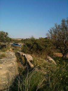
Old rock-carved acequia near Escatrón
---oOo---
§ 9.- Waterwheels
(Digression alien to the Roman aqueducts)
Waterwheel of the Monastery of Rueda
On the left bank, opposite the village of Escatrón, stood the great Cistercian monastery of Rueda, its water supply provided by a self-powered waterwheel. A smaller arm of the Ebro, created in order to power the wheel, started from a great weir. This one crossed and still crosses the river from side to side, forming the acute angle characteristic of this technique repeatedly practiced since very old times in the area of influence of Saragossa. The river arm has been cleaned and the wheel has been recently reconstructed. The medieval monastery was vandalized after the confiscation of its properties in the XIXth c. It stands now beautifully restored, along with the arched aqueduct that connects it with the waterwheel. It operated as a hotel, which closed as a result of the economic crisis starting in 2007-2008.

The waterwheel rebuilt besides the Cistercian monastery of Rueda,
to which it gave its name, according to some, according to others,
the place name would be prior to the construction of the wheel
"Among the provinces of Europe -thus wrote Baltasar Gracián- it is Spain ... " which had, and still has, the largest number of waterwheels.
Fame, as usual, has forgotten the ones existing in Aragon, pondering instead to the highest degree the one called Albolafia, in the Guadalquivir in Córdoba, capital of the Caliphate of the West (See Chapter XII Aqueducts in the Conventvs Ivridicvs XII Cordvbensis, § 4 The waterwheel Albolafia). Moreover, the modern coin of 25 pesetas, with a circular hole in its center, was dedicated to the waterwheel of Alcantarilla, near the city of Murcia, still in service.
The waterwheel of Rueda has been rebuilt with a diameter that I could not find, but in any case exceeding the 15 m that Albolafia was said to have.
Says the ingenious as well as anonymous author of The One and Twenty Books of the Devices and Machines (8) that "water, because of its gravity and weight, cannot by itself go upwards".
The self-propelled waterwheels belie this clearly excessive claim, since they lift water by themselves, using the same force of the flow. That is perhaps why they have always fascinated.
A new one, of the type we might called hamatic, was erected at the Expo Zaragoza 2008 to the delight of visitors. It was built by craftsmen from the city of Hama (Syria), brought for the purpose.

Waterwheel of Expo Zaragoza 2008 built by craftsmen from Hama
The ones of Hama (place name of Hittite origin), on river Orontes (in Arab, nahar al-cAsī), pour only water on one side, while the Aragonese have two wheels attached, with a rosary of pouring buckets to one side and another rosary to the other side. Furthermore, Hama's wheels are wooden ones, and their radii are not real ones, as they actually surpass the center, being tangent to a lesser circle.

A waterwheel in Hama (Syria), on river Orontes
Waterwheels working in parallel in Velilla de Ebro
Hispania's unique case with two parallel wheels. Each wheel is, in turn, double, pouring to both sides. The water lifted to the top is collected in four gutters, two for each wheel, visible in the photo, which converge to feed the irrigation ditches of the Sindicato de Riegos of Velilla, a partner in the restoration.
These wheels were dismantled half a century ago to install a pumping system, the compound consisting of a weir restored upon the great Iberian river, a lateral canal to feed the wheels, a public pool for washing clothes, the two parallel wheels, and a hydraulic mill.

Parallel waterwheels of Velilla; downstream side view
The Colonia Victrix Ivlia Lepida
From the hydraulic complex is visible on the top (not shown in the photograph) the great hermit of Saint Nicholas of Bari, adjoining to the colony founded by the triumvir Marcus Æmilius Lepidus in 44 BC (after the stabbing of Julius Cæsar that year) as Colonia Victrix Ivlia Lepida. First Roman colony in the Provincia Tarraconensis, it was built in what are now the eras of Velilla. It changed its name in Victrix Ivlia Celsa from the year 36, when Lepidus left the triumvirate in his path to exile. The city was excavated partially, accepts visitors, and is equipped with an interesting museum (10).

Velilla's parallel waterwheels; backwater upstream

Hermitage of Saint Nicholas of Bari: main façade

Hermitage of Saint Nicholas of Bari: Romanesque apse
Celsa and KeLZE
Celsa is the Latin version of KeLZE, city by the Ebro, in the region of the Ilergetes, which minted currency of the Celtiberian group of the "three dolphins". A colony Celsa built over a precedent Celtiberian population would explain the name of Belilla (now written Velilla), no doubt alluding to the powerful Celtiberian group of the Belli.
Velilla's bell
This hermitage of St. Nicholas was famous in the XVth and XVIIth Centuries for its bell, known as "campana de Velilla who, it was said, rang "in cross", foreshadowing catastrophes.
So, ringing sine manu and insistently on August 4th, 1435, it suspended the minds of those who heard it. Soon news came that on Friday August 5th, festivity of Our Lady of the Snows, " ... three hours before noon, an arch of the stone bridge being constructed over Ebro in this City [of Saragossa], that was the most noted and sumptuous building of these kingdoms, when about to be finished, suddenly fell, killing five people, and many were wounded".
The superstitious concern rose one grade when, after few days, news came of a major disaster: that this same Friday, at the same hour, after the naval defeat of Ponza, had fallen into the hands of the Duke of Milan the King of Aragon Don Alfonso V the Magnanimous, with his brother Don Juan, King of Navarre - and future King of Aragon - , and a large number of Aragonese, Sicilians and Castilians noblemen (11) and [2].
The ominous predictions became more frequent since then, and over nearly two centuries. Then, the bell fell silent for ever.
(End of digression)
---oOo---
§ 10 and 11. - Rané's Dam and pipelines, and Azubias' Dam (Saragossa)
Rané's Ravine flows into the Jalón to the left by Lumpiaque, a town that some experts identify with the historic Complega of the Celtiberian wars.
The Rané's Ravine, with a significant watershed, has a old dam as well as also ancient (yet undated) ditches slightly upstream its junction with road A-121, between PK 21 and PK 22, about 4 and 1/2 km from the access road to the Sanctuary of the Virgin of Rodanas, among Ricla and Fuendejalón.
In the valley of Las Azubias, east of Rané, and west of road A-1303 between river Jalón and Ainzón, about 5 km south of Pozuelo de Aragón, can be seen the remains of an old dam (still undated), whose type does not differ much from that of Cubalmena.
")
Old dam in Las Azubias (Saragossa)
The accused Celtiberic imprint of these regions, truffled with ancient caves, is consistent with the interest of the said Celtiberians in irrigation, stated in various parts of Central Aragon.
---oOo---
§ 12. - Aqueduct of Quicena (Huesca)
It runs southwest of the Castle and Abbey of Montearagón, not far from the city of Huesca.

The aqueduct of Quicena in 2009
About this little structure would flow a canal captured from the Flumen, downstream of the current and recent Montearagón Dam, and along the left bank of the river.
The existing ditch is bound to follow a path similar to that of the the Roman canal.
As its direction points towards the city of Huesca, it could have likely served the urban supply of Osca, where we could look for the thermae, everpresent in every Roman city.
---oOo---
§ 13.- Weir of Abrisén or of Fañanás (Huesca)
Abrisén
There is medieval documentation on this deserted village.
On the other hand, the Confederación Hidrográfica del Ebro (CHE) included, already in 2007, in the Hydrological Plan of river Alcanadre (of which Guatizalema is an affluent), a plan for the "Recovery of the medieval village of Abrisén and the Mill of Fañanás".
Weir's location
This interesting weir is on the Guatizalema, about 2 km south of Siétamo. The exit "Siétamo" is the provisional end of speedway A-22. The weir is 1 km south of the way. The city of Huesca is about 9 km to the west and the Huesca-Pirineos airport, at half that distance as the crow flies. Fañanás is 3 km away.
How to reach it
a) From Fañanás, at the south
To reach the weir just drive along a dirt road north from Fañanás (town in the TM of Alcalá del Obispo). In Fañanás, an information panel provides data of the contours, including the weir.

Structures of motorway A-22 over the Guatizalema.
In the background, the svelt bridge linking Siétamo (on the right) with Abrisén's weir (on the left).
The Guatizalema flows from right to left of the photo
a) From Siétamo, at the north
From Siétamo, a dirt road crosses the motorway A-22 on a svelt bridge, and leads directly to the ford of Guatizalema, just downstream of the weir.

Guatizalema's ford in Abrisén: an idyllic landscape

Puppies near the dam: an idyllic landscape
Brief description of the structure
The right abutment, which is the mouth of the acequia (X=725 499, Y=4 665 267, error ±5 m (Datum ED50); X=725 391, Y=4 665 057 (Datum ETRS89), is invisible, hidden as it is by vegetation.

Starting point of the Acequia de Fañanás, on the right abutment of Abrisén's weir
The left abutment is the only visible (X=725 451, Y=4 665 139, error ± 5 m (Datum ED50); X=725 392, Y=4 664 929 Datum ETRS89) - the rest of the structure is hidden under an inextricable tangle -. Can be seen well-shaped blocks, which could be Roman, although smaller than the of dams of Muel or Almonacid de la Cuba.

Weir of Abrisén's left abutment
It is located about 500 meters, and its length, measured from the approximate coordinates ut supra, is 137 m (± 10 m). According to the website which I quote at the end of this paragraph, the maximum height is of 9 m, and its thickness at the crest of 1.7 m, being visible up to seventeen courses of stones. It is a buttress dam. From it starts, on the right bank of the river, the canal currently called Acequia de Fañanás, since it irrigates that municipality.
The medieval documentation calls it Albella's Weir, and in its environs are still remains of a castle and ruins of what could be a Roman villa, abandoned and then reoccupied, like many others, in "the time of the Moors."
Comprehensive information on
www.fanyanas.com/2000/01/el-poblado-y-castillo-de-abrisen.html
Comment
This interesting weir deserves a cleaning of the vegetation that masks it. If also endowed with a picnic area, we would be emulating the Parque del Azud area described in § 18 Aqueduct of Peña Cortada, in Valencia. We would have here the advantage of its proximity to the A-22 (the most difficult and expensive, the bridge over the motorway, is done and operating), as well as the archaeological remains in their environment.
---oOo---
§ 14. - Aqueduct Albarracín-Cella (Teruel)
Roman artwork, this artificial channel catched from river Guadalaviar downstream the city of Albarracín. It is carved in the rock, at least in its initial stages. The lighting windows are visible from road A-1512. Always under ground it crosses the watershed limit between the Guadalaviar (Turia's basin) and the Jiloca (Ebro's basin) to reach the town of Cella, which recently discovered remains of a receiving castellvm aquæ.
In an unknown moment of the twelfth century, an abundant upwelling - a great artesian pit - surged upstream Cella. Its two large "eyes" are at the bottom of an elliptical pool, from which starts a great acequia towards Cella and further on. Water continues to flow through down to the Ojos de Monreal, traditional birth of river Jiloca. This upwelling of Cella made unnecessary the transfer canal Albarracín-Cella, who would be abandoned then, if it was not before.
Greographers tend to view the source of Cella as river Jiloca's birth.
See a detailed study on
http://traianvs.net/.
---oOo---
§ 17.- Weir of Agiria (Villafranca del Campo, Teruel)
How to reach it
This weir is located and clearly marked about 3 kilometers west of Exit 160 of the A-23, before reaching the railroad Saragossa-Teruel and about 400 m from the EF Villafranca del Campo, from which it is not visible.

Signpost marking the access to the weir or derivation dam.
Location within the Route 31 of Antonine's Itinerary
In this same website, and in my article on Route 31 of Antonine Itinerary I wrote in February 2009: "From Alba the distance of 9 km northwards leads us to Villafranca del Campo, where lies a presumed Moorish dam, labeled as "Presa romana" (Roman dam) on a road sign, and as "Azud romano" (Roman weir) on another one. The existence of this dam is due to the fact that river Jiloca did not go through there in Roman times."
In the aforementioned website I propose to identify Alba (formerly Alava) with the Roman Albonica, and the Roman Agiria - both quoted in Route 31 of Antonine Itinerary - with modern Villafranca del Campo, in the Aragonese district of Comunidad de Teruel. The Roman or Moorish (or both) weir would collect the flows procedent of river Guadalaviar referred to in § 16, as far as the canal was operational. Since the twelfth century, the flows would come from the source of Cella, located about 30 km to the south, and used in the mill of Villafranca.
Another lapsus calami of the Poem of Mio Cid?
Cella, placed between mansions Urbiaca and Albonica of said Route 31, which ignores it, reappears centuries later in the Poem of Mio Cid, which calls it "Çelfa la que dizen de Canal" (Verse 649) and "Çelfa la de canal" (Verse 869), doubtlessly alluding to the canal decanting from Guadalaviar to which I refer in § 16.
(The letter used in the only manuscript of the Poem is a high "s", very similar to the "f" without horizontal line - with a value of "s" - common half a millennium later in Aragonese books. Therefore, the spelling might be Celsa, and if so, this would be another case of isonimy, being Celtiberian both Celsas: the one next to the Ebro and the one commented now. My proposal is reinforced by the fact that no other Celfa is known, thus making useless the clarification «de la canal»).
And talking about isonimy, the question can be raised of why place names such as Pueyo (near Barbastro), or Pueyo de Fañanás, nearby Fañanás (Huesca), become en the valley of the Jiloca a linguistic rarity as "Poyo" del Cid. According to the said Poem, the hero camped in this "Poyo" with his three hundred knights with their lorigas, for what a quite big "pueyo" is needed so as to make room for them all. The Real Academia defines "poyo" as "banco de piedra, yeso u otra materia ... arrimado a las paredes" (Bench of stone, plaster or other materials sided to the walls). On the other hand, about the word "pueyo", the same linguistic Authority says: "The word pueyo is not registered in the Dictionary", which is most surprising, as the place name repetas itself since more than a millenium all over Aragon.
The copyist of the Poem, ignorant of Aragonese place names to the point of mistaking Huesa with Huesca (See § 18), could have also been mistaken here, wrongly correcting "pueyo" (word unknown in Castile) with "poyo" (which is known, but out of sense here).
Description of the weir
Its plant is straight, and the central section has disappeared, probably as consequence of a dash flood.
Its right end (X =639 094, Y=4 505 242; (Datum ED50), error ±5 m; X=638 985, Y=4 505 033 (Datum ETRS89) rests on the slopes of rocky Cabezo de la Cruz, from which probably were extracted the stones for its construction, and that still is exploited as a quarry.
His left end (X=638 952, Y=4 505 275 (Datum ED50); error ±5 m; X=638 843, Y=4 505 066 (Datum ETRS89) is not complete, having been cut to make way for an acequia.
The length between both ends is, therefore, of 211 m (error ±10 m), and from the westernmost point, the azimuth of the line is 119°.
It is aligned transversely to river Jiloca, which here runs roughly from south to north.
It is a structure of buttresses, of which ten are preserved, all in the right half. Across the central missing part runs a large acequia, which was undoubtedly the old mill's acequia, still running through all the village.
By the disappeared middle of the dam, there is now an almost blind arc, which leads to an smaller but higher acequia than the main one.

Right half of the dam as viewed from downstream, showing ten buttresses.

Arch located in the right half of the dam as viewed from downstream.

Right half of the weir, upstream view, showing its scarce thickness and height.
The left half lacks buttresses or other relevant characteristics. The image shows the size of the masonry used, all irregularly. There seems to be a regrowth.

Left half of the structure. In the background, the rocky Cabezo de la Cruz.

Shape and size of the stones and the regrowth. The orange folder is size A-4.
The limited storage capacity, given its meager height, justifies its classification as a weir or diversion dam and not as reservoir.
Final comment
The images show that the times are past when the environment of this interesting weir was carefully kept.
The aged posters and the fields cultivated almost to the border of the structure, cry out for a proper conservation of what was done in recent past.
---oOo---
16.- Dam of Monforte de Moyuela (Teruel)
Coordinates of the dam
Geographical coordinates: 41° 4' 39.5" N, 1° 0' 32.0" W (41.07 76 49º N and 1.00 89 89º W)
UTM coordinates: X=667269, Y=4 549 366 (Datum ED50); X=667 160, Y=4 549 157 (Datum ETRS89)
Altitude of the top: 921 m
Monforte de Moyuela
Geography and demographics
Monforte belongs to the province of Teruel, district of Jiloca, of 1,921 km2, its capital Calamocha totaling 14,128 inhabitants (1998). With a TM of 48 km2, Monforte, located 1,008 meters above sea level, has the following demographic evolution: 702 inhabitants (year 1913), 124 (1986), 84 (1998), 63 (2012).
Prehistory
In all these places there are many vestiges of old and even very old settlement, and so in TM Mezquita de Loscos a Chalcolithic burial was found.
The Celtiberian Monforte must have occupied the eras, located on a hill in front of todays housing.
Route of El Cid
In the Poem of Mío Cid, the copyist, not at all familiar with the place names in this part of the Celtiberia, corrected unfortunately "Monçon" where the original must have said "Monfort", and also erred writing Huesca instead of "Huesa" (or Ossa), thus completely breaking the geographical continuity of El Cid's itinerary.
The verses in question would say something like: «Ya va el mandado por las tierras todas - pesando va a los de Ossa e a los de Monfort». (Already the mandate by all the lands goes - it is heavy to the ones of Ossa and to the ones of Monfort). And the following verses: «Porque dan parias plaze a los de Saragoça - de Mío Çid Ruy Diaz que non temien ningun afront» (Because they pay tributes it pleases to the ones of Saragossa - from Mío Cid Ruy Díaz they were not afraid of any offence). (Verses 939-942).
Definitive Aragonese conquest
Until 1157, the Christian Aragonese would not definitely seize this part of the ancient Muslim kingdom of Saragossa, taking advantage of the deep crisis facing Spanish Islam.
By then, more than twenty years had elapsed after the death of Muhammad ibn Tūmart (1133), founder of the Almohade religious reform, and proclaimed Mahdī.
The Almohades (Arabic: al-Muwahhidun, the Unitarians) insisted on the oneness of God, imposed a sticter moral, and purified Islam of all anthropomorphism.
The disciple and successor of the Mahdī, cAbd al-Mu'min ben cAlī (1133-1163), capable and ruthless, systematically destroyed Almoravid power in Africa, creating an empire from the Atlantic to Tunisia.
Meanwhile, the Almoravid Taifas of the Peninsula gave him Tarifa and Gibraltar, and sent delegations to Africa recognizing him as Caliph of the West.
In a powerful land-sea operation, the Almohads seized Almería (1157), then mint and emporium of western Mediterranean, and the rex parvus Alfonso VII of León and Castile, in his retreat, died ( 1157) at the port of Muradal (Despeñaperros).
It was then (year 1195 of the Hispanic Era, or 1157 AD), with Queen Petronila as titular of the Kingdom of Aragon, when her husband the Count Ramon Berenguer IV peopled Monfort, giving it the Fueros (Laws) of Saragossa and setting its terms (since it, "término municipal", here abbreviated as TM). Among them he cites Peña de Lavant (de Avant or l'Avant), bow-shaped rock outcrop.
Civil and eclesiastic adscriptions
Within the Kingdom of Aragón, Monfort belonged until 1488 to the Sexma of Trassierra, one of six of the Community of Daroca. Then it went on linked to Daroca until the creation of the provinces in 1833, when it was incorporated into the province of Teruel.In 1916, his name became Monforte de Moyuela.
In ecclesiastical jurisdiction, since the Reconquista it was included in the diocese of Saragossa and, within it, in the arciprestazgo (vicariate) of Montalbán. This arciprestazgo was dismembered from the archdiocese of Saragossa and aggregated to the diocese of Teruel in 1955.
Hidrology
The river Santa Maria, with the name of river Nogueta, is born of the union of the brook of la Cañada (Glen Brook) and the brook of Prado Medio (Middle Brook Meadow), both joining in the Malpasillo, at the foot of Piedrahita, after collecting the runoff from the Sierra of Oriche. In this sierra happen more than a dozen peaks over 1300 m, from Rocha (1383 m) via La Muela (1384 m) and to the port of Rudilla (1345 m).
Upon entering the TM of Monforte, river Nogueta is to be called river Santa María.
Other various streams coming out of these mountains also run from SW to NE to converge on the town of Moyuela (province of Saragossa) in the district of Belchite. There they form the río de Moyuela, which flows into river Aguas Vivas (Living Waters) just upstream of Moneva reservoir.
How to get to the dam
Departing from Monforte to Loscos, on the provincial road TE-V-1611, about 500 m after crossing the said river Santa María, and about 2 km from the village (PK 9.8), you must turn right and walk 2 km for a dirt road that runs to the NE, like the river, invisible from said path.
After passing by Molino de Enmedio first and then Molino Bajo, both dismantled, can be seen at the distance the buildings of a chapel dedicated to Our Lady del Pilar. The annual pilgrimage to the shrine is celebrated on the third Sunday of May.
The dam or rather the remains of it, are between the chapel and the river, in a remarkable close of river Santa María, called the close of the Virgen del Pilar.

Overview of the Roman dam of Monforte de Moyuela,
with adjoining chapel of the Virgen del Pilar
The day of the date (31 Mar 2013) the chapel does not display religious symbols or images, either inside or outside. Nor is there any signage of the dam, or the chapel.

Left abutment of the dam of Monforte de Moyuela,
seen from inside the dam

Monforte de Moyuela Dam,
downstream side view
Brief description
The part that still survives is entirely in the left abutment, besides the chapel.
The visible Roman work is opvs cæmenticivm, though the photo above displays at its left some blocks that form part of the inner lining. The bottom photo shows also a coating of blocks, this time in the downstream face.
An old regrowth is evident and, according to (23), would have raised the upper level 2.60 m, thus reaching the respectable height of 16.8 m above the river bed, so in coronation could come to have, according (23), slightly more than 85 m, with a vessel volume of 450,000 m3.
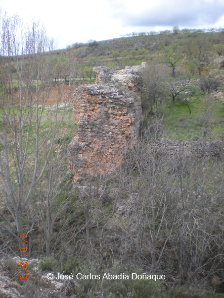
Section of the dam of Monforte de Moyuela,
showing its thickness of 6.90 m
The thickness of the dam, clearly insufficient on its base after the regrowth, would have been the cause, always according to (23), of its early definitive ruin. The partial clogging of the dam prooves that it was in service for an indeterminate number of years. Its breaking must have produced a tremendous wave of mud that would have destroyed everything in its path, then settling down in the areas downstream.
What was the vessel of the dam, partially clogged, is now farmland.
No remains of channeling are visible, which is curious, even after the violent destruction caused by the dam failure.
View in-depth study in (23).
---oOo---
§ 19.- Aqueduct of Peña Cortada (Valencia)
In the Conventvs Ivridicvs Cæsaravgvstanvs there was an interesting and important Roman canal, partly in use today, whose remains of more than 28 km are deployed along road CV-35 Valencia-Ademuz, section between Tuéjar, Chelva, Calles and Domeño, localities cited from the highest to the lowest and, therefore, contrary to the PK rising.
Belonging to the district of Los Serranos, in the province of Valencia, the highest of these places, Tuéjar, is by the PK 74 (PK zero in the city of Valencia), about 40 km upstream of Liria or Lliria.
From Aragon can be accessed from motorway A-23, exit Mora de Rubielos / EF Rubielos de Mora, to take road A-1514 to the limit Aragón-Valencia, which is located about 3 km to the west of Arcos de las Salinas.
Road CV-355 links in Aras de los Olmos with the aforementioned CV-35.
Also from Aragon, specifically from the city of Teruel, can be accessed through the Rincón de Ademuz corner where, from its capital Ademuz, the road follows the course of the Turia across Casa Altas and Casa Bajas to enter Castilla-La Mancha, where he receives the CM-9221 distinctive, and whose continuation in Valencia is the above mentioned CV-35.
The canal and its surroundings have been declared Bien de Interés Cultural (BIC) by the Consellería de Cultura of the Generalitat Valenciana. (See [3]).
Geographic clarification
In these parts of Teruel, Cuenca and Los Serranos, watercourses receive often consecutively the name of the towns they pass through. Thus, in Aragon, río (river) de Arcos is renamed río de Manzanera and then río de Albentosa.
Similarly, the río de Tuéjar, when entering the TM of Chelva is renamed río de Chelva, which later on pours into río Turia's left margin.
The "Parque del Azud" and the dam of Tuéjar I
It may be useful to take as a reference point the four span bridge of the CV-35 on river Tuéjar (PK 77, approximately), before reaching the town of Tuéjar, proceeding of Aragon, or after it, proceeding of the city of Valencia. This modern bridge replaces an older one, perhaps medieval, located immediately upstream, whose remains are a buttress with breakwater. Immediately upstream there are the old remains of a mill.

Plotting of the Roman aqueduct of Peña Cortada
In light blue, natural waterways, in dark blue, ditches into service, in green, Roman remains
At about one kilometer upriver Tuéjar on dirt road you will reach the place called "El Azud". In the pleasant Parque del Azud, an information poster displays two ancient dams whose characteristics seem Roman, unless contradicted by archeology.
The rest of the one set here, that we might call Tuéjar I, have been regrown with two overlapping rows of gabions to contain the explanation over which this park and prairie extends, that is the completely clogged vessel of a dam.
Its capacity can be estimated to have exceeded by far what is necessary for a mere diversion dam: I think it would work as storage and regulation. From the massive left abutment of this dam derives the Acequia Mayor de Tuéjar.
Immediately downstream of this dam of Tuéjar-I, a small rockfill dam creates an idyllic impounding, which enhances the beauty of the landscape.
The paved access from road CV-35, clearly marked, is to be found more towards Tuéjar.

Bridge in the Parque del Azud, on the clogged vessel of the dam of Tuéjar-I

Mini-weir at the Parque del Azud

Left abutment of the dam of Tuéjar I

Central part of the old dam of Tuéjar-I, regrowthed with modern gabions
The Roman dam of Tuéjar-II
Returning to our starting point, the bridge of four arches of the CV-35 on Tuéjar river, we follow the dirt road that passes under one of the arches in the downstream direction, coming soon to a magnificent narrow that was, no doubt, used by Roman engineering: the torn moles of mortar, accumulate in what were the abutments of the dam, while the central portion was washed away in date ignored.
I propose to call Tuéjar-II this old dam, now ruined.

Remains of the allegedly Roman dam of Tuéjar-II, seen from the right bank of river Tuéjar
The weir of the Acequia Mayor de Chelva
Taking advantage of the location, it was built later on (elevation 561.74, according to [3]) a diversion dam of just 1 m high, currently feeding the Acequia Mayor de Chelva. During the Islamic period, popular and inaccurately called "the time of the Moors" many restorations of Roman water facilities were held throughout Hispania.
Through the centuries, this acequia has experienced numerous repairs and alterations, but, despite this, the Acequia Mayor de Chelva, as it runs by gravity, can not but retain basically the same Roman layout. As it also continues to make use of various old works, it is necessary to follow its path when searching for Roman clues.

Weir of the Acequia Mayor de Chelva, supported on the left abutment of the Roman dam of Tuéjar II
Sections in service of the old canal, now Acequia Mayor de Chelva
The acequia runs along the left bank of río de Tuéjar, then it outlines the southern side of the hill on which the village of Tuéjar lies, leaving the TM Tuéjar and entering the TM Chelva, where the river changes its name from "de Tuéjar" to "de Chelva", as we advanced above.
Then it twists north, then east, pointing to road CV-35 by PK 71.1. To reach it, it must first cross the Barranco del Convento (elevation 527.34, according to [3]). So it does through a heavily restored aqueduct, with a single semicircular arch.
Its rather shocking whiteness is probably due to the use of lime as binder. Small stones are used, unlike what we will see later, further downstream, and in the village of Calles.

Much restored aqueduct over Barranco del Convento, upstream side seen from the CV-35, left margin according to the progress of the PK

Channel of the aqueduct over Barranco del Convento. The water moves toward the viewer, situated on the left bank of the CV-35, according to the progress of the PK. The channel, after running a few meters next to the road, passes under it and continues along the right bank
Flowing along the hillside, the acequia passes through the top of Chelva, bordering the Cerro Cojanta, to save the valley of Barranco de Montul over an arch of small size, possibly Roman, just immediately before the Fuente (Source) de la Gitana.

Single-arch aqueduct of the Acequia Mayor de Chelva over Barranco del Montul,
just upstream the Fuente de la Gitana. The water runs from left to right of the photo

Fuentes de la Gitana. To the left, the old one, modest and simple, with a single pipe; on the right, the new one, with its twenty pipes, very nicely remodeled and tiled.
The Acequia Mayor of Chelva runs above, from left to right in the photo,
just across the white mudéjar balustrade
In this place there is a small terrace with barbecue and children's pool, displaying Moorish delight by water
The Acequia Mayor de Chelva, leaving to its right Chelva's water reservoirs, which it feeds, describes an S-shaped curve heading towards the "espartidero" (splitter) of San Sebastián. It is located at the crossing in acute angle between road CV-346 and Av. Constitución, about a hundred meters down the Chelva Bullring.

"Espartidero" (water splitter) of San Sebastián: beach upstream

"Espartidero" (water splitter) of San Sebastián: inside, showing the minor branches
By the road CV-346 in a porch attached to the "espartidor", the image of the saint shown in coloured tiles is flanked by two black inscribed stones: one thanks the Department of Agriculture for the recent works to improve the Acequia Mayor de Chelva; the other one displays the tracing of the acequias network.

Inscription on stone located at the porch of the "espartidero",
dating the recent renovation of the Acequia Mayor de Chelva
The Acequia Mayor, and with it, the section of the Roman canal still operating terminates at this Espartidero of San Sebastián.
From him come out up to four minor branches. The "brazal de Dolda" and the "brazal de la Jarea" point toward the south east; the Acequia de la Torrecilla (now disused) and the Acequia del Viñaro point eastwards. So are flows distributed evenly between the different irrigation terms.
From the remains still kept of the Roman canal, the most spectacular ones are in disuse since centuries. They will be described in the following sections.
The quarry
The quarry from which come the two structures to be described has been identified. The stone is limestone, and clear vestiges of the ashlars extracted are evident.
It is reached by the path of Mas de Solaz.
Two large stoneworks
Further on, in the area of Peña Cortada, the remains most notable are in display: two ashlar's stoneworks, which can be accessed from Chelva, up the CV-346, surpassing the Bullring and the football stadium, and taking the dirt road to the right, clearly marked with the name "Acueducto de Peña Cortada."
We come in first to a sturdy structure that once consisted of six arches, according to references of the seventeenth century, of which only one stands up complete, and the pillar of a second one with the start of the belt.
This structure sapnned over the Rambla de Alcotas, which delimits the TM Chelva and the TM Calles. The arches which remain are entirely within the TM of Calles. The span of the arch still standing is just over 6 m. Its width of 2.60 m allowed at the time a way over it.
Its elevation, according to the declaration of BIC in [3]: 487.11.

Remains of the first major Aqueduct of Peña Cortada (TM of Calles).
At 2.5 km of Chelva 2.5 km, already within the TM of Calles, comes to an end the dirt road accessible by car, and information panels are on dipsplay.
Following a narrow path we reach the Congosto de la Peña del Gato, where the remains in excellent condition of a structure can be admired. It overlooks the congosto from its three arches 18 m high, 2.60 m wide, and with a total length of 125 Roman feet (about 38 m). Its level is 486.90 m, according to [3].

The second major aqueduct of Peña Cortada
on the Congosto de la Peña del Gato (TM of Calles)
The access from Calles
While both structures are in all or in part in the TM of Calles, they can also be reached from the core of Calles following the path PR-CV 92.
This route, although only accessible on foot, which may discourage some, has three advantages: it is short, it overlooks very scenic landscapes, and it gives access directly to the sections in tunnel dug into the rock.
These sections in tunnel, eleven in number, totalize about 300 meters long.
Their height of 1.85 m allow walking comfortably, and having light windows, allow also spectacular photos, as bordering the mole called Torre de Castro.
We thus reach by the canal itself the rock called Peña Cortada or Peña Serrada, which gives name to the aqueduct. It is a vertical, narrow, spectacular pit dug in the rock, less than 2 m wide, but 22 m high and with a floor length of about 26 m.
Arch over the barranco de la Cabra and other remains
Following the course of the aqueduct from these sections in tunnel toward Domeño, different vestiges are found: an arch on the Barranco de la Cabra (width 2.2 m; height 477.92 m, according to [3]); one of the pillars of an arch on the Barranco del Zurdo; the starts of the piers of an arc on the Barranco del Tío Roque; follows the canal (elevation 472.50 m, according to [3]); arc remains on the Barranco del Arenal (elevation 472.93 m, according to [3]), all of the above within the TM of Calles.
Arch over the Barranco de la Olivera del Arquillo
Over this ravine remains an arch of 1.42 m span, at elevation 471.93, also in the TM de Calles (according to [3]).
Remains in Domeño
Already in the TM of Domeño, several vestiges of the Roman canal have so far been found. A gallery dug in the rock, with light window, has been found in the term of Los Cerrados. Its width, slightly over 1 m, and its height, are lower than in the gallery next to the Peña del Gato.
Further on a second gallery has been detected, though interrupted by landslides, and a new section at half kilometer to the SE, at elevation 465.39 (according to [3]).
Presumed destination of the canal
It is not known with certainty which supply benefited from a work of this magnitude, datable between first and second centuries BC. A guess is to serve Domeño (name suggestive of a large estate or domain) and even, eventually, Liria/Lliria, the old EDETA, the important ethnic capital of the Iberian edetanos.
---oOo---
§ 18.- Aqueduct of San José in La Vall d'Uixó (province of Castelló/Castellón).
At the southern end of the modern province of Castellón, in the foothills of the Sierra de Espadán, also in the old Conventvs Ivridicvs V Cæsaravgvstanvs, the Romans built a rivvs or acequia one km long, approximately, from the source of the Cova de San José to the city called Vall de Uxó or, most recently, La Vall d'Uixó.
There was here an Iberian town, then Romanized, later Islamized, with no clear conclusions about their successive names.
Present day town would include the ancient places of Zeneta, Benizahat, Zeneja, Benigafull and Alcudia de Uxó, which merged into two at the seventeenth century, and to a single one at the end of the nineteenth century. It enjoys city status since 1926. Sagunto lies at about 16 km, Burriana at about 18 km, the town of Castelló/Castellón at about 22 km.
Origin of the water flow
Even more outstanding that the aqueduct itself is the natural marvel where its waters come from.
A permanent flow comes from the bottom of the Cave of San José, deep cavern open to paying visitors since 1954. Trough a sluice water level is kept constant, so as to allow navigation in little, pole moved boats, along the narrow, sinuous, well lighted undergronud gallery. After a navigation of about 800 m, visitors land up, to follow on feet about 255 m more. Then, they embark again to come back to the entrance, passing by the first pier. From the second pier, spelunkers have explored about 1950 m more into the heart of the mountain, but this stretch is not yet open to the public.

The aqueduct in 1920

Aqueduct of San José in 2014

Aqueduct of San José: contact between Roman and Medieval work

Acequia to derivate waters to the mill, crossing the ravine of Aigualit

Horseshoe shaped arc supporting waters to the mill, across the ravine of Aigualit
From the main aqueduct crossing the ravine of Aigualit, only the abutments, and their contiguous arcs and the little relief arcs -filled in probably during the medieval repairs - are Roman. The three central ojival arcades are, quite obviously, medieval in facture. Before reaching the aqueduct, the acequia bifurcated in two: one turned right to move a watermill, and later, to irrigate the orchards; the rest of the flow passed over the aqueduct for supplying the public fountains. The complex remained in service until the mid-twentith Century.
---oOo---
§ 19.- Aqueduct of Andelos (Mendigorría, Navarre)
Situation of the city of Andelos
The Roman city of Andelos, for centuries forgotten, was rediscovered in the TM of Mendigorría, en the Navarra Media, at scarcely 3 km of this town and at 29 km of Pamplona. It spreads over a terrace of the Arga, at some 500 m of the opposite margin of this river, that is, the right margin, and North of the chapel of Nuestra Señora de Andión.

Panoramic viewa: the white dais mark the outline of the aqueduct;
bottom left, the terrace over which lied Andelos;
bottom right, the cahpel of Nuestra Señora de Andión
Excelently exposed in its museum, its streets and houses are coming to light step by step. Outstanding is the amplitude of the decumanus (6 m). Thermæ have been found. In the opvs signinvm pavement of a domvs, decorated with very Celtiberian svasticas, can be read four words written from left to right in the Celtiberian variant of the Iberian signary. About the interpretation of the text, published in (32), see (33). The original is preserved in the Museo de Navarra. Here is the transcription:

Celtiberian text in a pavement of Andelos
From left to right: LIGiNE:ABuLORAUNE:EGiEN:BiLBiLIARS
where the syllabic signs are: the 3rd letter of the 1st word, the 2nd letter of the 2nd word,
the 2nd letter of the 3rd word, and letters 1st and 3rd of the last word.
Without daring to fully translate the text, let's display the following comments:
First word:
In the Celtiberian city of CaRAS (In latin CARÆ), in the floor of the site of La Caridad, in Caminreal (Aragón), can be read a text surrounded of svasticas -a very Celtiberian motive- the word LIGiNETe, also written in Celtiberian signary. (About CARÆ see in this same website Chapter 3 of the Article "Ruta 31"). This first word also remembers the word written in the reverse of the "Iberian" (in reality, Celtiberian) coins of LAGiNE.
Third word:
The city of SEGIA comes to mind (with the Celtiberian mint transcribed SEGiA, or ZEGiA), antecedent of the modern town of Egea, Exea o Ejea, this last writing used nowadays.
Fourth and last word:
It is impossible not to evoke the Celtiberian city of BiLBiLIS (Celtiberian mint transcribed BiLBiLIS, o BiLBiLIZ), with diggings still proceeding in the site of Valdeherra, near Calatayud, to the South of motorway A-2.
(More about Celtiberian coins in my blog "salduie.blogspot.com", Article "Mediana ¿ceca celtíbera?" -in Spanish-).
But by far the most notable of Andelos, a city that may have reached 2,500 inhabitantes, is its water supply system.
Other ancient cities in the surroundings
Apart from the capital of Navarre, Pompælvm/Pamplona (which owes its name to Pompaius Magnus), it is unavoidable to mention the site of Santa Criz or Santa Cris, in the TM of Eslava, 46 km Eastwards. Known since centuries the existence of monumental tumuli in this hill, they already attracted the interest of the illustrious don Blas Taracena Aguirre (1895-1951). In 1997 was published (34). Later works discovered remains of fluted and smooth columns, and great capitels, all of it in the frame of a monumental forum, cryptoporticus included. These eveidneces led the authorities of Navarre to promote important archaelogical works in the biennia 2012-2013 and 2014-2015, scoping the exhibition to visitors, that we hope not distant. It is not so far known the name of of this city, that by sure will connect, through the Roman network, with the also important city of Tarraca, already in Aragon (See Chapter V-2, § 4 Aqueduct of Tarraca/Los Bañales).
The watertaking dam of Andelos
Coming back to Andelos' water supply, the watertaking dam is found at about 3 km westwards of the city. With a length of 150 m and a maximum height of 7 m, its straight allineation describes an angle in its right third. It collects the high quality waters of several creeks. Its volume can be estimated in about 20,000 m³.
Two constructive phases are evident. In the first one, datable in the I Century AC, small stones were used. It has 13 buttresses, situated, curiously, upstream.

Perspective of the dam seen from the North
In a second constructive phase, datable at the beginning of the Second Century AC, a new dam, this time built in opvs cæmenticivm, was constructed downstream of the first one, parallel to it, and scarcely at a distance of 2 m. The straight allineation has 102 m, this time without angle, and 9 reinforcing buttresses were buil downstream, as required by hydraulic technique.

The dam: detail of the angle
A rather broad stone chest, not visible in the picture, housed the opening valve.
The pool collection and decantation
At scarcely 300 m of the city, an open air pool is conserved. Into it flowed the water duct coming from the dam. Shaped in an irregular rectangle, its main dimensions are 85 x 37 m, with a capacity of 7,300 m³. A stone stair allows the descent to the bottom, this not being horizontal, but leaning towards the exit.

Perspective of the pool seen from the West

From the pool, the white cubes mark the alignment of the lead pressure pipe, with Andelos at the top of the picture
The pool also shows two constructive phases. In the first one, the inside walls were plastered to guarantee its impermeability (remains of plaster are still visible in the North side). In a second phase, the plan was broadened, and the walls were left with its small stones in sight, reinforced by 37 interior anti-crumbling buttresses. The inmisarium was in the upper corner, at the left as we look to the city, and the emisarivm in the center of the wall closest to Andelos. The water duct from the dam is not evident, probably because, as in Conimbriga, its layout is underground. From the valve inside the chest came out the lead pipe, today lost, that allowed the whole network to be under pressure since this point
The base of the castellvm acquæ has also been found. In the decumanus several basements appear, that could have supported, in all verosimility, today lost arcades.
Return to Index
---oOo---
Conventvs Ivridicvs VI Tarraconensis
VI-WATERWORKS IN CONVENTVS IVRIDICVS VI TARRACONENSIS:
As indicated in the beginning, it is obviated here, because of already much studied, published and publicited, all teh referent to the famous Puente del Diablo, or Acueducto de las Ferreras (o Les Ferreres), centering ourselves in less known aspects.
§ 1.- Water supply to Tarraco/Tarragona
The capital of this Conventvs, and capital of the enormous Provincia Tarraconnesis, the modern Tarragona, was founded nearby the sea, over e rock under whose subsoil existed a lake that supplied drinkable water to the city. Such lake can be seen from a well which opens in the lower level of the public underground parking in the rectangular plaza parallel to the Rambla Vieja (or Vella), where the sees of the Ayuntamiento and the Diputación Provincial stand up.
Return to Index
---oOo---
Conventvs Ivridicvs VII Carthaginensis
VII-WATERWORKS IN CONVENTVS IVRIDICVS VII CARTHAGINENSIS:
TWO MILLENIA OF WATER SHORTAGE (UNTIL MAY 17th, 1945)
This Conventvs, along with the Cæsaravgvstanvs and five others, formed the enormous Provincia Tarraconensis.
In times of Diocletian, this Conventvs, the largest of all, was dismembered from its province, to form a new one of its own, called Provincia Carthaginensis, with its capital in Carthago Nova, city that was equipped with a provincial forum and the other administrative infrastructures required for the capital of a province (circa 310 AD).
§ 1.- Aqueduct of Carthago Nova/Cartagena
Location of the city of Cartagena
The city of Cartagena is located to the SE of Spain, on the Mediterranean coast, in the back of a cove facing south and surrounded by hillocks, between Cape Palos to the east and Cape Tiñoso to the west, at 37º 33' north and 0º 57' 30" west of Greenwich. Belonging historically to the Kingdom of Murcia, in the present constitutional framework is attached to the Region of Murcia, a single-province Comunidad Autónoma, and is the siege of its regional Parliament.
Description of the former physical environment
It is essential to describe it, since it differs greatly from today's.
In the old, to the north of the peninsula on which Cartagena stood, there was an albufera, connected to the cove by a mouth. The ebb and flow of the tides renewed the waters of the albufera.
The peninsula was flanked by five hills, and in the highest of them, the southernmost, facing the bay, there was a temple dedicated to Æsculapius (now Castillo de la Concepción).
Counterclockwise, on the next hill, the second one, stood the temple of Hephaistos (current Cabezo de Despeñaperros); in the next one, the third, looking north to the lagoon, was the tomb of Aletes (now Cabezo de San José).
Between Hephaistos and Aletes -the discoverer of the silver mines- was the main access to the peninsula: the Puerta de Tierra.
On the north bank, overlooking the lagoon, there was the fourth hill, the temple of Moloch-Kronos-Saturn, called the Holy Mount, and finally, the fifth hill would be the current Cabezo del Molinete, partly overlooking the lagoon, part over the mouth of it.

Physical environment of Cartagena in Punic and Roman eras
In red, wall of Hasdrubal; 1 Hill of Æsculapius, 2 Hill of Hephaistos, 3 Hill of Aletes, 4 Sacrvm Mons, 5 Hill of the Molinete (Pinwheel), extramural, in 6 there was a temple dedicated to Thoth, god of Pharaonic Egypt, protector of writing - considered sacred (hieroglyphos means sacred scripture) -, and in general, of sciences and techniques.
On this hill rests today the so-called Castillo de los Moros.
Modern maritime references: MM Sea of Mandarache, AG Algameca Grande, A-CH Algameca Chica, 1 Punta de la Veleta, 2 Punta de la Podadera, 3 Punta de Santa Ana; 4 Punta del Gato. "Albufera" is a 'lagoon'.
Hydraulic reference: the dotted blue line is the hypothetical bed of the now called Rambla de Benipila.
In this ancient peninsula would have been Mastia of Tharsis, over which Hasdrubal the Handsome, that since the death of his father-in-law Hamilcar Barka the year 229 BC led the Carthaginian Expeditionary Force in Iberia, founded in 223 BC the city of Qart Hadašt (in Punic "new city"), replicating the name of Carthage.
Hasdrubal built a walled circuit of about 2.5 km in perimeter, supported on the five hills and covering, with these, more than 40 hectares.
Over the fifth hill, the northwestern one, he built, according to the sources, as strategos autokrator of the newly hatched Iberian coalition, a magnificent palace. The place was called since, in Latin, Mons Arx Asdrvbalis (Asdrubal's Acropolis).
After his death in 221, he was succeeded in command by his brother-in-law Hannibal, son of Hamilcar Barka, whose story I will save here.

Monument to Hasdrubal the Handsome, founder of Cartagena
(Cartagena, gardens of the Cabezo de la Concepción)
Author: Manuel Ardil Pagán (1965)

Hasdrubal: Profile
(Historical digression)
During the Second Punic War, Scipio seized Qart Hadašt in twenty-four hours, in an amazing lightning action (210 BC). The city was renamed Carthago Nova.
Julius Cæsar would have been to Cartagena in 45 BC, having given it the legal range of Colonia Vrbs Ivlia Nova Carthago.
The city remained under the power of Rome until it gave over Hispania to the Visigoths, initially as fœderati of the Empire.
The Byzantine Emperor Justinianus I (527-565) who, in his grand project of Renovatio Imperii Romanorvm had conquered Africa (533) and Italy (552), sent to Spain (end of year 552) an strong contingent in said support of Atanagildus. The troops landed in Carthago Nova under the command of the patrician Liberius.
Expanding this bridgehead, the area of the Southern Levant of Hispania under control of the Eastern Empire was renamed Carthago Spartaria.
Once consolidated, these domains formed the province of Spania, which never included the northern half of the former Provincia Carthaginense, dominated by the Visigoths from Toletvm.
Emperor Mauritius I (582-602) sent to Carthago Spartaria the patrician Comenciolo, from which the following Latin inscription was found in the late XVIIth century in Cartagena, Plaza del Lago (now Plaza de la Merced), and dated the year 590:
QVISQVIS· ARDUA· TVRRIVM· MIRARIS· CVLMINA· VESTIBVLVMQ· VRBIS· DVPLICI· PORTA· FIRMATVM· DEXTRA· LEVAQ· BINOS· PORTICOS· ARCOS· QVIBUS· SVPERVM· PONITVR· CAMERA· CURVA· CONVEXAQ· COMENCIOLVS· SIC· HÆC· IVSSIT· PATRICIVS· MISSVS· A· MAVRICIO· AVG· CONTRA· HOSTES· BARBAROS· MAGNVS· VIRTVTE· MAGISTER· MIL· SPANIÆ· SIC· SEMPER· HISPANIA· TALI· RECTORE· LÆTETVR· DVM· POLI· ROTANTVR· DVMO· SOL· CIRCVIT· ORBEM· ANN· VIII· AVG· IND· VIII·
An English translation:
Whoever you are, admire the hard tops of the towers and the city hall founded on double door, right and left, double gate over which are superimposed double vaulted arches of convex curvature.
So ordered Comenciolo, patrician sent by Mauritius Augustus against the barbarian enemies. Great for his braveness, magister militum [4] of Spania, for ever Hispania will be happy by this rector, while the poles rotate and as the sun turns around the world. Year VIII of Augustus. Indiction VIII.[5]

Old Puerta de San José, now demolished,
ordered to be built by Carlos III
between the hills of Despeñaperros (old Hephaistos) and San José (former Aletes)
The Byzantine project aspired, as Comenciolo wrote, to survive "as long as poles rotate and sun goes around the globe", or so he thought. Though, as we know since Copernicus, is the globe who circles around the sun. Comenciolo was also mistaken in the rest, as things turned out very differently.
Three decades after, under King Gundemaro (610-612), Carthago Nova was emptied of his archbishopric (the Byzantines would have replaced the Latin rite by the Greek rite?) and transferred to Toletvm, where it remains today.
After the disastrous end of the reign and life of Mauritius I, the imperial power in Hispania was abandoned by Constantinople.
It collapsed for ever during the reign of Sisebuto, whose general Suintila, who would succeed him as king (621-631), managed to force the evacuation of the Byzantine garrison, commanded by Patrick Caesarius, who abandoned Carthago Nova at the mercy of the victor.
Suintila, whose name rhymes with Attila, not content to dismantle the fortifications, razed the entire city (year 616).
It took centuries to revive, and would do it very slowly during the half millennium of Islamic rule (eighth to thirteenth centuries) with the name of Qartayena al-Halfa', in Arabic, Cartagena del Esparto.
Twice conquered by the Kingdom of Aragon (by James I and James II), both times it was donated to the Kingdom of Castile (Alfonso X and Ferdinand IV, respectively).
In 1290, the bishop of Cartagena exilated himself to Murcia, where he still continues to reside, although Cartagena retains the title of the see.
After this violent history Roman water supply is almost unknown.
(End of the historical digression)
Freshwater and saltwater in Cartagena: the problems
Actually, as far as water is concerned, Cartagena has been subjected for centuries to a triple scourge:
a) First, the center of the city, surrounded by five hills, was in deep, as quoted by Polybius, an eyewitness certainly surprised by it.
As an inevitable consequence, the torrential rains that now and then punish Mediterranean landscapes have flooded the city countless times, the last one in October 19th, 1972, when the City Hall Square became navigable. As a compensation, well's water would seldom be missing. See (16), p. 192.
b) Secondly, there is no permanent river or stream many miles around, only some poor sources.
Therefore, home delivery as in the hands of "azacanes", forced to make endless queues in the few existing public sources.
c) Third, and worst of all, the earthen materials of the Rambla de Benipila ended up blinding the mouth of the lagoon, which so lost the water renewal provided by the tides. (The tidal range here is about 30 cm, wisely used by Scipio in his brilliant capture of the city).
Thus, the fish-rich lagoon became an unhealthy "almarjal" whose freshwater fed the larvae of mosquito Anopheles, becoming the mother of recurrent malaria epidemics. They were joined by the yellow fever, brough in by sailors infected in tropical lands. See (16-1).
Salty waters and fresh waters in Cartagena: Solutions
The third problem was freined under Charles III, by diverting the mouth of the said Rambla de Benipila to the Algameca Chica.
But would not be definitely solved until the "almarjal" was dried and filled up, on which today extends a magnificent expansion of the city.
To the second problem a solution was proposed in the twenties of the twentieth century by a draft of the distinguished ingeniero de Caminos,Canales y Puertos Don José-Eugenio Ribera Dutaste (1864-1936) (which has not even a memorial bust in Cartagena), consisting of bringing water from the nearest river with enough quantity and quality: the river Taibilla, a tributary of the Segura.
To pass from draft to fact took two decades, not such a long time if we consider the complexity and magnitude of the work, and with the civil war 1936-1939 in between.
(Digression on the modern water supply to Cartagena)
A pharaonic work
The Taibilla uptake stems from a reservoir of 9.5 Hm3 in TM Nerpio upstream of Letur, in the neighboring province of Albacete.
The closed ovoid section passes by Moratalla, Bullas, and Totana, after crossing the river Guadalentín in southeast direction. Then the ducts arrive to Cartagena, after a journey of 186 kilometers, of which 55.3 km of tunnel, 8.4 km of aqueducts, 3.4 km of rapids, and 9.1 km of siphons: a colossal work.
A historic date: May 17th, 1945
The huge cost was assumed by the State, ans so the waters reached the reservoirs of Tentegorra which supplied the city as well as the Naval Base in May 1945, date historical for the city, which finally overcame his bi-milenary hydraulic hardships.
Data on the complex and growing network of canals and desalination plants in the provinces of Murcia and Alicante
More information about the Taibilla base project and the Canal del Segura, the Canal de Murcia and the Canal de Alicante, which also serves the cities of Orihuela and Elche (another additional 148 km, of which 30.8 km of tunnels, 5.8 km of aqueducts, and 9.6 km of siphons) in http://www.mct.es, website of the Mancomunidad de Canales del Taibilla (MCT); and about subsequent expansions, including the so-called post-transvase Tajo-Segura, the Canal del Campo de Cartagena, and the Canal Nuevo de Murcia, Canal Nuevo de Alicante and Canal Nuevo de Cartagena in http://www.chsegura.es
(End of digression on the modern water supply to Cartagena)
Water Supply in Punic and Roman times
In the absence of flowing waters in proximity, the Mastienos and then the Carthaginians, from African arid lands, and sober in drinking water, would supply themselves from wells, supplemented by cisterns that collected rain water.
But the Romans built baths, demanding continuous flow or, as the very expressive Spanish phrase says, "agua por un tubo" (water by a pipeline).
The extraordinary archaeological findings in a short span of time in Cartagena include a section of the Punic walls, a theater (discovered in 1988) and an amphitheater (elliptical in shape, with nearly 104 m in his major axis and a minor axis of 78 m), the great forum, an Augusteum devoted to the imperial cult, a thermæ that would be fed from the castellvm aqvæ discovered in 1977 on top of the western end of the Cabezo del Molinete.
In May 2012, I was able to visit as a tourist the baths, the peristyle, the adjoining atrium for religious banquets, all very well displayed with access from the Calle Balcones Azules.
In any case, since the conquest of the city by Scipio (210 BC) to the construction of the baths several centuries elapsed: it is estimated that they were in use between centuries I to V AC.
About the Roman aqueduct
Display in plant
A hypothetical Roman aqueduct to which seems to allude an inscription recently found in the theater, which will flow into the said castellvm aqvæ would come from Fuente Cubas, at about 2 km north of the modern city and, bordering the lagoon, would have crossed the mouth to enter the city.
Since also the westernmost exit of Carthago Nova must necessarily cross this mouth, one wonders whether the water line used the same bridge that the Roman road, which seems more likely, or rather it had, for reasons geometric or other, its own bridge.
In the current Alameda de San Antón, four foundation sockets appeared aligned Northwest to Southeast. They could have supported an aqueduct. See them in (17a), p. 218, Fig. 7.
The map of Fernández Villamarzo of the Punic-Roman Cartagena shows clearly how the aforementioned Alameda de San Antón marks the possible alignment of the hypothetical aqueduct, whatever the value to be given to that plane. See (16), p. 29.

Possible layout of the Roman aqueduct
Plotting elevation
It may well have crossed the mouth of the albufera by a lead underwater pipe, or by a mixed solution of bridge and pressure pipe, as probably was the case in Bilbilis and river Jalón (see § 5 of Chapter I in this site), in Toletvm and river Tagus, and Cæsaravgvsta and river Ebro.
Only archeology could answer these exciting question marks.
The distribution
The stump of a lead pipe, found in the excavations, was published in (17).
Other pipe fragments would have been found, which would prove that there was distribution to different users.
Promising archaeological works go on (May 2012) at the foot of Cabezo del Molinete (pinwheel), whose publication is awaited with great interest.

Street sign of Calle Balcones Azules

Cabezo del Molinete: South Side
The Augusteus, where imperial cult was celebrated, is also superbly displayed, as well as the House of Fortune. The excavations go on, having recently discovered a Punic cistern. The area of the main Roman Forum has been delimited, located further east.
In the eastern part of the city, one wonders whether naumaquias would be held in the amphitheater, which would have required a relevant water supply. Perhaps the underground channels with vents, dating from the eighteenth century, might have had a Roman precedent.
---oOo---
§ 2.- Aqueduct of Toletvm/Toledo
In December 2009 was presented (19), which publishes the existence - detected after three years of studies and works, and with the help of GPR - a culvert about 15 km in length, that from the foothills of the Sierra de Layos, reaches the left bank of the Tagus against Toledo on the land occupied by the Academia de Infantería.
To this duct, called "de la Rosa", should belong the remains of the aqueduct that crossed the Tagus.
Up to 49 manholes had been detected, using (I imagine, because I could not still get a copy of the book to study it) a constructive technique similar to that used in the also Roman and also underground aqueduct Albarracín-Cella, in Aragon. (See, in this same Article, Chapter V-2Conventvs Ivridicvs V Cæsaravgvstanvs § 14).
Also in (19) is disclosed another aqueduct, a lesser one, laid down parallel to Arroyo de la Pozuela.
The supply system to Toletvm/Toledo known traditionally would have been built in the second century AC starting at about 38 km south of the city, from the reservoir of Alcantarilla, over Arroyo de Guajaraz, nearby the village of Mazarambroz.
Situated at an altitude of about 725 m, the dam had two different straight alignments, converging on the channel, the eastern section, with an azimuth of approximately 60°, and the western section, with an azimuth of approximately 290°. In plan, they described a V, open about 130°.
Its capacity would have reached 3.5 million m3, operating as a true regulating reservoir.
Later on, were added to this reservoir additional flows, from a catchup in Arroyo de San Martín.

Alcantarilla Dam upstream view: eastern wall

Alcantarilla Dam upstream view: center gap

Alcantarilla Dam upstream view: western wall
The aqueduct ran northward with the bed covered, leaving the said creek west, until reaching the left bank of river Tagus, which it would cross from east to west.

Roman aqueduct to Toletvm
The supports of the aqueduct at its junction with the Tagus are still visible about 50 m downstream of the new Alcántara bridge [4].
the plundering of most of its granite coating left visible the core of opvs cæmenticivm. The central body of the work was destroyed, apparently, during the siege put to Toledo by cAlī ben Yūsuf, Miramamolín of the Almoravids in the year 1109, shortly after the death of King Alfonso VI. The city resisted, but the aqueduct was never rebuilt.

Aqueduct over the Tagus: left abutment remains
(on the parapet of the road: X=413 026, Y=4 412 505, Z=499 (Datum ED50);X=412 916, Y=4 412 298 (Datum ETRS89)

Aqueduct over the Tagus: bases of the piles, one on each side of the river

Aqueduct over the Tagus: remains of the right abutment (X=412 935, Y=4 412 534, Z=530 Datum ED50);
X=412 825, Y=4 412 326 (Datum ETRS89), partially hiding the view of the new Alcántara bridge
According to (1), the aqueduct would have crossed the river trough an inverse siphon, over three arches of 30 m span each, and 50 m above the river's bed. Come through to the right margin, the duct would have penetrated under the current Alcázar (level 548), near which would be the castelvm aquæ, dominating this sector of the city.
The azimuth of 270º points exactly westward (as evidenced by the approximate coordinates of the abutments displayed at the bottom of the picture), which is approximately to the farthest Cave of Hercules, that would be just another old cistern. This is today (2011) visitable, with access through the Callejón de San Ginés, after hard works of conditioning, access, lighting, etc., conducted by the Consortium of Toledo. Investigation of how water reached the cisterns detected at even higher levels is still pending.
Excellent photographs of the area where stood the Roman aqueduct, including one by Clifford (1857) and another one by Jean Laurent (1858), and other assumptions about their characteristics, different from the ones indicated ut supra, in
http://toledoolvidado.blogspot.com/2008/11/el-acueducto-romano-de-toledo.html
---oOo---
§ 3.- Juanelo's Device
(Digression alien to Roman aqueducts)
Genesis of the "Artificio de Juanelo" (Juanelo's Device), and succint description
In 1534, Emperor Charles V (1516-1556) suggested to his Italian watchmaker Juanelo Turriano to imagine a self-propelled mechanism to elevate water in Toledo from the Tagus (level 448) up to the Alcázar (level 548). Turriano's idea was late to mature. Already in the next reign, in 1565, he signed a contract with representatives of the Crown (owner of the Royal Alcázar) and of the Concejo of Toledo, with the compromise to build a most original facility of his invention. Once operational, he will be paid eight thousand gold ducats, plus a lifelong rent, to be transmitted to his successors perpetually, of another nineteen hundred ducats yearly.
The uptaking point was chosen at about one hundred meters upstream the Roman aqueduct remains. It will have two waterwheels - according to modern investigations -: the first one will move a chain with copper buckets elevating the water 14 m over the level of the river. This flow would feed the rest of the artificio, that, through a set of oscillating brass pipes with a bucket of the same metal in each side - a total of 192 buckets -, will elevate the water another 86 m, so as to complete the 100 m required; the second waterwheel would supply the power for moving the complex mechanism [7].
The two "Juanelo's Devices"
The first "Juanelo's Device" entered in service in 1569, working to complete satisfaction, and being the objet of general admiration, to the point of meriting a personal visit of Don Juan de Austria, younger brother of the King.
But then the Concejo of Toledo refused to pay his part, not without reson, since the Royal Alcázar wanted to reserve for itself the totality of the flow, estimated in «CCCC cargas entre dia y noche que son jU[-]c cantaros de a quatro açumbres cada uno» (four hundred charges between day and night, which are one thousand cántaros of four azumbres each) - 1,000 cántaros of 4 azumbres are equivalent to little more than 8,000 litres per day, since the azumbre, in Castile, had a capacity of two and 0.017 litres - «con que Joanelo se obligue a hazer buena esta cantidad de agua» (as far as Joanelo obliges himself to really reach this quantity of water).
It was decided to go on with the second artificio, already begun, with a presumed cost of ten thousand ducats, that would be finished in five years, spending two thousand ducats per year. In compensation to the amount indebted to Juanelo for the first artificio, the agreement was: «Que el agua que suviere este segundo ingenio aya de ser y sea para que Joanelo se aproveche della a su libre voluntad» (That the water to be elevated by this second facility had to be for Joanelo profiting of it at his free will).
Both devices were indeed very close to each other, since according to an old document, the two above mentioned waterwheels were common to both machines, and could serve indistinctly to the one or the other.
Bankruptcy of the Crown and diferred payments
Payments to Juanelo were to be delayed in very kafkian style through administrative difficulties, to which was not alien, probably, the bankruptcy of the Prudent King in 1575 - four years after the glorious but super expensive victory of Lepanto in 1571 - and, as a consequence, the second artificio did not enter in service until 1581, according to (20). Meanwhile, maintenance expenses were eroding the solvency of Turriano, which finished donating his rights of exploitation to the Concejo of Toledo, few months before his death in 1585 and in total bankruptcy. He had to be buried by charity.
Epilogue
Both artificios went on working, admired by all, one until 1617, the other one until 1634. The reason of their abandonment is not known. My guess points to their expensive and complex maintenance, together with the scarcity of the flow, probably decreasing along time, while the mechanism aged on. It was, on the other hand, totally insufficient for supplying the whole city. This one and the Alcázar came back to the traditional "azacanes" (watermen).
Baltasar Gracián, in his opus magnum «El Criticón» (written between 1651 and 1657) mentions admiratively the wonderful device (Criticón-I, Crisi VII La fuente de los engaños (The fountain of deceits) [8]; and Criticón-II, Crisi II Los prodigios de Salastano (The prodigies of Salastano) [9]), but without detailing that there were, in fact, two devices, nor mentioning they were stopped years ago. Quevedo [10] and Góngora [11] versified over the device, and Cervantes mentions it on passage in La ilustre fregona, one of his Novelas Ejemplares.

Model of the "Juanelo's Device" exhibited in the pavilion of Castilla-La Mancha
of the "Expo Internacional Zaragoza 2008"
(End of the digression)
---oOo---
§ 4.- Dam and aqueduct of Consabvra/Consuegra, in the present Comunidad Autónoma de Castilla-La Mancha, province of Toledo.
Consuegra
Origin of the place name
In the place name Consabvra, Consabrvm or Consabvrvm, the pre-indoeuropean root «kon» means plateau or rock, by the prominence or cabezo Calderico, that stands over the modern town. At about 14 kilometers away is found Urda, also a very old, no-indoeuropean place name, not that different from the Pirenaic Urdos, first station in the trans-pirenaic railway - off service since 1970 - between Saragossa and Pau. Other Pirenaic place names as Ourade, Lourdes, Ur, etc. include also the syllable «ur» which means «water» in Basque.
The Carpetanian city of Consabvra, for many years stipendiaria, that is, subjet to tribute, did not receive the Latin right until year 73 AD, under Emperor Vespasianus.
Geography and demography
Thr city of Consuegra is in the southeastern corner of the broad province of Toledo. Geographic coordinates: 39º 27' 43" N, 3º 36' 23" W. Coordinates UTM: X=447 832, Y=4 368 291, Z=704 meters over sea level. In 2012 it had almost eleven thousand inhabitants. The title of city was awarded to Consuegra by King Alphonse XIII in 1927.
A bit of legend: Romance del Cid
Yo soy el Cid Campeador * que fincó sobre Consuegra
Tan humilde al rey Alfonso * cuanto a mí doña Jimena
Aquesto escribe Rodrigo * a los condes de Consuegra
A los fidalgos y pobres * con honor y sin facienda
Y si en mi Valencia amada * no me hallaseis a la vuelta
Peleando me hallaredes * con los moros de Consuegra.
(I am the Cid Campeador * that stood over Consuegra
As humble to King Alfonso * as to me is Doña Jimena
This is what writes Rodrigo * to the Counts of Consuegra
To the gentlemen and poors * landless and honourful
And if in my beloved Valencia * you don't find me at your return
Fighting you will find me * with the Moors of Consuegra.)
Two bits of History:
1.- The battle of Consuegra (1097)
The almoravids, under the command of the Emir Yūsuf ibn Taxufīn, had disembarked in the Peninsula and had defeated King Alphonse VI of Leon and Castile in the battle of Zalaca (October 23rd, 1086). A new battle faced both contenders eleven years after, near Consuegra. The Cid Rodrigo Díaz de Vivar, from the Valencia that he had just submitted (1094), sent a reinforcement under the command of his son Diego Rodríguez. Joined the battle, in the Christian vanguard «throwed the Omnipotent the confusion», in the words of an Arab historian, resulting defeated the Castilians and dead the only son of El Cid (August 15th, 1097).
2.- Consuegra and the knights of St John
Alphonse VIII, King of Castile - but not of Leon -, donated in 1183 Consuegra and his castle to the Order of the Hospital of Saint John of Jerusalem, donation corroborated by pope Lucius III. The castle was headquarters, till the very Desamortización of Mendizábal, of the Great Prior of Castile. An illustrious Great Prior would be - when the Order had already its see in Malta - the bastard son of King Philip the Great, don Juan José de Austria, later on to be appointed Viceroy of Aragon (1653-1665).

Cabezo Calderico. On its top, the Castle of Consuegra, under resatauration
and windmills to the right.
Situation of the dam
The Roman dam is to be found picking an earthen road to the left, at about 5 km leaving Consuegra in direction to Urda. The pictures were taken from the left margin of river Amarguillo, fron a point not distant of the possible left abutment of the structure. The coordinates UTM: X = 443 327, Y = 4 364 889 of such point allow to calculate a distance of 5.645 m to the center of Consuegra. The approximate heigth of the said point is of 748 metres over sea level (± 6 m).
Dimensions and characteristics of the dam
It enclosed the waters of river Amarguillo, the construction extending for no less than 800 m: the longest known dam in the old Empire. Its heigth, though, does not exceed 5 m. Fifteen buttresses stand up today, and all is executed in opvs cæmenticivm. Its typology is very similar to the dam o weir of Agiria (Villafranca del Campo, Teruel), also of buttresses and also of limited height. See, in this same site, Chapter I Aqueducts in the Conventvs Ivridicvs Cæsaraugustanvs § 17.- Weir of Agiria (Villafranca del Campo, Teruel).

Dam of Consabvra, upstream side. At far top, Cabezo Calderico
with the Castle and windmills.

Dam of Consabvra, downstream side. River Amarguillo flows at the bottom of the picture, from right to left.
The canal
Unfortunately, nothing is left of the canal until Consuegra, that should have been between 4 and 5 km long.
---oOo---
§ 5.-Aqueducts of Baeza (Jaén)
The discovery
In 2010 and during the works of the Autovía del Olivar, between the TM of Baeza and the TM of Begíjar,both in the province of Jaén and to the SE of the city of Linares, came to sight the remains of hydraulic constructions corresponding to a Roman town of unknown name that existed in the surroundings of the Cortijo del Ahorcado. Three aqueducts, consecutive in time, were identified, dedicated to the supply of the said town and to irrigation.
The authorities have delimited an area of 4 Has. around the Loma de la Carnicera. The archaeological excavations are being performed by the Centro Andaluz de Arqueología Ibérica, of the University of Jaén.
---oOo---
§ 6.- Aqueduct of Valeria (Las Valeras, Cuenca, Autonomous Community of Castilla-La Mancha)
The ruins of that Roman city are scattered by and underthe little village of Valeria, TM of Las Valeras, at about 34 km South of the city of Cuenca, on the autonomic road CM-2100.
The name Valeria comes from Caius Valerius Flaccus, proconsul of Hispania Citerior (92-82 AC). This anomalous lasting, when proconsulates used to last one year only, requires quite an explanation.
Precedents
Between years 93 and 82 BC, while Rome was at war against several Italic peoples (the so-called Social War), she was imposed another war, a foreign one, by Mithridates Eupator, King of Pontus, that had planned and organized the massive killing of tens of thousands of Roman and Italic people in certain cities of Anatolia (Ephesian Vespers, year 88 BC).
In the Social War, a Tvrma Sallvitana (Cavalry Squadron of Salduba, afterwards Colonia Cæsar Avgvsta, today Saragossa), distinguished itself in such a way that the consul Cneus Pompeius Strabo, after the battle of Ascvlvm and in full battlefield, awarded the Roman citizenship (together with other advantages) VIRTVTIS CAVSA (because of their braveness) to all the Hispanic EQVITES (riders) of the said Tvrma. This conspicuous case was immortalized in the Bronze of Ascoli (the city of Asculum, in the Italian Adriatic coast, is now called Ascoli-Piceno), which is in display at the Musei Capitolini in Rome, and is dated A. D. XIV K. DEC. (14 days before the kalends of December, that is, November 17th). Cneus Pompeius Strabo and his colleague Lucius Porcius Cato were Consuls of the Roman Republic the year 89 BC.
(See the Article Mediana ¿ceca celtíbera? in http://salduie.blogspot.com, in Spanish.)
After the war against Mithridates, the return to Rome of Sulla at the head of his victorious army caused the fleeing to Africa of consul Papirius Carbo and the suicide of his colleague Marius the Younger. Faced to such power vacuum, the Senate appointed Interrex to Lucius Valerius Flaccus, who submitted to the people the Lex Valeria de Sulla dictatore (year 82 BC). Approved by the Comitia Centuriata and by the Senate, this Law appointed Sulla, for indefinite time, Dictator legibus scribundis et rei publicæ constituendæ. (Dictator to write laws and to settle the Republic).
Sulla - who walked by Rome flanked by 24 lictors (consuls had right to 12 lictors each) -, received thus legally all the power for indefinite time, and started its exercise publishing lists of outlaws (proscriti), whose killing he declared not only licit, but awarded with a strong sum of money, and with the liberty if the whistleblower were a slave. In this operation, Roman transcript of the Ephesian Vespers, fell eighty senators, as well as 220 equites, and 200 citizens. Their patrimonies were confiscated. So, great fortunes were born out of such extorsions. The memory of these tremendous facts would last for ever. Sulla introduced reformes in the constitution of the Republic and, considering concluded his task, renounced all his powers at the third year.
The proconsul Caius Valerius Flaccus
While this happened in Rome, perdured as proconsul in Hispania Citerior, and probably in Hispania Ulterior also, Caius Valerius Flaccus, that had been consul the year 93 with Marcus Herennius as his colleague. He inaugurated his proconsulate in Hispania (year 92) with the takeover by surprise of the Belian city of Belgida, and the subsequent massacre of about twenty thousand Celtiberians. Its ferocious destruction was so complete that we yet ignore the exact situation of that city. Such was the punishment to the party that had set fire to the Senate of Belgida, with the death of the senators prone to friendship with Rome. From then on, Caius Valerius Flaccus developed towards the Celtiberians a deep and successful pacificating action.
Caius Valerius, conspicuous sympatizer of the party of the populars, whose head was Marius, kept not only his life, but his proconsulate in Hispania during the dictatorship of Sulla, head of the party of the optimates. Such astonishing fact might be explained for his being cousin of the aforementioned Lucius Valerius Flaccus that, in his capacity of Interrex, had designed the legal way of access for Sulla to the Dictatorship.
Politics of Caius Valerius Flaccus in Hispania
The Latin bronze of Contrebia or Tabvla Contrebiensis (also called Botorrita-2, and exposed in the Museum of Saragossa, Aragon, Spain), dated in the Idus of May of year 87 BC, is suscribed by this proconsul, in his position of respected pacificator that refrended the sentence of the Senatus Contrebiensis. This arbitral award allowed the construction of a water supply acequia (rivvs) for the Celtiberian city of Salduie, where the aforementioned Tvrma Sallvitana had been recruited two years before.
Celtiberian settlement. Foundation of Valeria
Concerning the Olcades which Hannibal had fighted in these areas, it is pertinent to remember here that the Celtic term "olca" means "orchard", thus the "Olcades" would just be the orchard peoples, and very Celtiberian indeed.
As in most Celtic Galicia and Portugal, as well as in Central Europe and in the British Isles, and in all Celtic and Celtiberian lands, the settlement always had and goes on having a disperse character, which makes it difficult political as well as military control. It just happens that around present days Camino (path) a Valeria, there are fresh lands at more than one thousand meters of altitude, from where derives the water flows to which we will alude in § Hydraulic system of Valeria; and that East of that camino an elevated glacis hundred of meters long and flanked by big stone blocks can be seen, evident witness of a big area, fortified in its time, but abandoned since many centuries ago.
Hence the interest of Caius Valerius Flaccus in founding, as before did Metellus founding Metellinum/Medellín in Lusitania, an administrative center well defended militarily, while, at the same time and with great emphasis, autochtones were forced to abandon their strongholds.
Thus, in the frame of the pacificating politics of Caius Valerius Flaccus, fits perfectly the foundation, in uncertain date of his long proconsulate, of the new city of Valeria, set at 875 m of altitude, in a 'muela' girded by the ravines of the confluence of Barranco Zahorra and River Gritos, ravines that defend the East, South and West flanks of the new settlement. Remains attest the existence of houses in cantilever over the ravine, as we can see today in cities such as Cuenca or Tarazona (Aragon).
Valeria kept its importance for centuries. Under the Wisigoth domination it was an active episcopal see, from which nothing is known during the Islamic period.

Ravine over River Gritos seen from Valeria.
Left of the photo, the marks in the rock attest the existence in ancient Valeria
of houses in cantilever as there are today in Cuenca and in Tarazona
Decadence of Valeria
When Alphonse VIII, King of Castile -but not of Leon- settled these just conquered sierras, Pope Lucius III, by Bulla of 1182, created the new episcopal see of Cuenca, to whose territory he adscribed the land of the former diocesis of Valeria.
A humble little village, Valera de Arriba - that changed its name to Valeria - would reach our times (since 1971 fused with Valera de Abajo, and calling Las Valeras to the set of both nuclei) by the ruins of the Roman city, that in its best times - period of the dynasty julio-claudia - would have thermæ, theater and amphitheater.
Outstanding among the ruins is, by its greatness, a notable nymphæum second to none in Hispania, though inferior in beauty to others of the Roman Empire. The amphitheater might have occupied the area surrounded by the streets Valerio Flaco, Amargura and Gruda. In the vicinity, to the south, two old bridges might also be of Roman origin. Thermæ have apparently been found in the summer of 2015.
Excavations
Systematic excavations started in 1974, centered mainly in the foundations of a basilica, in a great exedra, in the forum under which great cisterns appeared, and in the impressive nymphæum 85 m long, leaning on a wall 105 m long.
Hydraulic system of Valeria
The nymphæum
The top of the hydraulic system of Valeria is doubtlessly the nymphæum, a really spectacular one, though surprisingly not mentioned by Fernández Casado in (1). It is formed by thirteen exedræ, a central one, with six others at each flank, ~3,1 m wide each (about 10' of Rome), but of a height difficult to estimate, its top being lost, but no lower than ~ 6 m (about 20'), all of them sunken respect to the outer vertical plane of the 85 m long wall. Such plane is but the outer plane of the southern contention wall of the great platform of the forum.

General view of the great nymphæum of Valeria
Each exedra would have housed a great size statue, but if so it was, no remains have been found. Two water jets flowed from the base of the plane wall between two contiguous exedræ, twelve pairs of jets in total, six pairs at each side of the central exedra. The water of every pair of jets slided down over a leaning plane, thus increasing its visibility. Water would come from a kind of lineal pool, hidden after the wall, covered with a very fine and waterproof lime plaster, and fed by the four great vaulted cisterns hidden under the floor of the forum. Under the central exedra, a vaulted sewer gave way out to the rainwaters of the esplanade of the forum, clean waters to be -for sure- very carefully kept for further use.

Detail of the central exedra of the nymphæum of Valeria, set over the sewer vault.
The design briefly described would impress the visitor's eyes and ears, result of the rumorous liquid. Under the light of the data soon to be added, water flow must probably be cut by night to allow for the recharging of the cisterns.
The cisterns
The four vaulted cisterns, attached to each other, have a rectangular plant, very elongated, and measure 21.5×3×4m each, that is, 258 m3 each, which gives a total volume of more than one million liters. They lie under the esplanade of the forum, at level ~ 869. They were fed, apart from the rainfall, with the water flowed by a lead pipe, doubtlessly procedent from a not yet found castellum acquæ.
The watertaking
A single spring is out of question; thus, the Portuguese expression mãe d'agua (mother of water), would describe better the situation. Indeed, what we have found going up the brook Zahorra, that is, northwards, is a main drainage parallel to the Camino a Valeria, and other secondary ones, that would converge with it until uniting in one point near today's supply well of the municipality (39.811723º N; 2.152310º W; height ~964).
We should so be before a cunicular system, like in Liciniana/Leciñena (Huesca) or Hispalis/Sevilla. Here, in the whereabouts of Valeria, the water flows would have its origin in the ample and fertile plain that spreads around the crossroads of 39.82 68 48 º N; 2.16 79 25 º W, height ~1003.
The castellum acquæ and the aqueduct
Downstream, by Fuente Navarro, apud the road CM-2100, pk 40.7, and at height ~ 950, we would expect the castellum acquæ to have been built, so that, coming from it, water could reach underground the city at height enough to feed the four great cisterns under the esplanade of the forum.
Underground ducts
During the construction works of the water treatment plant (December 2012), 6 m of a little underground aqueduct came to light, already discovered and reburied in 1974. Its section and flow are small, what explains the numerous cisterns found in different points of the city. That would allow its refilling in valley hours so as to make possible to afford demand on peak hours. Recourse is made, thus, to the same solution that in Bilbilis Augusta, where also cisterns proliferated. (See Chapter V-2, Conventvs Ivridicvs Cæsaravgvstanvs, § 5).
Return to Index
---oOo---
Conventvs Ivridicvs VIII Emeritanvs
VIII-AQUEDUCTS IN THE CONVENTVS IVRIDICVS VIII EMERITANVS
This Conventvs, one of the three that constituted the Provincia Lvsitania, received its name from its capital and provincial capital, the city of Emerita Avgvsta, some times written Avgvsta Emerita. As advanced at the beginning, here is omitted, as it is well studied, publicized and publicited, all related to the aqueducts of the provincial capital, so as to concentrate -once and again- in less known aspects.
§ 1.- Aqueduct of Augustobriga of the Vettoni
Another case of isonymy
Two cities, at least, bore in Hispania the place name Avgvstobriga. The Eastern one was in Muro de Ágreda (Soria). It was founded by Alphonse el Batallador, I King of Aragon of this name and VII of León, also King of Castile, of Toledo, of Saragossa. Muro de Ágreda is over the mansio Avgvstobriga of the Way XXVII of the Itinerary of Antoninus, AB ASTVRICA PER CANTABRIAM CÆSARAVGVSTAM, of 301 Roman miles (445,48 km), precisely at 23 miles (34 km) of Nvmantia and at 17 miles (25.16 km) of Tvriasone/Tarazona (Aragon), in the Conventvs Ivridicvs V Cæsaravgvstanvs.
We could call it Augustobriga of the Pelendoni, by the autochtonous ethnia living there, and no aqueduct is known on this location.
Here will be treated another city of the same name in the Conventvs Ivridicvs VIII Emeritensis, in the Provincia Lvsitania, whose ruins were submerged in 1963 by the waters of the Valdecañas Dam, over river Tagus. The modern town there, Talavera la Vieja, colloquially called Talaverilla, stood over the left bank of the Tagus, already in the province of Cáceres (Extremadura), downstream of the city of Talavera de la Reina, former Cesaróbriga, also by the Tagus, but in the province of Toledo (Castilla-La Mancha).
We could call it Augustobriga of the Vettoni, by the autochtonous ethnia living there.
Aqueduct of Augustobriga
Not at all spectacular, since it was about 1 m high by 1/2 m wide, its remains were flooded under the waters of the said dam.
How to reach there
The nearest village is Bohonal de Ibor, over the road EX-118, just south of the bridge over the Valdecañas Dam, between Navalmoral de la Mata and Guadalupe, all three localities in the province of Cáceres.
Other remains: «Los Mármoles»
The most spectacular vestige kept from this Augustobriga is the portico of svelt fluted columns, moved stone by stone in 1960 so as to save it from the waters of the future dam. It is known as «Los Mármoles» (The Marbles), even if it is of granite.

Los Mármoles (Possible access of a temple of Jupiter Optimus Maximus)
Return to Index
---oOo---
Conventvs Ivridicvs IX Scallabitanvs
IX-AQUEDUCTS IN THE CONVENTVS IVRIDICVS IX SCALLABITANVS
This Conventvs, one of the three that conformed the Provincia Lvsitania, received its name from its capital, the city of Scallabis/Santarem (Portugal).
§ 1.- Aqueduct of Conimbriga/Condeixa-a-Velha, near Coimbra (Portugal)
Origin of the place name
In the place name Conimbriga, "Conim" would be a pre-indoeuropean word, while the root "kon" means plateau or rock, and the very Celtic suffix "briga" means "fortress". So, for instance, Munébrega in Aragon; or Segóbriga, in Castile.
This pre-roman village already existed at the end of the II millenium BC. Its display in irregularly shaped insulæ survived Roman and Wisigoth times. Not so its walls, if any. In the VIth Century BC the territory was occupied by Celtic peoples, that under Roman presence were known as Lusitanians. Nowadays, their kinship with the Lusones of Aragon is accepted, not only for the similitude of names, but also for many other circumstances.
The Roman city
Rome took over the city through Decimus Iunius Brutus (138 BC), soon after the assasination of Viriatus.
During Roman domination, the city doubled its primitive size, being quite embellished. The aqueduct was built in times of Augustus.
The plane over which the city spread had a triangular shape, with a surface of about 20 Has, from which no more than 15% has been excavated. The Forum was monumental. Protected at the South by the deep ravine today called dos Mouros (of the Moors), need was, to complete the defence, to build a wall. In the High Empire, the wall encircled an area whose eastern border covered ¾ of a circle that included the amphitheater. The two axis of its elliptic design measured 60 m and 90 m.
As defence against the Barbarian invasion of the year 260, under the Low Empire, a new wall was built, in a hurry and in great part with re-used materials, extracted from the amphitheater and even from sepulcral tablets, a second, higher (6 m) and stronger (no less than 3 m thick) one, but leaving outside the northern area, around the amphitheater, as well as the eastern areas of the city. It even cut in two the most sumptuous of the houses, the one called today «de los surtidores» (of the water jets). Rectangle shaped towers reinforced the precinct.

Present state of the monumental Forum of Conimbriga
Christian beginnings
Mosaics from a paleochristian basilica have been found. An episcopal see is documented between the VIth and the VIIth centuries. The necropolis by the basilica was in use till the XIIth century.
Destruction of Conimbriga
The city was destroyed by the Swabians (465-468), emigrating its inhabitants to the neighbouring Æminium, in the right bank of the Mondego. Later on, Æminium would abandon its name, to adopt the historical one of Conimbriga, later on modified to Coimbra, episcopal city since ~ 580 and, much later on, universitarian city par excellence of the Kingdom of Portugal.
Extraordinary museum display
The aqueduct, the thermæ, the notable series of mosaics, the monumental forum, the basilica, the numismatic collections, everything has been displayed «in situ» in an admirable way. Notable is, apart of the house «de los surtidores» (of the water jets), at present (2013) protected by a roof, the so-called house of Cantaber, whose situation inside the walled precinct did not stop its sacking by the Swabians in 468.
A selection of pieces is exhibited in the stands of the Museo Monográfico de Conimbriga, built by the site, and remodelled in 1984.
The aqueduct
a) Access to the walled precinct
The aqueduct accessed the city, through the wall, parallel to the entrance way used by persons and carriages. Immediately afterwards stood the castellum divisorium, which divided the waters among the different kinds of users.

End of the aqueduct inside Conimbriga
To the right, in the far side, the white church of Condeixa-a-Velha and,
under it, the arcade of over the ring of the wall

Arcade of the aqueduct over the ring of the wall

Entrance of the aqueduct in Conimbriga. To the center, remains of the castellvm divisorivm.
In the background, the white tower of the church of Condeixa-a-Velha.
b) The distribution
Lead piping (fistulæ) have been found. Some fragments are exhibited in the annexed Museum. The existence of an amphitheater implies naumaquias, which required important quantities of water, as well as a generously designed sewage system.
c) The watertaking
It is perfectly documented in the village of Alcabideque, at less than 4 km from Conimbriga. The Latin expression capvt aqvæ, mispronounced in times of the Moors, is the origin of the present day Arabic-sounding place name.
An abundant karstic surgency (its annual flow is estimated in ten million cubic meters) fills in a circular pool, whose exit passes through a castellum aquæ with an acceptably survived exterior. It operated as decantation well, today -and since centuries ago- totally filled.
Coordinates of the castellum aquæ
Geographic coordinates: 40º 6' 23,85" N, 8º 27' 54,45" W of Greenwich
UTM coordinates: X = 545 588, Y = 4 439 805

Alcabideque: surgency and castellvm aqvæ

Alcabideque: side view of the castellvm aqvæ
d) The upper pool
At scarce height over the circular pool exists a smaller rectangular one, flanked in its northern side by several pillars. Over them must have laid in the past the little canal of a waterwheel elevating water from the lower pool, so as to provide a permanent flow to a higher level.
This waterwheel would be a Moorish work.

Alcabideque: the two pools seen from the southwest
e) The conduction
Most of the conduction, of almost 3.550 m long, was underground, ventilation wells being found. There were arcades - 16 in number, from which only one remains - only when approaching Conimbriga.
---oOo---
2.- Aqueduct of Saint Sebastian or Acueduto do Jardim Botânico (Coimbra, Portugal)
Æminium and its Roman Forum
Since the years 30 of the XXth century, the existence of Roman remains in the surroundings of the Paço Episcopal (Episcopal Palace) was evident in Coimbra - the former Æminium. Progress of the archaeological investigation was slow, due to the inexorable urbanistic conditionants, but a construction of great magnitude was seeing the light progressively. So as to get a horizontal esplanade for the Forum, the steep topography of the site required from Rome a work really monumental, layed down in two vaulted levels.
The Criptopórtico and the Museu Nacional Machado de Castro
The recent and most fortunate display of the complex allows the visitor an access to the enormous criptopórtico, the biggest Roman structure yet discovered out of the city of Rome. So, the Portuguese state has provided to the illustrius city of Coimbra of a complex to the rank of its most rich cultural and monumental patrimony, and it has done it with care and in an exquisite way.
The access is from the Largo Dr. José Rodrigues, quite near the Sé Nova (New Cathedral), and not far from the Faculties of Medicine and Philosophy and Letters. From the century old (founded in 1913) museistic complex, recently refurbished, and whose name honors Machado de Castro (royal sculptor since 1782), the Sé Velha (Old Cathedral) can be seen, as well as a great part of Coimbra and, in the far away, the soft hills of the left bank of the Mondego. Lifts provide comfortable access to the different levels.
The two lower levels are occupied by the Cryptoportico, enormous vaulted U-shaped complex.
Level zero displays the remains of the ancient church of Saint John (in reality, three successive churches), with part of its Romanic cloister, the whole being completed with the Chapel of the Treasurer, splendid plateresque altarpiece of the lost church of Saint Dominique. The whole is accompanied by a most notable collection of sculptures, outstanding among them being the dramatic figure of the so-called "Black" Christ agonizing in the Cross.
In the upper levels are exhibited paintings, church jewelry, tapestry, furniture, etc., composing a rich and delicate set.
Under the foundations crosses transversally the cloaca maxima (main sewage) of Æminium.

Model of the Cryptoportico of Coimbra
The twelve Apostles, according to Filipe Hodart
Special mention among the sculptures has to be made to a paramount work (1530-1534) of Filipe Hodart: the thirteen participants in the Last Supper at natural scale, in terracotta. Around a Jesus Christ imagined by the artist, the twelve Apostles are portraid by persons of flesh and bone, impactant by their realism. This set has to be placed in the summit of the Renaissance scupture of Europe, with a Baroque touch avant la lettre.
The aqueduct of Saint Sebastian (São Sebastião)
The greatness of the Cryptoportico has discovered the importance of Æminium, importance that makes unthinkable the lack of an aqueduct. It was always known (and so says the inscriptions ut infra) that the aqueduct of Saint Sebastian, built in 1570 by order of King Sebastian I of Portugal and under the direction of the Italian engineer Filipe Terzio, was in fact the reconstruction of a ruined old aqueduct, and so is assumed in modern publications.
The structure borders the southern side of the ovalum in whose center stands the bronze statue of Pope John Paul II, in the Plaça (Square) of the same name. In the outer façade, and over the main skew arcade, a templet protects a statue of Saint Sebastian; over the arcade and under the statue, the coat of arms of Portugal; in the inner façade, the same templet houses a Saint Rock (or Rollock in Scotland). Inscriptions in Latin and Portuguese date the said reconstruction.

Outer façade of the aqueduct of Saint Sebastian (Coimbra)
Under the skew arcade, the Largo de João Paulo II can be seen, and in its center, the bronze statue of the saint Pope
 del Acueducto de San Sebastián")
Outer façade (upper stretch) of the aqueduct of Saint Sebastian (Coimbra)

Skew arcade of the aqueduct of Saint Sebastian:
Latin inscription
Text of the Latin inscription to the left, coming down from the Botanic Garden:
ANNO/SALVTIS·H/VMANAE/1570·INVI/CTISSIMVS·LVSITA/NIAE·REX·SEBASTIA/NVS·I·
NOBILEM·HV/NC·AQVEDVCTVM/QVI·MVLTIS·ANTE/SECVLIS·PARTIM/VETVSTATE·CORR/VERAT·
PARTIM·EX/CISO·ET·PERFOR/ATO·VRBIS·MO/NTE·LONGVA...
Text of the Latin inscription to the right:
...HOMINVM·OBLI/VIONE·DELITVE/RAT·A·PRIMIS·FVN/DAMENTIS·FERVM/NOBILIVSQVE·
Æ/DIFICATVM·POPV/LO·CONIMBRICEN/SI·RESTITVIT·ATQVÆ/DILAPSAS·AQVAS/IN·COMMVNEM·
CI/VIVM·TOTIVSQVE/ACADEMIÆ·VS/VM·REDVXIT
Return to Index
---oOo---
Conventvs Ivridicvs X Pacensis
X-AQUEDUCTS IN THE CONVENTVS IVRIDICVS X PACENSIS
This Conventvs, another one of the three constituting the Provincia Lvsitania, received its name from its capital, the city of Pax Ivlia, later on renamed Pax Avgvsta, which is the modern city of Beja, in the Alentejo (Portugal).
1.- Aqueduct da Prata (Évora, Portugal)
Over the Celtiberian polis of EBoRA growed the Roman Évora - nicknamed Ebora Cerealis -, over a hill, yet today surrounded of several hundred meters of a wall called Cerca Velha (Old Fence). Later on, by its fidelity to Julius Cæsar, it received many privileges and the name of Liberalitas Ivlia. In the Andalusi period, the city broadened its walled perimeter. Its definitive conquest (1165) by Geraldo sem Pavor (fearless) is sung in the epic Os Lusiadas (Chant III, Stanza 63th), of the immortal Luis de Camões:
Eis a nobre cidade, certo assento
Do rebelde Sertorio antigamente,
Onde ora as águas nítidas de argento
Vêm sustentar de longe terra a gente,
Pelos arcos reais que cento e cento
Nos ares se alevantam nobremente,
Obedeceu, por meio de ousadia,
De Giraldo, que medos não tenía.
An English translation could be, loosing the rhyme:
(It is the noble city, sure headquarter
of the rebel Sertorius in old times,
where now the nitid waters of silver
come to feed from far land the people,
by the royal arches that two hundred
in the airs raise up in noble way,
obeyed, by means of audacity,
from Giraldo, that fears did'nt have.)
Évora was residence of the Kings of Portugal since the eleventh-twelfth centuries, reaching its maximum prosperity with the house of Avís, in the time of the Discoveries. At this epoch was undertaken the construction of the present aqueduct muito provávelmente sobreposto ao antigo aqueduto romano (quite probably overpost to the ancient Roman aqueduct), in the words of IGESPAR (Instituto da Gestão do Patrimônio Arquitetónico e Arqueológico).
The work was directed by the royal arquitect Francisco de Arruda, being King of Portugal Don João III (1521-1557), lasted six years and was finished in 1537. It received the name of Aqueduto da Prata (Aqueduct of the Silver), as Camões says. It starts in the Heredad del Divor, at almost 18 km from Évora and, if we are to believe Camões, if would have two hundred archs. Today there are white little houses embedded in the archs inside the city. Arruda designed a Caixa d'Agua (Castellvm aqvæ) of octagonal shape and Renaissance style, embellished with Toscan pilasters, at the end of the aqueduct, in Praça do Geraldo. There he also constructed a fountain with marble lions, today disappeared.
Return to Index
---oOo---
Conventvs Ivridicvs XI Hispalensis
XI-AQUEDUCTS IN THE CONVENTVS IVRIDICVS XI HISPALENSIS
This Conventvs, one of the four that constituted the Provincia Bætica, received its name of its capital Hispalis, present day Seville, word this one deriving from the Arabic Išbiliya. Julius Cæsar was questor of Hispalis (68-65 BC).
Sevilla is today the capital of the province of its name and capital of the Autonomus Community of Andalusia, comprising eight provinces.
§ 1 Aqueduct of Hispalis-Išbīlīa / Sevilla
'Calcarenita' and 'albero'
The area of Los Alcores, that dominates from the South the valley of the Guadalquivir, stands over a porous rock of lime skeleton and marine facies with remains of shells, of yellolw-coloured tiny grains, called 'calcarenita', that is in reality the petrification of an old beach. This rock stands over a clayish substratum, impermeable to rainwater. In this context several 'mines' have been digged since very old times, so as to canalize the infiltrated waters. Furthermore, the yellow sands so extracted, known as 'albero', are very appreciated by their colour and texture for garden walks and for bullrings.
The 'mine' of Santa Lucía
In this area stands Alcalá de Guadaíra, town at about 17 km of Seville, and by river Guadaira. In this town is known since very old times a water 'mine' under the now disappeared hermitage of Santa Lucía, 'mine' that advances westwards, and whose water flow fed till not so many years ago a most notable mill in hypogeum. There is no doubt today that such 'mine', that crosses all the underground of the town, from Southeast to West (Zacatín), was destinated to supplying water for Hispalis, given the magnitude of both the work and the waterflow.
'Mines' and 'cuniculi'
The explorations of the "Sociedad Espeleológica Geos" are discovering a notable network of underground galleries for watertaking. What we have is an excellent example of the Roman technique, of Etruscan origin, of 'cuniculi' (rabbit's galleries), technique that searches single underground water veins, that are converging later on in bigger flows, flows that can be increased as necessary.
I know another example in Aragon: in the works to broad and improve the autonomic road A-129 near Lanaja (Huesca), were found at least two of these 'cuniculi' near the crossing with road CHE-1434 to Cantalobos, intended apparently to feed a great cistern, whose mouth dominates the village of Lanaja.
The Almohades renounce to reconstruct Córdoba
The destructions perpetrated in Córdoba during the fitna caused an irreversible decadence of the once lavish capital of the Caliphate of the West.
When cAbd al-Mu'min, disciple and successor of the Mahdī, and first Almohade Caliph, dominated in Córdoba, which was in ruins, he ordered its reconstruction, but his prompt death (1163) delayed sine die the execution of his ambitious plans. His successor Abū Yackub Yūf renounced to reconstruct Córdoba, choosing to concentrate his energies in Seville, where grandiose works were performed, as the inner and outer alcazabas, the Torre del Oro, and the Great Mosque, with its zoma or minaret (finished in 1197) crowned with three great golden 'apples' (spheres), today known as La Giralda.
Reconstruction of the aqueduct
One of the biggest works performed in Seville by Abū Yackub Yūf, second and most opulent Almohade Caliph (1165-1184), was the reconstruction of the Roman aqueduct. Thus says (15-2), pp. 417-418:
The year 567 [H. that began 4 sep 1171] ... the Amir al-Mu'minin ... drove the water from Qaclat Ŷābir to Seville, spending immense amounts of money in all this ...
Outline of the aqueduct
The underground gallery coming from Alcalá de Guadaíra, with decens of inspection wells (spiraminæ) perfectly visible and documented, came to the surface in Torreblanca de los Caños (today Torreblanca de Sevilla). From there it followed at surface till Išbiliya. All that infrastructure degradated as a result of the invasions of the Vandals and Alani, and of the later fall of the Roman Empire, was restaurated by the Almohades.
The outline of the aqueduct converged with modern freeway A-92, that alineates itself parallel to the former canal, by the North. It entered Išbiliya parallel to present day Avenida de Andalucía and by its South margin.
A branch derived southwards by Avenida de la Buhaira to feed the great open air alberca (pool) at the Buhayra (though al-buhaira has the same philologic origin than albufera, the Spanish language reserves «albufera» to designate a coastal lagoon), and irrigated the gardens of the palace yet existing there. It entered in service the Saturday 13 feb 1172, with great joy of the population, and the quantity and quality of the water was paramount for the extraordinary growth of Seville.
Christian conquest
Ferdinand III, King of Castile and León, in his unstoppable advance southwards, was able in 1247 to take over the Qaclat Ŷābir (Castillo de Geber[12]), imponent fortified complex dominating the lower course of river Guadaira, and key of the defensive belt of Seville, at whose feet would grow in the future the town of Alcalá de Guadaíra.

Alcalá de Guadaíra: Puente del Dragón and Qaclat Ŷābir
in a stamp of Correos de España
When little after (1248) Seville handed over its keys to Ferdinand III, it did so keeping intact all its buildings «sin tocar una teja» (without touching a tile), as well as all its infrastructures.
The visible part of the aqueduct (~4 km), would be called «Caños de Carmona» because it entered in Seville by the former Puerta (Gate) de Carmona. The Almohade duct - with the logical repairs - went on serving Seville until well advanced the XIXth c. The demolition of the majority of the archs, accorded by the authorities, was iniciated in 1912, seven hundred and fifty years after its entering in service.
From the ~400 archs it used to have - all of them in bricks -, with a stretch with up to three orders or levels of archs, at the entrance of Seville, scarcely are conserved today (2014) three short stretches of aqueduct, all three inside the city itself. The third one was discovered embedded inside the bridge called Puente de la Calzada, when it was demolished during the works of the Expo 92. The other two stand up in Calle de Oriente (today Calle Luis Montoto). See (15-3).

Picture courtesy of don Jaime Busto Abadía
Caños de Carmona: Almohade reconstruction of the Roman aqueduct
Stretch belonging to the Alcantarilla de las Madejas, that crossed over the creek Tagarete
Embedded under the bridge Puente de la Calzada, it came to light during the railway works of Expo '92
commemorating the Pentacentennial of the Discovery of America (1492)

Picture courtesy of don Jaime Busto Abadía
Caños de Carmona: Almohade reconstruction of the Roman aqueduct
Stretch preserved in Calle Luis Montoto: detail

Picture courtesy of don Jaime Busto Abadía
Caños de Carmona: Almohade reconstruction of the Roman aqueduct
Stretch preserved in the crossroad of Calle Luis Montoto with Calle Jiménez Aranda

Picture courtesy of don Jaime Busto Abadía
Piping embedded in the Almohade wall between Calle del Agua and Jardines de Murillo
The tile says:
MURALLA DE LA CIUDAD
DE ÉPOCA ISLÁMICA (S.
XI-XII), QUE CONTIENE
LAS CONDUCCIONES QUE
SUMINISTRABAN AGUA
AL REAL ALCÁZAR Y A
LA CIUDAD
(Wall of the city
of Islamic epoch (C.
XI-XII), that contains
the conductions that
supplied water
to the Royal Alcázar and to
the city).
Recent news (2014)
A detailed description, with very interesting field data obtained by "Sociedad Espeleológica Geos", with pictures and maps of the underground galleries, in:
http://minasdeagua.blogspot.com.es
An in depth study, entitled El acueducto a Sevilla desde Alcalá de Guadaíra (The aqueduct of Seville from Alcalá de Guadaíra), by the association "Sociedad Espeleológica Geos", in www.traianvs.net
---oOo---
§ 2 Aqueduct of Itálica
Near Seville (at about 12 km), in the TM of Santiponce, can be admired the ruines of the old Roman city of Itálica, which caused big impression in Spanish poets. Let's see two samples.
Rodrigo Caro (1573-1647), in his ode A las ruinas de Itálica (To the ruins of Itálica) wrote:
Estos, Fabio ¡ay dolor! que ves ahora
campos de soledad, mustio collado,
fueron un tiempo Itálica famosa;
...
de todo apenas quedan las señales
del gimnasio y las termas regaladas
leves vuelan cenizas desdichadas ...
An English translation in prose could be:
(These ones, Fabius oh pain! that now you see
fields of solitude, withered hill,
were once Itálica famous;
...
of all just left signals
of the gymnasium and the luxurious thermæ
light fly up ashes unhappy ...)
Also captain Andrés Fernández de Andrada (Seville, 1575-México, 1648) alludes to the ruins of Itálica in his famous Epístola moral a Fabio (Moral epistle to Fabius), saying:
... Casi no tienes ni una sombra vana
de nuestra antigua Itálica ¿y esperas?
¡Oh error perpetuo de la suerte humana!...
(...Almost you don't have even a vane shade
of our old Itálica, and do you expect?
Oh perpetual mistake of human fate!)
The importance of Itálica required of course an aqueduct. This was recently studied by the Confederación Hidrográfica del Guadalquivir.
It catched water from fountains of river Guadiamar and from the Fuente de la Coriana (TM Valencina de la Concepción) near Olivares, and it reached Itálica after 36,5 km of route. Surface sections and underground sections have been found. The more recent branch of the Fuente de Tejada, 15 km long, intended to increase the initial flow so as to satisfy the great ampliation of Itálica in the second century AD. The highest work in surface should be 4 m high, and from a length of 500 m, only a single semi-buried arch is conserved.
It was studied in depth by Alicia María Canto, professor of the Universidad Autónoma de Madrid.
See it www.traianvs.net
E. Barragán presents a nice virtual animated reconstruction of these archs in http://italicaromana.blogspot.com
Return to Index
---oOo---
§3- Aqueduct of Onvba Æstvaria – Awnaba / Huelva
Location of Huelva
The town of Huelva, capital of the modern province of that name, one of the eight that conform the Autonomous Community of Andalusia, sits at the confluence of rivers Odiel (to the west) and Tinto (to the east), which flow there together into the Atlantic Ocean, forming an estuary, in front of which develops the long spit of El Rompido, south of the island of Saltés. The town had 141.854 inhabs. in 2022.
Coastline: big changes
Open to the Atlantic Ocean, with a tidal range that can exceed two meters, this coast has its westernmost end at Cape Saint Vincent (Portugal), the Sacrvm Promontorivm of the Ancients, and develops towards the East until the Columns of Hercules, today Strait of Gibraltar.
There were in remote past great changes in the Iberian coastline beyond the Columns, with an enormous lagoon (the Lacvs Ligvstinvs of the Classical Antiquity) in the area today occupied by the Marismas de Doñana. The mouth of river Guadalquivir, today in Sanlúcar, would had been in those remote times shortly upstream from Seville.
In Huelva, the estuary lacked the enormous spit that it currently has.
Beyond Cape Saint Vincent, the coast takes a South-->North alignement. There was also an estuary in the Lisbon area that would reach Santarem, and therefore considerably larger than present day Sea of Straw.
Causes of coastal changes: tectonic plates, earthquakes and tsunamis
In all this coast – and at the opposite, African façade - earthquakes and tsunamis have been decisive for millennia. Indeed, in these areas, the African plate advances litlle by little towards the north, entering under the Eurasian plate, with the result that the Strait of Gibraltar is narrowing between 2 and 4 mm per year. But, simultaneously, there is subduction of the Atlantic crust under the Iberian microplate.
We very well know about the Lisbon earthquake of Sunday November 1st of 1755, All Saint's Day, which affected mainly Lisbon, buy also, but to a much lesser intensity, to all the South East of the Iberian Peninsula. It was felt, though in decreasing intensity, in most of the Peninsula. Some minor damage was even registered in the Palace of Sástago in Saragossa, almost 775 km from Lisbon. br>
The subsequent great tsunami damaged Lisbon much more than more distan coastal cities, such as Faro (Portugal), Huelva o Cádiz (both in Spain), but it affected both African as European costs of the Golfo de las Yeguas (See map in Chapter XIII §1 Aqueduct of Gades).
Effects in Huelva of the Lisbon earthquake and tsunami
This earthquake affected seriously Huelva, where it totally collapsed the already very broken Guzmán castle, abandoned for many years, and demolished the bell towers of of the churches of San Pedro and the Conception. This last bell tower, crumbling over the nave of the church, crushed it under its weight.
The tsunami initially manifested itself with the retreat of the sea, but when the wave returned it washed over the island of Saltes and went up the channels of both Odiel and Tinto rivers, up to a level that I ignore; then retreated. In the Huelva street network the wave swept away the entire street of La Calzada, as well as the small settlemens by the marshes, and reached La Placeta, where five streets converge: Plus Ultra (extension of Méndez Núñez), José Nogales, Gravina, Jesús Nazareno, and Calle de las Bocas.
The death toll was 66 people drowned and another 8 buried under the rubble.
The bell towers were already rebuilt two years later.
Other earthquakes and tsunamis
Already in another article in Chapter XIII §1 Aqueduct of Gades, we commented several years ago the very serious matter of earthquakes and tsunamis in the area of Cádiz, not far away from Huelva.
Since then, considerable progress has been made in this problem: the imposing cable-stayed bridge of the Constitución has been built, which connects Cádiz directly with los Puertos. In addition, more studies and analysis on earthquaques and tidal waves have been published, seeking, among other things, to find out their impact on the settlement of these places over the millennia.
We know today (2023) that about the year 218 BC. (about the years in which Rome began its II Punic War against Carthage) a tsunami flooded all the Marismas de Doñana, also flowing up the lower courses of the Odiel and Tinto rivers.
We also know that, centuries later, between 370 and 390 AD., an earthquake, followed by a tsunami, not only destroyed Bælo Claudia (See Chapter XIII, §2 Aqueduct of Bælo Claudia, Ensenada de Bolonia, Cádiz), but necessarily will also affect a much ampler coastal area.
In 2015 was published the 16-pages article referenced in the Bibliography with letter e) at the end of this §3 Aqueduct of Onvba Æstvaria.
That article identifies up to three catastrophic tsunamis in these coastal areas between years 2000 and 1550, both BC.
Other paleogeographic studies date two other later tsunamis: one around 1450 BC, and another around 1150 BC.
Digression. Start
First descriptions of the geographical environnement
There are many ancient texts that provide descriptions of this environnement, but they are always confusing and often contradictory. As sample, we choose three:
Stesichorus of Himera (~630-554), cited in Geographica (Book III, 2, 11) by Strabo of Amasia (a contemporary of Augustus), poetizes in his Geryoneida that the heardsman Geryon, a three-bodied monster, was born "almost front of the illustrious Erytheia, next to the inexhaustible springs of silver root of the river Tartessos, in a hiding place of the rock". Herakles would have come to this Geryon to steal his cattle, or so states the Mythology.
Ephorus, more prosaic, specifies that the Columns (of Herakles) were 900 stadia from Tartessos.
Strabo also mentions (Book III, 5, 3) that, sailing west from Gadir, at two days of navigation an island is found next to the city of Onoba in Iberia.
Digression. Final.
Tartessian digression. Start
From the end of theTartessian world to the Roman era in Onvba
The impact of the telluric phenomena such as those mentioned above - and others that are surely yet to be documented - had to be decisive in the human occupation of these lands, an occupation in which Tartessos is emerging with increasing features.
The southwestern quarter of Iberia: Tartessian place names and the Lacus Ligustinus.
We do find Tartessian place names in all the vast territory covering the south western quarter of the Peninsula. Thus, Olissipo (Lisbon), Ketouipo (Alcacer do Sal), and Ossonoba (Faro), all of them in Portugal; in Spain, Læpo (Lepe, Huelva), and the already mentioned Onuba (Huelva) in the Odiel-Tinto estuary. Further to the East are Aipora (Sanlúcar de Barrameda), the current mouth of the Guadalquivir and the point where the fleet under Magellan's command entered the Atlantic (year 1519), and through which Elcano's ship Victoria returned to Seville, completing the 1st circumnavigation of our Planet in 1522.
Here in Sanlúcar had its mouth until Classical Antiquity the Lacus Ligustinus, enormous lagoon that some propose to call Tartessian Gulf, and into whose northeastern inlet the Guadalquivir then emptied. In its surroundings were the Tartessians Spal or Ispal (Seville), Ilipo (Coria del Río), Ilipa (Alcalá del Río); and further upstream Corduba (Córdoba), Epora (Montoro, Córdoba), Isturgi (Andújar, Jaén). Other Tartessian toponyms in these areas woud be Ituci (Tejada, Huelva), Ostippo (Estepa, Seville), Iporca (Constantina, Seville), Ipolca (Porcuna, Jaén), and a considerable etcetera.
A Tartessian toponym not shown in this map but that I want to mention is Sosipo (cortijo de La Bienvenida, prov. of Ciudad Real), mansio of the Vía 29 De Emerita (ad) Cæsaravgvsta.

Map of the southwestern quarter of Iberia with some Tartessian toponyms
The recent find of a sumptuous building deliberately buried with remains of more than fifty equids in Casas del Turuñuelo (Guareña, Badajoz), besides the Guadiana and at ~9 km downstream of Medellín, the former Conisturgis, has motivated an special exhibition in Alcalá de Henares (Museo Arqueológico y Paleontológico de la Comunidad de Madrid). This spectacular find, together with the already well known of Cancho Roano, and many other findings, such as the treasures of Aliseda and El Carambolo, several necropolis, etc., has led investigators:
- To define as Tartessian the findings catalogued until XXIst Century as "orientalizantes".
- To state towards year ~550 BC. a displacement of the Tartessian hub from the coast around the mouth of the Guadiana to the area Mérida-Medellín, also at the banks of the Guadiana, but many kilometers upstream, in the present province of Badajoz and surrounding lands.
It is still under discussion if ever existed a city called Tartessos, yet not identified so far. But if such a mysterious city ever existed, an increasing number of scholars defend that it could not be very far from Onvba.
Tartessian digression. End.
The II Punic War: Gadir surrenders to Rome>br>
It is surprising the week resistance to Rome of Gadir and its surroundings, being since centuries ago the nuclear zone of Phoenitian (and later on, Carthaginian) presence beyond the Columns of Hercules.
Maybe the then recent tsunami of ~218 BC., interpreted as a divine manifestation, induced a deep religious-political change, attested in deliberate sacrificial burials, as the ones mentioned above.
Whatever the cause, it is patent that when, later on, Julius Cæsar visited Gadir, he was warmly welcome. And few years later the most opulent Balbo the Lesser would build at its own expense a new city of Gades, aqueduct included, with long legs of stone athanors. (See Chapter XIII, §1 Aqueduct of Gades).
Huelva: water supply to Onvba Æstvaria
After this long geologic-archaeologic introduction, let us enter the concrete matter of Roman aqueduct of Huelva.
Once again, it happens to be a document in Arabic language who offers us some information, long time forgotten. Compiler Muhammad ibn cAbd al-Mu'min al-Himyarī (passed away in 900 H., 1494-1495 AD.), in his work Kitab ar-Raw'd al-Mictār fī jabari al-aqtār (Book of the Fragant Garden in the news of the country), he bequeathed us a geographic dictionnary of the Iberian Península written between centuries XIII and XIV AD. Translated into Spanish by Pilar Maestro González [Editorial ANUBAR; Valencia, 1963], it seems to reflect data of ~1.200 AD. It says so (p.77 of the translation):
«AWNABA
Una de las ciudades que dependen de Gibraleón en al-Andalus. Es una ciudad defendida naturalmente: las montañas que la rodean no ofrecen más que pasos estrechos. Es antigua y se encuentran en ella vestigios antiguos. Está abastecida de agua por un acueducto, formado por arcadas de ancha abertura, que atraviesa altas montañas. El agua es conducida hasta la parte más baja de la ciudad, y sirve para el riego de una parte de sus jardines. No se sabe exactamente de dónde viene este (sic) agua. Hay al este de la ciudad una gran iglesia venerada por los habitantes, que pretenden que contiene los restos de uno de los Apóstoles. Sucede a menudo que se descubren hermosos vestigios cuando se hacen excavaciones en el suelo de esta ciudad.»
(One of the cities dependent of Gibraleon in al-Andalus. It is a city naturally defended: the hills that surround it offer nothing more than narrow passes. It is old, and ancient vestiges are found in it. It is supplied with water by an aqueduct, formed by wide-opening arches, that crosses high hills. The water is taken to the lowest part of the city, and is used to irrigate part of its gardens. It is not known exactly where this water comes from. There is to the east of the city a large church venerated by the inhabitants, who claim that it contains the remains of one of the Apostles. It often happens that beautiful vestiges are discovered when excavations are made in the soil of this city).
Comments to this text
If we substitute in this text the words "montañas, hills" by the word "cabezos" (all expressable by Arabic ŷebal), we will better adjust to the geography of Huelva.
As for the "great church that venerates the remains of one of the Apostles", it cannot be other than the current Huelva parish of San Pedro Apóstol.
Also - and this is a very valuable information to help in the researches - it states that the church was "at the east of the city" (which for centuries spreads rather to the south).
See below the map of the city of Huelva, with its contour lines, curves that delimit the complicated topography of of the mentioned "cabezos".
Gibraleón
Gibraleón is today a prosperous town of almost 13.000 inhabitants, located on the left bank of the Odiel, ~10 km upstream from Huelva. Its Latin name would have been Olontvs: hence the name olontenses.
This town, origin of the Roman aqueduct, is inextricably linked to Don Quixot, whose 1st part was dedicated by Cervantes to the then (1605) Duke of Béjar (thr 6th) and Marquis of Gibraleón (the 5th), don Alonso de Zúñiga, grandson of the 3rd Duke and 1st Marquis don Álvaro de Zúñiga.
The ruin of the Western Roman Empire was so complete that a debate aroused for a time whether the Roman Onvba had been in Gibraleón.
It is in the Islamic period when fountains and aqueducts are restored, and hence the place name Gibraleón, which would come, according to some, from the Arabic expression Yebel al-cUyun, the hill of the Eyes, "eyes" with the meaning of "springs", like the Eyes of the Guadiana (los Ojos del Guadiana) or the Saharian town of El Aaiun.
The multiple springs of Gibraleón
Gibraleón, indeed, abounds in fountains, among them: the beautiful Fuente de la República, next to the creek of la Bocina, with its circular pond; the trough-basin of el Liberal; the two fountains of the Alcázar; the Fuente del Oro, with beautiful tiles with metallic reflections (coords.: 37.3745, -6.9653); the Fuente de la Plata, with its twelve spouts (coords.: 37.3701, -6.9737), and the most splendid of all: the Fuente de los Leones, in the Plaza de los Leones (coords.: 37.3770, -6.9640).

Gibraleón: Fountain of the Lions
The Caja de Agua or castellvm aquæ
On the southern bank of Rambla del Tejar, at the southeastern end of Gibraleón, just downstream of the bridge for the railway and the H-30 speedway, we find very close to el Tejar basin-trough - quite disfigured by that contemporary leprosy of graffiti -, a vaulted structure, apparently made of mortar, compatible with a castellvm aqvæ (coords.: 37.3718, -6.9612; X=149.197; Y=4.143.486) that seems to have operated till a not so distant past. This alleged castellvm aqvæ is better known as la Caja de Agua (in portugués caixa d'agua) that is Water Box.

El Tejar trough-basin, besides Arroyo del Tejar, near the railway station
(at bottom right can be seen the presumed Roman castellvm aqvæ)

Rear view of the castellvm aqvæ
(coords.: 37.3718, -6.9612; X=149.197; Y=4.143.486)>
In the surroundings there are more vestiges of old pipelines.
Let's now look at the aqueduct section by section
Section Gibraleón---> Roundabout of H-30 with A-60 (10,1 km)
From the above-mentioned castellvm aqvæ the Roman aqueduct would statrt towards Huelva, running parallel to the railway Huelva-Zafra and to the speedway H-30, the three of them running parallel to the point (37.318462, -6.942885; X=150.572, Y=4.137.497), with azimuth 193º. From there, the railway drifts to the East continuing the speedway and, presumably the aqueduct with the same previous azimut until point 37.3084, -6.9391; X=150.861, Y=4.136.366, where the H-30 describes a curve for taking azimuth 345º, leaving to the east a furniture factory until reaching the roundabout in (37.2843, -6.94559; X=150.174; Y=4.133.715), where it meets the A-60 speedway, that embraces Huelva to the north.
We are now in the surroundings of the Sanctuary of Our Lady de la Cinta, at the northern end of the Huelva streets network.
In all this section the piping would be in athanors, similar to Gades, athanors that, according Onuba Listuaria (1883), by Baldomero Lorenzo y Leal, appeared here and there in the earthworks.
Digression about Our Lady de la Cinta. Start.
The Sanctuary of Our Lady de la Cinta
This Sanctuary is an important landmark in the route of the aqueduct.
The most learned Rodrigo Caro already wrote in 1634: "Ay una ermita un quarto de legua [~1,25 km] del lugar, que llaman nuestra Señora de la Cinta, donde esta una imagen muy devota de muchos milagros, y cerca della ay un antiguo aqueducto, que por debaxo de tierra da muy buena agua y bastante a la villa".
(There is a hermitage a quarter of a league [~1,25 km] from the town, called Nuestra Señora de la Cinta, where there is a very devout image of many miracles, and near it there is an old aqueduct, which beneath the ground gives very good water and plenty to the town.)
Centuries later, in 1830, Baldomero Lorenzo Leal wrote, referring to the Fuente Vieja, located downstream and which we will later comment: "...según la tradición, estos caudales de agua se enriquecían con los riquísimos que le enviaba la inmediata villa de Gibraleón por medio de atanores, cuyos restos se descubren con frecuencia en las labores de los terrenos".
(...according to tradition, these water flows were enriched with the very rich water sent by the immediate town of Gibraleón, by means of athanors, whose remains are frequently discovered in the landworks.)
In the area of la Cinta there are today buildings from various periods.

Open air cloister of the Sanctuary

Bells of the Sanctuary seen from the cloister
It is particularly interesting to know about Columbus' visit. He was returning aboard the caravel La Niña from his first trip to the New World, where, after touching in the Azores, on Sunday 3rd of March of 1493, he wrote in his bitacora, according to the redaction of Fray Bartolomé de las Casas:
"... vínole una turbiada que le rompió todas las velas, y vídose en gran peligro ... echó suertes para enviar un peregrino diz que a Santa María de la Cinta en Huelva, que fuese en camisa, y cayó la suerte al Almirante".
(...a storm came upon him that broke all his sails, and he found himself in great danger... he cast lots to send a pilgrim to Santa María de la Cinta in Huelva, that had to go walking and dressing in shirt, and the lot fell to the Admiral).
After touching at Lisbon on Tuesday 5th of March, where he was friendly received by the King of Portugal Don Juan, he sailed round Cape Saint Vincent and "... el V-15 mar 1493 .. a la hora de mediodía y con la marea montante, entró por la barra de Saltes, hasta dentro del puerto de donde había partido a 3 de agosto del año pasado."
(... the Friday 15th March 1493 ... at noon and with the rising tide he entered through the Saltes bar into the port [of Palos] from where he had left on August 3rd of last year).
In compliance of the vote, and in thanksgiving for the success of his historical voyage, Columbus went on pilgrimage to the Virgin de la Cinta, which is remembered every year by the Hermandad de la Cinta and by the Real Sociedad Colombina Onubense.

Tiles of the Epistol side, depicting the Vote of Columbus
Work of the Segovian Daniel Zuloga (circa 1928), recently restaurated
Visit of the Pope Saint John Paul II
Half a millenium later, on Monday jun 14th 1993, Pope Saint John Paul II, on his trip to Spain for the Vth Centenary of the Discovery and Evangelization of America, would kneel holding on the processional step of the sanctuary to pray to the Virgin de la Cinta.
The historical event is remebered in a tile.
Digression of Our Lady de la Cinta. Final.
Effects of the earthquake of 1755 on the Roman aqueduct of Huelva
If in 1492, when Columbus' flotilla sailed from Palos, there was already a highly venerated sanctuary, it could not lack of drinking water; nevertheless, given the heigth of present day sanctuary, it is impossible that it had water brought by the Roman aqueduct. Today's marvelous gardens and its fountains and pool are recent y they depend on a cistern fed by the urban water network. The coordinates of the sanctuary pool are: 37.2775, -6.9446; X=150.231, Y=4.132.965.
The aqueduct would pass at the feet of the present sanctuary, and could be looked for around the Humilladero, taht is at a level quite inferior , that is, at level 9,3 msnm (meters over sea level). In Spain the benchmark is the medium level of the Mediterranean in Alicante.
Although it is possible that the wave of the 1755 tsunami, going up the bed of the Odiel, reached the latitude of 37.2775º N, where the Sanctuary de la Cinta is located at "a 1/4 legua de Huelva" ("1/4 league from Huelva", from then, of course), would have done so along the riverbed, without affecting at all the top of the hill. About the possible heigth of the tsunamis' wave, see Chapter XIII, Conventvs Ivridicvs Gaditanvs, § 1.- Roman Aqueduct of Cádiz, the considerations about it.
It seems, however, that the earthquake of 1755 irreversibly damaged the water duct from Gibraleón, reducing the amount of water flowing into Huelva, although without completely canceling it. There was and still is a relict flow procedent from the rainwater fell on the Cabezos del Conquero and of San Pedro , which infiltrates into the tunnels through the bricks and ashlars, which were never sealed with mortar.
This small but not insignificant flow was collected in the Fuente Vieja and, further downstream, in the Fuente Nueva, that we will soon see.
Peculiar topography of Huelva town
It is really singular. The town spreads over the limited triangular area delimited by the convergent mouths of rivers Odiel and Tinto, that conform a joint estuary when entering the Atlantic Ocean. In contrast with the coasts of the Mediterranean, the Atlantic ones register important tides whose span exceeds in Huelva two meters.
The northern side of the said triangular area is dotted, so to speak, of a swarm of hills, denominated "cabezos" that form a natural wall, because the access has only been posssible historically crossing narrow paths dominated by these cabezos, up tol 60 m high. Furthermore, being these cabezos formed by permeable materials, their base is a stratus of waterproof marls, which collect the rainwater infiltrated.

Huelva showing level lines
and the hipothetical layout of the Roman aqueduct
with some modern streets as reference
Arrival of the Roman Acueduct to the Humilladero of Our Lady de la Cinta, in Northern Huelva
Coming from Gibraleón towards Huelva, the speedway H-30 runs North-->South and ends in a roundabout (coords. 37.2842, -6.9456). From this roundabout begins to the East the Northern Belt of Huelva, also designated H-30. And from this same roundabout leads towards the South, that is, following in straight line the road from Gibraleón, the Avenida Humilladero de la Cinta, which ends 600 m southwards in another roundabout (coords. 37.2793, -6.9478), in whose Southeastern side stands the Humilladero: there starts, towards the Southeast, the ramp ascending to the most venerated Sanctuary; there starts, towards the West, the Paseo Marítimo. And we arrive thre from the Plaza de Toros, situated far to the South, by the Avenue Cristóbal Colón.
Humilladero of Our Lady de la Cinta (37.2789, -6.9478; X=149.953, Y=4.133.123)
It is a nice well kept templet whose inside keeps under its semi-spherical dome the image of the Virgin with the Child. It has a salient in its back, decorated with azulejos representing San Roch (South) and Saint Sebastian (North), both saints very much linked to the Sanctuary.

Humilladero, front view

Humilladero seen from the North
Being the humilladero at level 9,3 m, very inferior to the Sanctuary, it could very well be that the Roman underground aqueduct, built with atanors, was nearby, procedent from Gibraleón and leading to the Fuente Vieja.
Section Sanctuario of Our Lady de la Cinta –> Fuente Vieja (1,24 km)
This section of the aqueduct lies outside the attached plan.
Without details of this section having been published, its underground layout is an incognita till reaching the so-called Fuente Vieja (37.2678, -6.9488; X=149.812, Y=4.131.895), which is well known.
The aqueduct would follow under the elongated Cabezo del Conquero, whose top is reached from Av. Manuel Siurot. The three-pipe fountain itself is found at the southern slope of the western base of the Cabezo del Conquero and can be reached from c/ Menéndez y Pelayo, a dead end street, perpendicular to c/ Pérez Galdós.
The fountain sprouts under an access for cleaning and maintenance of a decanting chamber, underground like all the aqueduct. It measures 1,80 × 2,50 m in plan, and the vault covering it reaches up to 2,40 m high. It is built with sandstone minor ashlars, or bricks (depending on zones), but without using mortar, so that rainwater falling over the Cabezo del Conquero, infiltrated, accumulate in the duct until overflowing to the outside. The flow is modest, but not negligible, reaching up to 150.000 litres/day.
To the back of the vaulted chamber ther e is a narrow (0,4 m) gallery in N-->S direction, also brick-made and also vaulted, 1,2 m high, from which only about 50 m are known, and that should be interesting to investigate in bigger length, as, being found register wells (spiraminæ) perfectly visible and well documented, more could be found.
In 2023 were cleaned from vegetation and debris. And at early 2024 was ready, with the help of FEDER funs the improvement called "Puesta en valor y accesibilidad vertical entre Fuente Vieja y Avenida Manuel Siurot, conectividad del pulmón verde".

Arriates for flowers in the access to Fuente Vieja

Final walkway, with Fuente Vieja at bottom

The Fuente Vieja with its three sprouts
Section Fuente Vieja --> Fuente Nueva (80 m)
In the attached map of Huelva, this section of the aqueduct is represented in blue color.
At ~80 m southeast of the Fuente Vieja there is a second access to this underground section of the aqueduct. The access, called Fuente Nueva, is closed with a fence and is located at the point of coords.: 37.267076, -6.948966; X=149.795, Y=4.131.615).
The short underground section between both Fuentes, the Vieja and the Nueva, of just 80 m, runs also under the western slope of the Same Cabezo del Conquero, and the access can be reached from Calle Juan Mateo Jiménez. At the top of the Cabezo is the Casa del Conquero, with an entrance from Calle Pedro Gómez, next to its intersection with Calle Manuel Siurot.
Using thermoluminiscence it has been proven that part of the bricks in the vault date back to the 1st Century AD (Imperial period, Flavian dynasty), others being datable to the Islamic period (end of the X century to the beginning of the XI century), that is contemporary of the works, also in bricks and also Islamic (Almohad dynasty) from the water supply to Seville (See in this same Chapter XI § 1 Acueducto de Hispalis – Išbilia / Sevilla).
Section Fuente Nueva --> Pza. Ivonne Cazenave (0,6 km)
This underground section is also pending investigation sigue pendiente de ser investigado.
In the attached map of Huelva it is represented in green color.
A secondary branch (30 m)
Adjacent to the southern border of Pza. Ivonne Cazenave, a secondary branch of the aqueduct was left visible, when the building of the old French Institute was demolished. The branch is ~ 30 m long. The visible section ends just by Calle Dr. Plácido Bañuelos (former c/ Onésimo Redondo, before c/ Matadero), parallel to Calle San Andrés.
It ran near a necropolis of Roman times.
The highest point of this secondary section is in: 37.26216, -69.94972; X=149.702, Y=4.131.211, and the lowest point in 37.26144, -6.94948; X=149.723, Y=4.131.191, with an azimuth of 226º.
Section Pza. Ivonne Cazenave--> Pza. de San Pedro (190 m)
The parish church of San Pedro, mentioned by the aforementioned Arab source, lies on the southern slope of the Cabezo de San Pedro, crowned by the remains of the old medieval castle of the Guzmán. Attached to the southern wall of the church, next to an exterior side staircase, remains with ancient ashlars have appeared. Currently (sep 2023), protective tarps prevent viewing the works in progress.
In 1978 about ~10 m of a wide, stone all, dating back to the VIII century BC., with a short section of ashlars in its middle section. No further excavatio was the carried out, although it was evident that it continued towards the west, as if encircling the Cabezo.
In 2003, remains of the city's primitive wall were found, dating back to the III century BC., in a lot on Pza. San Pedro nº 4, corner with Calle San Andrés. The construction was authorized, on conditon that the remains were left visible through a glass floor.
Plaza de San Pedro: aqueduct
The main aqueduct must have run under the Cabezo de San Pedro, from Plaza Ivonne Cazenave until the southwestern corner of Pza. San Pedro with Calle Aragón.

Southwestern corner of Cabezo de San Pedro
showing a part of Edificio Aragón
In the opposite side (East) of Pza. de San Pedro, in the corner with Calle San Andrés, the remains of a Roman cistern appeared.
By this cistern of Pza. de San Pedro there are references of a public fountain which would have given name to the Calle de la Fuente. Coords.: (37.25972, -6.94971; X=146.695, Y=4.131.002). Since at least the XVI century till the earthquake of 1755, ran under this street a water pipe going down in direction of Pza. de las Monjas.
Aqueduct: Section Pza. de San Pedro-->calle de la Fuente-->Pza. de las Monjas (0,3 km)
In the attached map of Huelva this section of the aqueduct is represented in red color.
The aqueduct was affected by the earthquake of Lisbon of 1755. The repairs being concluded in 1772, during the reign of Charles III, water flowed again fron Pza. de San Pedro and along Calle de la Fuente, down to the southeast corner of Pza. de San Juan (today Pza de las Monjas: coords. 37.2571852, -6.9508012; X=149.586, Y=4.130.724), distant ~300 m from Pza. de San Pedro.
It is assumed that the coast reached in Roman times till just East of Pza de las Monjas (in 1920 Pza. de la Constitución) (see adjacent map). In the area of Pza. de las Monjas, specifically in the yard of Colegio de las Agustinas, ancient vestiges have appeared: the solid foundations of maybe a Roman lighthouse.
Ancient remains under lots and streets in the center of Huelva
There is a long list of places in the center of Huelva where ancient vestiges have recently been found.
Calicatas reaching down to 6 m under current ground level around the intersection of Calle del Puerto with Calle Méndez Núñez have found a black level with a great quantity of ceramic fragments, some with written signs.
Cabezo de la Joya
Last but not least: we left deliberately this Cabezo to the end because of its most important finds, that is not an exaggeration to describe as spectacular.
A large number of protohistoric tombs (up to eighteen, so far) have been excavated in top of this Cabezo de la Joya. Researchers describe them as princely due to the richness of the funerary goods they have revealed. The grave goods from Tombs 17 and 18 are displayed and explained in separate showcases in the Museum of Huelva, in Alameda Sundheim.
Bibliography
a) Tiro y las colonias fenicias de Occidente; (3ª edición actualizada y ampliada); autor: Mª Eugenia Aubet; edita: Bellaterra Arqueología; Barcelona, 2009.
b) Los últimos días de Tarteso; catálogo de la Exposición marzo-septiembre 2023 en Alcalá de Henares (Museo Arqueológico y Paleontológico de la Comunidad de Madrid); editores científicos: Sebastián Celestino y Enrique Baquedano; Madrid, 2023.
c) Tartesos y tartesios; autor: Diego Ruiz Mata; edita: Almuzara; Córdoba, 2023.
d) Los cuatro viajes del Almirante y su testamento; (8ª edición); autor: Cristóbal Colón, compendiado el 1er. viaje por fray Bartolomé de las Casas; edita: Espasa-Calpe, S.A. (Colección Austral); Madrid, 1982.
e)Atlantic extreme wave events during the last four millenia in the Guadalquivir estuary. SW Spain (Eventos de olas extremas durante los últimos cuatro milenios en el estuario del Guadalquivir, Sudoeste de España); coautores: Antonio Rodríguez Ramírez, José Noel Pérez Asensio, Ana Santos, Gonzalo Jiménez Moreno, Juan José R. Villarías Robles, Eduardo Mayoral, Sebastián Celestino Pérez, Enrique Cerrillo Cuenca, José Antonio López Sáez, Ángel León, Carmen Contreras; publicó: Cambridge University Press, Journal Quaternary Research, 2015,/1, Volume 83, pp. 24-40.
Return to Index
---oOo---
Conventvs Ivridicvs XII Cordvbensis
VII-AQUEDUCTS IN THE CONVENTVS IVRIDICVS XII CORDVBENSIS
This Conventvs, one of the four constituting the Provincia Bætica, received its name from its capital, and capital of the province, the patrician city of Cordvba/Córdoba.
Aqueducts of Cordvba/Córdoba
Today three Roman water ducts are known in the city of Cordvba. From the pre-roman period few is known, and about its water supply even less. The roman foundation is attributed to the general Claudio Marcelo, dating it between 165 and 150 BC. Marcelo walled a precinct in shape more or less romboidal, of about 42 Has, and separated from river Betis. The water was supplied by wells. The city suffered terrible avatars during the wars between Cæsar and Pompey's sons. Under Augustus a great broadening is performed, almost duplicating the surface of the city, filling in the area to the Betis, and reaching 78 Has. inside a walled precinct. A spendid brige over the Betis was built, and Córdoba received the rank or title of Colonia Patricia. This made of Córdoba another Rome at a lesser scale, where patrician families established themselves, and whose aristocratic air still can be perceived in the city. From these times would date the so-called Aqva Avgvsta or Aqva Vetvs, the first Roman supply enough for the functionning of thermæ.
1.- Aqva Avgvsta or Aqva Vetvs/Aqueduct of Valdepuentes
This duct was known since old times with the name of Valdepuentes, because of the structure so called. The water supply to Medina Azahara was studied and published, being the work of the opulent Abderramán III, Caliph of the West (300 H./912 - 350 H./961). Notwithstandingly, since ends of the XXth century it is accepted that the Caliph just restaurated and refurbished the Roman conduction, and not completely, but only between the catchment (arroyo del Bejarano) and the said city of Medina Azahara, and to the Fountain of the Elephant.
As the Roman work arrived to the northeastern corner of the urban perimeter, the question raises of how was resolved the water supply to the enormous Córdoba of the Caliphs.
The canal was underground for most of its length, so defending it from possible contaminations, and was built in opvs cæmenticivm, with an internal coating of stucco. Along its 18.5 km has survived the above-mentioned structure, called Valdepuentes, over three horseshoe archs, structure dated in 929, to substitute a ruined Roman one. Its length is of 24.7 m.

Aqueduct of Valdepuentes
(Photo courtesy of J. P.)
Relevant in this canal is the existence of no less than 40 spiramina or steps for losing heigth, given the great difference of level between the catchment and Córdoba. The spiramina are built every 5 actus (one actus had about 35 m). The flow supplied is estimated between 25.000 and 35.000 m3/día. In the Arruzafilla was found a stretch of more than 70 m; one section of 2,5 m is now on display in the junction of avenida Arruzafilla and the Glorieta de Santa Beatriz.

Remains of Aqva Vetvs, set besides the Glorieta de Santa Beatriz
---oOo---
2.- Aqva Nova Domitiana Avgvsta
This water suppply, attributed to Emperor Domitianus (81-96), had its watertaking in the northeast of the city, in four independent fountains that, already together in a single duct, turned their direction to the south-southeast, then to southeast, and finished flowing into the same main cistern of Aqva Avgvsta. The length between the farthest away fountain and this cistern is of about 13 km. The section is rectangular, of 90 × 60 cm, what permits an estimated flow of about 20.000 m3/day.
---oOo---
3.- Aqva Fontis Aureæ/Aqueduct of the Fuente Dorada (Golden Fountain)
The recent works of the new Bus Station (1998) of the city of Córdoba have put to light an stretch of about 100 m, left visible in the car parking. Constructed like the other ones in opvs cæmenticivm, with an internal coating of stucco, and with a covered section of 90 × 45 cm, this aqueduct had the capacity of providing between 10.000 and 20.000 m3/day. In its southeastern direction, it crossed the Aqva Avgusta to serve directly its own sector, and among other constructions, the palace of Maximianus Herculeus, Augustus of the West during the first Tetrarchy. The upper stretches from this aqueduct are still in service, supplying the albercas (pools) of Calle Cairuán and the Alcázar of the Christian Kings.

Remains of the Aqva Fontis Avreæ, kept on display in the new Bus Station.
---oOo---
(Digression alien to Roman aqueducts)
4.- The waterwheel Albolafia
As I say ut supra, the self-propelling waterwheels, that elevate water using as power the same flow of the river or acequia from which they take, are devices that have always fascinated, as they forced the water to rise, overcoming its natural tendency to descend.
A waterwheel of great diametre (about 15 m) was installed in the Andalusi period in the right bank of the Guadalquivir, a bit downstream of the Roman bridge, reconstructed by Hixem I, emir of al-Andalus (172 H./ 788 - 180 H./ 796). The waterwheel construction is attributed by some to Abderramán II, Emir of al-Andalus (206 H./ 822 - 238 H. / 852), while others propose rather the date of 1136-1137, when the Governor of Córdoba was Tašfin ben cAlī, son of the Emir of the Almoravids cAlī ben Yūsuf (500 H./ 1106 - 537 H./ 1143). The wheel elevated water from the river for the supply of the Alcázar of the Emirs (Kasr al-Umara) and, after the Christian conquest (1236), the Episcopal Palace. Its image was included in the seal of the Christian city, and it was so famous in old times, that even had a name of its own: Albolafia.
One version proposes as author to a Bo Lafiya (berber name that in classical Arabic would be Abu-l-Afiya). God knows better all that. Still operating in the times of the Catholic Kings Fernando and Isabel, it is said that Queen Isabel ordered to stop it, feeling umbearable its noise.
In this same fifteenth century (the oldest date is 1483) the wheel structure was remodelled as watermill, installing a hydraulic rotor of much lesser diametre, whose power was used for milling grains.
In 1832, the Scottish painter David Roberts made a drawing of this mill of Albolafia, accessed through a ramp by chariots transporting grains and flour. Around 1850, besides the former "arrecife" or slab pavement, a contention wall was built in the bank of the river, then demolishing the part of the mill of Albolafia incompatible with the new structure. A photograph (1880) of Lucien Levy shows the bridge over the Guadalquivir seen from the other bank and, as well, the ramp of access, but the mill was outside the image.
The drawings of Roberts and the photographs of Levy can be found in Internet without difficulty. Also from Internet, I obtained the following image, from author unknown to me:

Romantic drawing of the mill of Albolafia
Being don Antonio Cruz Conde (†2003) mayor of Córdoba (1951-1962), the decison was taken to restaurate the wheel. The works wers directed by Félix Hernández that, for installing the great wheel, was forced to demolish part of the existing construction. In opinion of Hernández, the wheel was dismounted since at least 1485. The primitive wheel was remade, and remade in wood, for fidelity to the original, even knowing that this building material requires continuous maintenance, and that it is very noisy. Furthermore, if the wheel happens to stop, the wood dries up in the upper part, that looses weight, while the submerged part keeps itself the imbibition water and the weight. The difference of weight between the two circular sectors imbalances without remedy the turning on. The turn of the wheel was, on the other hand, merely testimonial, since it did not elevate water at all, nor had been reconstructed the canal for crossing to the Episcopal Palace, canal whose level would forbid the transit of vehicles by that Ronda de Isasa.
In September 5th, 1993, after a fire ten days before, it was necessary to retire the rests of carbonized wood of the wheel. Herminio Trigo Aguilar, at the time mayor of Córdoba (1986-1995), ordered the reconstruction of the wheel, that was happily finished in March 24th, 1994.
In 1997 the wheel was again restaurated by a school-workshop, that even installed in it ceramic "cangilones" or "arcaduces" (buckets) fabricated copying old models, found after hard investigation.
In november 2011, the Federación de Asociaciones de Vecinos «Al-Zahara» asked a new restauration of the wheel, again stopped, and whose arcaduces had disappeared.
In august 2012, the historian Juan Galán made public his opinion that the excessive growing of the trees of the copse must be limited. In effect, the drought of recent months had been paradoxical cause of a disproportionate growth of the trees in all the copse of Albolafia.
At today's date (november 2012), once finished the restauration of the bridge and of the Plaza del Triunfo, the area of the Ronda de Isasa contiguous to the wheel is still under construction, and the trees hide completely the wheel.
(End of the digression)
Return to Index
---oOo---
Conventvs Ivridicvs XIII Gaditanvs
VIII-AQUEDUCTS IN THE CONVENTVS IVRIDICVS XIII GADITANUS
This Conventvs, one of the four that belonged to the Provincia Betica, received its name from its capital city, Gades, present day Cádiz.
§ 1.- Aqueduct of Gades/Cádiz
Old and modern studies
Peculiar is this aqueduct in its pressure stretches being made of stone athanors or perforated dovetailing blocks, sealed with chalk mortar. In (1) it is given a length of 75 km. It was already studied (XVIIIth century) by different authors, following orders of the Captain General of Andalusia, Count O'Reilly, being King of Spain Charles III. The year after the printing of the study (1786), which evaluated the reconstruction in almost 3 million reales of billon, Count O'Reilly was destinated to the Cantabric coast, under proposal of the Count of Floridablanca.
Political digression
One year after (1788) died King Charles III, and his successor Charles IV maintained Floridablanca as prime minister during four years. Then, he dismissed him (February 1792), offering this position to the Count of Aranda, that had already occupied it before, with Charles III, after the fall of Marquis of Esquilache. Aranda accepted provisionnally. Indeed, in Novembre of this same year, at the suggestion of Queen María Luisa, the King appointed Secretary of State to Manuel Godoy, a young bodyguard 25 years old, without experience in government. In 1793 the King of France Louis XVI was guillotined. Aranda was maintained as head of the Council of State till March 14th, 1794. That day, in a session presided by the King, Aranda attacked mercilessly the idea of Godoy of continuing the war against the revolutionary France. Whether for its form or for its substance, the King, very angry, abandoned abruptly the reunion, and the old (75) and brilliant stateman was deposed this same day. He would die 4 years after (1798), and Godoy was to govern the Spanish Monarchy in these turbulent years, with disastrous consequences.
End of the digression
The idea of restoring the ancient aqueduct was abandoned, probably more for its technical complexity than for the cost of its execution. The 3 million Rs of billon equaled 1.5 million Rs of silver, or 187.500 $ (silver pesos of 8 Rs). The ratio silver/gold of 1/16 in force under Charles III gives us an equivalent 11,719 ounces of gold of 8 escudos.
More recent studies [(25) and (26)] retake the abundant documents of that time, and advance in defining over the field the UTM coordinates (the tedious problem arises now with the recent change of the datum for the Iberian Peninsula for these coordinates) of different points of the aqueduct, partly underground, and studied by the authors starting by its fountain: the spring of El Tempul, in the village of Algar.
We may suppose that the inverse siphon over the valley of River Salado was built with lead pipes, lead being a metal abundant in Hispania. In any case, all the piping has disappeared since centuries ago.
As for the stone athanors, they could have been preferred to ceramic ones, or even to lead piping, for presenting better qualities of mechanical and chemical resistance when crossing brackish lands, and specially in the leg under the sea to reach the then island of Gades, as we will soon see.
Approximate layout
From the fountains to the sea
From Algar it followed westwards bordering the southern banks of the Guadalcacín reservoir, to turn slightly towards the SW, passing to the North of San José del Valle; it then turns more to the SW passing at about 7 km North of Paterna de la Rivera. There it has to cross the valley of river Salado, affluent of river Guadalete, what it did over arches which used to support a piping under pressure. The distance between the heads of the inverse siphon was of about three kilometers. It continued with the same direction until intersecting the parallel of San Fernando. There it adopted direction straight West, crossing the 'caño' (tidal channel) of Sancti Petri over the Roman predecessor of Puente de Zuazo.
The Puente de Zuazo (or Suazo, or Suaço)
This medieval road bridge has experienced numerous reparations, some less fortunate than others. It would rise itself over the foundations of a Roman predecessor, exclusively destinated to the aqueduct here studied. Several authors explicitly exclude that it served any Roman way. A reference assures that the Roman bridge had 14 arcades over 13 pillars and two abutments, its length being 259 varas, and its width 5 varas. The vara of Castile had 836 mm, giving thus a length of 216.5 m and a width of 4.18 m, equivalent to 2.84 Roman steps, what does not look Roman.
The modern bridge of the speedway CA-33 is nearby, though not parallel, and just to the North.
Near the Puente de Zuazo, by the road N-IV Madrid-Cádiz, pk 674, a length of 70 m of stone athanors, forming a triple duct, appeared during certain works. [See (26), p. 112].
Crossing form the Continent to Kotinoussa Island
The Puente de Zuazo gives access to the former Antipolis Island (see map), over which displays itself present day's town of San Fernando. The so-called Isla de León is the result of modern coastal shape, its surface being much bigger than Antipolis Island. The Roman aqueduct's layout crossing from Northeast to Southwest the said island is unknown. According to the blog "Mi corralito", article "El acueducto TEMPUL-GADES", published in Dec 13th, 2011, several stone athanors were found near Caño Zurraque, and were on display there for some time -it includes photo-, but they were retired later on. It seems that the aqueduct, already in pressure piping, reached the whereabouts of Torregorda, by present day's coast.
At this point an interesting question arises: if the Island Kotinoussa was one, how the aqueduct reached it? The answer is provided by the Arabic geographer Abū-l-cAbbās Ahmad al-Maqqarī (Tilimsan, 1578- Cairo, 1632) in his work Nafh at-tīb min gusn al-Andalus ar-ratīb (Exhalation of the soft smell of the green bouquet of al-Andalus) where, according to the translation of the Arabist Pedro Martínez Montávez, says:
... they brought it by the bottom of the sea, in perforated stones in shape of male and female... to come out in the island of Cádiz...
What was the width of the strait from the Continent to Kotinoussa Island? According to Strabo Γεωγραφικα (Geography) III, 5, 4:
... the Herakleion is in the other edge [of the Kotinoussa Island], to the East, where the island approaches more to the Continent, being separated from it by a strait of about one stadion.
Nevertheless, it is quite evident that, were the aqueduct have crossed over there, the detour would be important, thus increasing the lost of pressure of the piping. Another unresolved question mark.
From the strait to Cádiz. The Roman way according to the Vases of Vicarello
Once in the island (now a peninsula) of Cádiz, the layout was parallel to present day road and to the Roman way, that is, straight, till arriving to the city.
To know data of the Roman way becomes thus relevant. The four cilindric silver vases, known as Vasi Apollinari, were found in Vicarello, near Rome, three of them in 1852, the fourth in 1863. They detail the steps De Gades ad Romam. Here we are interested only in in the first leg: De Gades ad Pontem (From Cádiz to the bridge), XXIIII miles/35 km. Being the length of the Kotinoussa Island, between Gades and the Heraklion (or between Cádiz and the castle of Sancti Petri, using the modern references) of 12 miles/17.6 km, what bridge do the vases refer to? Because if this bridge was, as looks logical, the one connecting Kotinoussa Island with the continent, the distance does not fit at all. Be it as it may, in the present coast the remains of an old way, presumably Roman, can be seen submerging into the sea. We will see later on why. The following step of the Vases of Vicarello is Hastam/Asta Regia, Mesa de Asta, and the distance, XVI miles/23.5 km. (A Roman mile of one thousand steps has 1,469 m.)
Findings of stone athanors on the beach
In relation with the siege put to Cádiz by the armies of Napoleon, the Spanish Army performed about 1813 two 'cortaduras' (big wide trenches) around Cádiz: one in the sector Matagorda-Trocadero, that was cut off from the Continent; the other one cut in full the isthmus that drives to Cádiz. In the oceanic beach of this second point (P.K. 686 of road N-IV Madrid-Cádiz), did surface in 1981 an important number of athanors (about 450), carved in 'piedra ostionera' [13], and evidently belonging to the Roman aqueduct. Dimensions: high, 82 cm; long, 80 cm; wide, between 28 and 50 cm; inside diameter 25 cm (according to (26) p. 109). Today they are displayed in the gardens of Plaza de Asdrúbal. Later on, the sea surfaced some athanors more, that were collected and stored by the pertinent authorities.

Athanors recuperated and mounted in Plaza de Asdrúbal

Athanors exposed in Plaza de Asdrúbal. Lateral view
Thecastellvm acquæ
The castellvm acquæ, according to (1), p. 319:It seems that at the end [the aqueduct] flowed into four (oher references speak of two, or seven), rectangular deposits ... existing in the Puerta de Tierra of the city. According to references of who saw them, before they disappeared in the past [XIXth] Century, they had dimensions of 200 × 70 feet each. Castile's foot measured 27.86 cm, thus obtaining dimensions, in metric units, of 55.7 × 19.5 m.
The project Acqua Ducta
Being in full work (2014) the project Acqua Ducta, a project that will mean, by sure, an important advance in the knowledge and diffusion of this great hydraulic work, here and now I shall center in the complicated and changing geography of the Bay of Cádiz, in which enter the final stretches of the aqueduct.
The Gadeiras Islands of the Antiquity
Given the importance of the changes happened to the landscape, it is indispensable to describe them as clearly as allows the present state of the question.
According to the fountains, eighty years after the war of Troy, founders from Tyrus installed a Gadir (in Phoenitian, a «closed precinct») beyond the Columns of Hercules, in the Far Occident. At that time (1104 BC) were Kings of Egypt Ramses IX (1123-1104) or Ramses X (1104-1094), Pharaohs of the XXth Dynasty. Archaelogy has proved till now the Phoenician presence in Huelva by mid IXth c., or not much before, and in Cádiz by the end of IXth c., and that in the remains found and displayed (2014) in the former Cine Cómico.
The abundance of Phoenician remains in the "Castillo de Doña Blanca" area contrasts with the scarcity of such remains in the heart of Cádiz, scarcity maybe related to to the devastating effect of tsunamis.
There would be other Phoenician settlements beyond the Columns, as Lixus, that pretends to be even older than Cádiz. The isonomic Agadir, former Santa Cruz del Cabo Agüer, would be a Portuguese foundation (~1500), and would owe its name to a Bereber word. In full Atlantic façade, it was destroyed by the terrible earthquake of 29 feb 1960 when it had ~12,000 inhabitants. It was splendidly at about 2 km from its former situation, and today (2014) it has almost 700.000 inhabitants.
The three Gadeiras Islands alluded by the classical authors are reflected in the following map:

The Gadeiras Islands in the Antiquity
Blue line: costal line in the Antiquity - Green line: present coastal line
Greenish colour: former sea bottom filled with sediments
Red area: Phoenitian settlement
Ocre area: Roman new town
Small Erytheia (Eρυθεια) was the Northernmost, separated from the Island of Kotinoussa (Koτινοωσα) by a canal. This canal would connect present day beach of La Caleta with the bay, passing before the Cathedral and the church of Saint James, and finishing in the bay through the esplanade of San Juan de Dios, in front of the Ayuntamiento (City Council), where the monument to Segismundo Moret stands up. Present day Cádiz would occupy the totality of the first island, and a small part of the second one. By then, a third island, Antipolis (Aντιπολις), will be identified grosso modo in modern times with the part of Island of León, over which spreads the city of San Fernando.
The fortunate theory of the canal Caleta-bahía was iniciated by Francisco Ponce Cordones and Juan Ramón Ramírez Delgado, and is now generally accepted. The Phoenitian settlement had been in the Erytheia Island, by this canal, thus imitating the ubication of Tyre, also in one island. So, Gadir was well protected by the island itself from the winds, the waves and, above all, the tsunamis of the Atlantic Ocean.
The illustrious Erytheia would have the sanctuary of Astarte, while the Kronion would have been (This advocation of Kronion is identical to what we have seen in Cartagena, that one of Barkid origin), dedicated to Kronos, that the Romans identified with Saturn. The exact place has not yet been settled, but it is being looked for near the Cómico site, where numerous Phoenitian and Punic remains have appeared.
At the South of the elongated Kotinoussa Island (about 18 km long), maybe over the foundations of present castle of Sancti Petri, an Herakleion was erected, dedicated to Herakles-Melkart (others are known, for example, the one recently discovered in Egypt, at about 6 m under sea level, in the former Canopic mouth of the Nile), but the Herakleion of Cádiz was said to keep the remains of the heroe.
Rome settles in Cádiz
In the year 206 BC, and given the look of the Second Punic War in Iberia (and maybe affected by the tsunami of ~200 BC), Gadir abandoned its alliance with Carthage to make a pact with Rome.
Date of construction of the aqueduct of Gades. Precedent of Pergamon. Patara's aqueduct
Archaeology has not found referencias dating the aqueduct of Gades, considered Roman.
Today we know (25 bis) that Eumenes II, King of Pergamon (197-159 BC), built a water supply from the Madradag, with ceramic athanors cerámicos, simple, double or triple, according to the different stretches and, as flourish, a daring inverse siphon with lead pipes, for the supply of the acropolis of Pergamon. This was at level 350, and the siphon's head was found at level 376,26, with a length in straight line of ~3,000 m, and a pit (in Spanish, flecha) of 190 m.
Nevertheless, also in the inverse siphon called in Turkish Delikkemer, venter of the aqueduct to Patara, at a couple of hectometers from a creek in the coast of the former Lykia (at ~5 km East of the mouth of river Xantos and West of Antalia, Turkey) were used and can still be seen stone sculpted athanors. Two Greek inscriptions mention: one, Emperor Claudius (41-54); another, Emperor Vespasianus (69-79). This last one describes a great reparation that left in service two ducts in parallel: one with ceramic athanors, the other with the mentioned stone athanors [14].
Gades, doubtlessly older than the Delikkemer, would have known the technical feat of Pergamon, and given some analogies between the aqueducts of both cities, as the use of athanors for the inverse siphon, as well as the Helennistic spirit that inspired the Barkides, we can question ourselves if Gades' aqueduct might be older than the time of Cæsar and Balbus that we shall now see.
To Lucius Cornelius Balbus the Lesser is attributed the foundation or, at least, a great impulse, to a Roman neapolis in Gades. From year 19 BC on, this rich son of Gadir/Gades settled a neapolis, a new city, in a different sector of the Kotinoussa Island. This neapolis spread over present day quarter of El Pópulo and with part of the one of Santa María. He placed the harbour in the bay, giving its back to the Atlantic coast, as by then the canal Caleta-bay was infilled (¿because of a tsunami?), melting in a single one the two islands of Erytheia and Kotinoussa.

Modern bust of Balbus the Lesser
Museum "Casa del Obispo"
Julius Cæsar himself went in person to the Herakleion, with its façade decorated with bronze panels displaying the twelve works imposed to the heroe by King Euristeus, and there a bust of Alexander the Great induced him a premonitorian dream. Among other illustrious characters that visited, with the years, the famous sanctuary, was the very Emperor Traianus, great benefactor of the Herakleion.
Finally, another Phoenitian settlement must be mentioned in the area of Puerto de Santa María, an important one indeed, though scarcely studied.
Geomorphology of the Bay of Cádiz
The two islands Erytheia and Kotinoussa united establish a barrier between the Atlantic, a tidal ocean, and the bay of quieter waters, in which three rivers flow: from West to East, the two first ones are the Guadalete, and the river of San Pedro, both to the West of the Trocadero (inexistent in the Antiquity); the third one is the river of Sancti Petri, that leads in the caño of the same name, that connects the Atlantic with the bay, allowing the tidal flow to circulate. Over this water course lies the bridge of Zuazo, of clear Roman traits, though much restaurated. Over this bridge might have crossed the Roman duct, or the road, or both. What is not clear at all is the point of access to the island in Roman times, given the great changes experienced by the landscape. It is at present a saltwark zone, as it was since the Antiquity, spreading over the alluvia of the said river. But everything points towards the disappearance under the sea of a long strip of the main island, the Atlantic side strip, as well as almost all the southern 40% of Kotinoussa Island. Only the little island of Sancti Petri has survived from the sector where stood the sanctuary of Herakles-Melkart. On the contrary, great extensions of the former bay were infilled of earths, and the alluvia of the river of Sancti Petri have turned in a peninsula the former island of Cádiz. About the temple itself, an anonimous reference in Arabic language informs us that the «Idol of Cádiz» was destroyed by cAlī cIsà ben Maymūn in the year 540 H. (equivalent to 1145-46). Later on, a castle was built there, the castle of Sancti Petri, recently restaurated.
Litoral dynamics and tsunamis: the aqueduct, under water
The Levante and the Poniente arte the two dominant winds in these lands and seas near the Strait of Gibraltar, that the Greeks called The Columns (Tα Στηλαι) of Herakles. The winds and the waves generate coastal formations as spits or tomboli. (Spit is "flecha" in Spanish; in German). Examples of coastal spits in this area are: El Rompido in Huelva, Doñana - that, closing the mouth of the Guadalquivir, created an enormous lagoon called by the Romans Lacus Ligustinus, today the district of Las Marismas del Guadalquivir -, and Valdelagrana in El Puerto de Santamaría.
The line of fracture between the African and Euroasiatic tectonic plates passes by this area, its frictions generating frequent earthquakes, both in the Sea of Alborán and in the Atlantic. At about one hundred or one hundred and ten sea miles Southwest of Cape San Vicente was perhaps the epicenter of the terrible Lisbon's earthquake of 1755, followed by a tsunami which destroyed the Portuguese capital, causing tens of thousands of deaths.
At least two pictures document the arrival of this tsunami to Cádiz: the one kept in the City Hall, remembering the procession of Our Lady of the Rosary while the wave arrived to the Puerta de Tierra;

Poster of the Fiestas of 2005 commemorating the CCLth anniversary of the tsunami of 1755
the second picture is fixed in a façade of calle Virgen de la Palma, street pointing to the gate of the parish church of Virgen de la Palma. Both street and parish are in the quarter of La Viña, next to the Caleta, and the picture shows the point where the tsunami waters stopped when the parish priest planted the banner and the crucifix, both yet being kept in the said church.

Tsunami of 1755
under the picture, a tablet encastrated in the wall displays sixteen hendecasyllable verses remembering the prodigy happened here on November 1st, 1755.

Tablet with verses remembering the prodigy of 1755:
+OCTAUAS
En el año de mil y setecientos
y mas cincuenta y cinco, primer dia
de Nouiembre la Tierra en violentos
vaiuenes de un Temblor se estremesia.
Enfureciendo al Mar sus mouimientos
por los muros de Cadiz se subia,
preparando entre ho[r]ror, ansias, y males
el ultimo castigo a los mortales.
Vn sacerdote saca feruoroso
el Guion de la Ymagen de la Palma.
«¡De aqui no pases!» dice, al mar furioso
y al punto el mar se vuelue, y todo calma.
Por caso tan notable y prodigioso
esta ylustre Hermandad con vida y alma
de Dios y de Maria en honra y gloria
erigio en gratitud esta memoria.
(In the year of one thousand and seven hundred
plus fifty five, first day
of November, the earth in violent
sways of a quake shaked.
Iinfuriating to the sea its movements
by the walls of Cádiz it climbed up
preparing between horror, anguishes and evils
the last punishment to the mortals.
A fervorous priest takes out
the banner of the image of La Palma
"From here do no trespass!" he says to the furious sea
and on the spot the sea turns back, and all calms up.
By such so notable and prodigious case
this illustrious Brotherhood with life and soul
of God and Mary in honor and glory
erected gratefully this memory.)
Cádiz was at that time surrounded by high walls, that protected most of the city -excepted the La Viña sector- from the waves of the tsunami that, according to references, might have reached 15 m high in the Puerta de Tierra. For this reason and for the most right order of closing the said gates, given by the Governor, the deaths inside the walls of Cádiz were just about fifteen. On the contrary, all that were outside the walls were swept out by the waves.
In Lisbon, city displayed along an estuary whose mouth opens to the Atlantic, the three main waves might have killed one thousand survivors of the quake.
Other Spanish towns, such as Huelva, Conil or Lepe, also suffered destructions and deaths. The same can be said of the cities of Morocco, whose coast was slammed in full by waves of 16m, with the lost of 9,000 to 11,000 human lives.
This tsunami may not be the only one affecting the three thousand years old Cádiz, but we ignore most of the events along this long lapse of time. The drastic changes in the costal shape arise the strong suspicion that something more violent than the slow marine erosion may have acted. We know by sure, for example, that the tsunami wave that swept Alexandria in the year 365 -well documented by the historian Ammianus Marcellinus- was felt -very mitigated, of course- till the coasts of Abdera (near today's Adra) and Malaka (present day Málaga). It is also established that not only lies under water the southern 40% of the former Kotinoussa Island, but also all its Atlantic strip and, with it, part of the Roman aqueduct: the 25 m exposed in Plaza de Asdrúbal were extracted from under present sea level. And under sea waters we have to look for the remains of a possible Roman bridge linking the island with the rest of Iberia.
Relation of some tsunamis documented in the area of Cádiz
a) After Lisbon's 1755
Feb 28th, 1969, a submarine earthquake of grade 7,3, with epicenter in front of the coast of Portugal, generated a tsunami affecting the shores of Portugal, Spain and Morocco. No casualties detected.
b) Before Lisbon's 1755
Jan 26th, 1531, a strong earthquake affected Lisbon and the Tagus' valley, causing one thousand deads.
May 26th, 881, a most great earthquake followed by a tsunami affected al-Magrib, from Tilimsan to Tangiers, and all al-Andalus, in its beaches and its mountains, from the Mediterranean to the far Occident. No casualties were reprted.
In the year 382 AD, a tsunami, associated to an earthquake of grade 7,5, affected Cape San Vicente.
Studying the sands of the Bay of Cádiz, levels of alluvia are detected, indubtedly resulting from at least five tsunamis datables between years 2200-2300 and 5300-5500 BC.
The stone called "piedra ostionera" [12], so abundant in Cádiz and so much used in numerous houses and monuments, as the Cathedral itself, is a very porous stone, ocre colored, formed by very thick sands amalgamated with shell remains, that might owe its geological origin to tsunamis of past ages.
c) Conclusions
The highest tsunami risk in Western Europe affects the coastal zona between Lisbon and Gibraltar. Studies over this serious danger have being done, but must be deepened so as to implement concrete mesaures of Civil Protection.
Location of the castellum acquæ
Let us turn back to Cádiz's aqueduct, indubtedly affected by some of the mentioned episodes. For instance, if the three waves of the 1755 tsunami swept over part of Kotinoussa Island, they would have inflicted serious damage to what was left of the Roman water piping.
Remains of up to seven great water deposits have recently been found in Cádiz, inside the precinct delimited by the Puerta de Tierra.
Also a stretch of 50m of Roman sewage has also been found in 2014, carved in the pure "piedra ostionera". The finding is near the remains of the Roman theater.
Return to Index
---oOo---
Conventvs Ivridicvs XIV Astigitanvs
XIV-AQUEDUCTS IN THE CONVENTVS IVRIDICVS XIV ASTIGITANVS
This Conventvs, one of the four that constituted the Provincia Bætica, received its name from its capital, Astigi, present day Écija.
1.- Aqueduct of Egabrum/Cabra
The Turdetan city of Licabrum was conquered (197 BC) by the Roman general Caivs Flaminivs, who took prisoner its King or leader Corribilo. Under the Romans, the city was called Igabrvm. In its proximity took place the terrible battle of Munda (45 BC), that meant the final victory of Cæsar over the sons of Pompeivs. In the territorial division of Augustus/Tiberius was adscribed to the Conventvs Ivridicvs XIV Astigitanvs. Its aqueduct was built in the third century AC, payed for by Marcus Cornelius Novanus Bebio Balbo, illustrius son of the city, that was flamen of the Provincia Bætica. The canal was five miles long. In Christian times the city was an episcopal see.
Return to Index
---oOo---
BIBLIOGRAPHY
(1) Ingeniería hidráulica romana; author: Carlos Fernández Casado; editor: Colegio de Ingenieros de Caminos, Canales y Puertos; Madrid 1983. Five chapters and 674 pp. There is a recent 2nd edition.
(2) El acueducto Alcanadre-Lodosa; author: María Ángeles Mezquíriz; 1977.
(3) An irrigation decree from Roman Spain: the Lex Rivi Hiberiensis, by Francisco Beltrán Lloris; editor: The Roman Society, in The Journal of Roman Studies, volumen XCVI; 2006.
(4) La presa de Almonacid de la Cuba (del mundo romano a la Ilustración en la cuenca del río Aguas Vivas); authors: J. Iñigo Hereza Domínguez coordinates the following eight authors: Miguel Arenillas Parra, Carmen Díaz-Guerra Jaén, Rafael Cortés Gimeno, Miguel Beltrán Lloris, José-Mª Viladés Castillo, J. Ángel Sesma Muñoz, Juan F. Utrilla Utrilla y CarlosLaliena Corbera;editors: Gobierno de Aragón and Confederación Hidrográfica del Ebro (Mº de Obras Públicas, Transportes y Medio Ambiente), with the collaboration of Auxini Construcción; Madrid, 1996.
(5) El tercer bronce de Botorrita (Contrebia Belaisca), by Francisco Beltrán, Javier de Hoz y Jürgen Untermann; editor: Departamento de Educación y Cultura, Gobierno de Aragón; Zaragoza, 1996.
(6) Algunos comentarios sobre el abastecimiento de agua a Cæsaraugusta; author: José-Carlos Abadía Doñaque; edited in Cuadernos de Aragón nº 23, of the Institución Fernando el Católico; separata funded by the Demarcación de Aragón del Colegio de Ingenieros de Caminos, Canales y Puertos; Zaragoza, 1995.
(7) Ritos y mitos, edits Francisco Burillo Mozota, "VI Simposio sobre los celtíberos"; chapter "Dioses, espacios y sacerdotes", § 11 La ley del 1er bronce de Botorrita, by Patrizia de Bernardo; Daroca, 2008.
(8) Los veintiún libros de los ingenios y máquinas de Juanelo Turriano; author: under investigation; facsímile edition of the manuscript, with transcription, notes and comments by Fundación Juanelo Turriano, Ediciones Doce Calles, and Colegio de Ingenieros de Caminos, Canales y Puertos; Madrid, 1997. Facsimile in five volumes; transcription in two volumes. The manuscript was attributed to Juanelo Turriano, clock keeper of Charles Vth, which today is discarded, given the well known professional trajectory of Turriano. In the part of the text treating hydraulic topics, Aragonese words and expressions are extremely abundant; for these and other reasons Nicolás García Tapia has proposed in (13) as author the Aragonese Pedro Juan de Lastanosa.
(9) Calatayud, Alfonso el Batallador y los almorávides, numismatic study with historical notes, by José-Carlos Abadía Doñaque; editor: Institución Fernando el Católico; Zaragoza.
(10) Celsa, por Miguel Beltrán Lloris; editor: Diputación General de Aragón, Departamento de Cultura y Educación; 2ª edición ampliada y corregida; Zaragoza, mayo de 1991.
(11) Anales de la Corona de Aragón, Libro XIV, § xxvii De la batalla de mar que hubo entre la armada del rey y la genovesa [frente] a la isla de Ponza, en la cual fueron los reyes vencidos y presos; editor: Institución Fernando el Católico, text prepared by Ángel Canellas López; Zaragoza, 1976.
(12) Obras hidráulicas romanas en Hispania; by Miguel Arenillas Parra; edits "I Congreso: Las obras públicas romanas en Hispania"; Mérida, 2002.
(13) Los veintiún libros de los ingenios y máquinas de Juanelo, atribuidos a Pedro Juan de Lastanosa; by Nicolás García Tapia; editor: Departamento de Educación y Cultura, Gobierno de Aragón; Zaragoza, 1997.
(14) La vida corriente de las aguas en el Aragón romano, p. 101, revista Aquaria.
(15) Rawd al-Qirtas; autor, Ibn Abi Zar'; Spanish translation by Ambrosio Huici Miranda, in Textos Medievales, 12; 2ª ed., Volumen I; Valencia, 1963.
(16) El recinto de Cartagena, by Juan Soler Cantó (†2009); ¿Cartagena?, 2004.
(16-1) Las áreas históricas de inundación en Cartagena: problemas de drenaje y actuaciones; by C. Conesa García andE. García García; Universidad de Murcia.
(17) Características principales del sistema de captación, abastecimiento, distribución y evacuación de agua de Carthago Nova; by Alejandro Egea Vivancos.
(17 bis) Las Áreas suburbanas de la Ciudad Histórica. Topografía, usos, función; authors: SF Ramallo Asensio, AJ Murcia Muñoz, J. Vizcaíno Sánchez; editor: D. Vaquerizo; Córdoba, 2010.
(18) El pantano romano de Alcantarilla, en Mazarambroz; author: Raúl Celestino y Gómez (†); editor: Real Academia de Toledo; Madrid, 1973.
(19) El abastecimiento de agua a Toledo en época romana; authors: Miguel Arenillas Parra, Marisa Barahona, Fernando Gutiérrez Argul y Carlos Cauce Cañizares; editor: Confederación Hidrográfica del Tajo, of the Ministerio de Medio Ambiente; Madrid, 2009.
(20) El prodigioso y desaparecido artificio que Juanelo construyó en Toledo, in www.revista-avalon.es, april 2011.
(21) Historia política del imperio almohade-Primera parte; author: Ambrosio Huici Miranda; Editora Marroquí; Tetuán, 1956.
(22) Caminos antiguos entre Cástulo y Córdoba, en Revista de Obras Públicas, may 2002, nº 3.421, pp. 53 to 62.
(23) La presa romana de la ermita del Pilar (Monforte de Moyuela, Teruel), by Miguel Arenillas Parra, Carmen Díaz-Guerra Jaén y J. Iñigo Hereza Domínguez; in Revista de Obras Públicas, nº 3456, pp. 55-62; Madrid, 2005.
(24) Informe; authors: Scipion Peronesi and Henrique Dubournial, 1786.
(25) Avance del estudio hidráulico del Acueducto Romano de Gades; authors: Jenny Pérez Marrero and Isabel Bestué Cardiel; presented in the IV Congreso de Obras Públicas en la ciudad romana, Lugo, 2008. Can be seen in traianvs.net
(26) El trazado del acueducto romano de Cádiz; author: Drª Jenny Pérez Marrero (Doctoral Thesis); Fundación Juanelo Turriano.
(27) La «Tumba de Melkart» del Herácleion de Gadir; author: Martín Almagro-Gorbea; editor: Real Academia de la Historia; Madrid.
(28) New study of the 1755 earthquake based on multi-channel seismic survey data and tsunami modeling; Hazard and Earth System Sciences; European Union of Geosciences, 2003.
(29) Eventos tsunamigénicos en las costas del Golfo de Cádiz; author: Joaquín Rodríguez-Visal; conference pronounced in the University of Cádiz; 2012.
(30) The Novembre 1st, 1755 Tsunami in Morocco: can numerical Modeling Clarify the Uncerttainties of Numerical Reports?; authors: R. Omira, M. A. Baptista, S. Mellas, F. Leone, N. Meschinet, de Richemond, B. Zourarah and J.-P. Cherel; http://dx.doi.org/10.5772/51864.
(31) Los acueductos de Bellone Claudia (Bolonia, Cádiz); author: Alfonso Jiménez; separata de la revista Habis, University of Seville; Seville, 1973.
(32) Pavimento de «opvs signinvm» con inscripción ibérica [*] en Andelos; author: María Ángeles Mezquíriz Irujo; Trabajos de Arqueología de Navarra/10; Pamplona, 1991-92.
(33) El valle medio del Ebro como zona de contacto lingüístico de las lenguas paleohispánicas (The Mid Valley of the Ebro as zone of linguistic contact of the paleo-hispanic languages); author: Carlos Jordán Cólera (Universidad de Zaragoza); paper presented in the XXXVII Simposio Internacional de la Sociedad Española de Lingüística; Pamplona, 2007.
(34) Santa Criz, una necrópolis de incineración en Eslava (Navarra); authors: Rosa Armendáriz, Rosario Mateo and María Pilar Sáez de Albéniz.
---oOo---
NOTES
According to Sheet 1:50.000 of the Instituto Geográfico y Catastral (Edition 1953) is the Camino (path) from Borja to Tudela, that the most recent edition 1:25.000 transforms, curiously, in Camino from “Tudela to Borja”.
Return to [1]
The fact between absurd and prodigious that in a naval battle against Genoese ships in waters of Naples our Kings fall in the power of the Duke of Milan, an interior city, needs clarification. Being the Duke of Milan the shipowner of the fleet, the prisoners were handed over to him. These were abrumated with honors by the Duke, that, between afraid and magnanimous, hurried up to free them. For more details, see (11).
Return to [2]
DOGV nº 4837, of September 8th, 2004. The text of the Decree includes de Declaration of BIC and a very precise description of the canal.
Return to [3]
In Pharaonic Egypt, years were counted since the beginning of each reign: year X of Pharaoh Y. As neither the beginning nor the end of reigns use to coincide with the beginning and end of the year, when additioning the years of successive reigns, important errors could be accumulated. In Rome was used since ancient times a period of 15 years called indiction. But since the Fathers of the Council of Nicea (year 325) determined that Eastern be celebrated in all the Christian world the first Sunday after the first full moon of Spring, on condition that this day falls between March 21st and April 23rd, it was necessary to calculate it in advance. For this calculation, the Church was using the Roman indiction, together with the Aureus Number, the solar cicle, and the Epacta. This tricky system became technically overcome since the German mathematician Charles Frederick Gauss (1777-1855) developed a precise and simple formula to determine any year's Eastern, it being fixed astronomically.
As for civil calendar, Emperor Constantine ordered to complete datings with the corresponding year of the indiction. The first constantinian indiction stemmed from year 313, whose indiction is 1. The following year, the indiction was 2, and so on till completing the period of 15 years. On year sixteenth began a new period, its indiction being again 1. The indiction is easily obtained dividing by 15 the Gregorian year, incremented in 3; the rest of the division will give us the indiction; when the rest is zero, the indiction is 15. Thus, the indiction corresponding to 2011 will be obtained dividing by 15 the number 2011 + 3: we obtain 134 + 4/15, so, to the year 2011 corresponds indiction 4. Byzantine indiction, though, starts on September 1st, and is quite useful to check datings. In the case of the inscription of Comenciolus, carved the year VIII (8th) of Emperor Mauritius I, that started his reign in 582, his eighth year would be 590; the inscription points that it was carved on indiction VIII (8), that corresponds, effectively, to year 590 AD.
Return to [4]
The dignity of magister militum in the Low Empire included military command but not civil power. Mauritius, excellent military commander and theoretician (he is considered the author of Strategikon (Στρατηγικον), treatise in twelve books (chapters), the most important about military strategy in the Antiquity, after Art of the War of Sun Tzu and Arthashastra of Kautiliya), and later on as Emperor, author of organizing measures as outstanding and durables as the creation of the Exarchates of Ravenna and Carthage. These were true frontier marches under the command of an Exarch with military and civil powers, and would be equivalent to the Spanish position of Capitán General, as it was exerced much later, for instance, by the Gran Capitán in Naples until his remotion by King Fernando el Católico in 1507.
Return to [5]
Different from the old bridge of Alcántara, also in Toledo, and from the most famous Puente de Alcántara, near the frontier with Portugal. The repetition of the place name arises from its etimology, as this Spanish word derives from Arabic "al-qantara", which means, simply, "the bridge".
Return to [6]
So described Ambrosio de Morales the functioning of the device: «... La suma de esta invención es anexar o engoznar unos maderos pequeños en cruz [de San Andrés] por en medio y por los extremos, de la manera que en Roberto Valturio está una máquina para levantar un hombre en alto ... mas lo que es más maravilloso es haber encaxado y engoznado en este movimiento de la madera unos caños de latón, de cuasi una braza de largo, con unos cazos del mismo metal a los cabos, los cuales subiendo y abaxando con el movimiento de la madera, al baxar el uno va lleno y el otro, vacío y, juntándose por este lado ambos, están quedos todo el tiempo que es menester para que el lleno derrame en el vacío. En acabando de hacerse esto, el lleno se levanta para derramar por el caño en el vacío, y el que derramó ya y quedó vacío, se levanta para baxarse y juntarse con el lleno de atrás, que también se baxa para henchirle. Así, los dos vasos de un caño están alguna vez vacíos, teniendo sus dos colaterales un vaso lleno, yéndose mudando, así que el que tuvo un vaso lleno quedó vacío del todo, y el vacío del todo tuvo luego un vaso lleno, y siempre entre dos llenos hay un caño con dos vasos vacíos...».
("The basics of this invention is to annex or to hinge small timbers in cross by their middle and edges, in the way that in Roberto Valturio is a machine to elevate a man up … but what is most marvelous ... is to have fit and hinged in this movement of the wood, brass pipes of almost a fathom long, with buckets of the same metal at their edges, that going up and down with the movement of the wood, when down, one is full and the other, empty, and joining both by this side, they stay still all the time necessary for the full one to pour into the empty one. Once this finished, the full one goes up to pour through the pipe into the empty one, and the one that already had poured and left emptied, goes up for going down and joining with the full one at its back, that also goes down to fill it in. Thus, the two buckets of one pipe are at once empty, having its two collateral ones a bucket full, going changing on, so that the one who had a bucket full became totally empty, and the one totally empty had afterwards one bucket full, and always between two full ones there is a pipe with two empty buckets …")
In 2011, two different models pretend to interpretate the intricate mechanism. Both accept the existence of two waterwheels and the basic principle, that is no other than the one employed in the machine of Roberto Valturio, modified. The first model, of vertical system, groupes the brass buckets or ladles in two "towers": in the reality there had been 24 adapted to the 306 m of slope; the second model places the buckets in a leaning plane, and in two lines in parallel. This second idea - much more operational - is applied by the model made by Juan-Luis Peces-Ventas, and exhibited in the Expo Internacional Zaragoza 2008, dedicated to the theme "Water and Sustainable Development" (See magazine "Castilla-La Mancha, n° 23, january 1987).
Return to [7]
«Llegaron ya a la gran fuente de la gran sed, tan nombrada como desseada de todos los fatigados viandantes, famosa por su artificio, injuria de Juanelo, célebre por la perenidad de sus líquidos cristales». (Crit.-I, Zaragoza, 1651).
("They arrived to the great fountain of the great thirst, as much renowned as desired by all tired travelers, famous by its artifice, insult of Juanelo, famous by the perennity of its liquid crystals.")
Return to [8]
«-¿Qué edificio tan raro es aquel que desde el Tajo sube escalando su alcáçar, encaramando cristales?
-Ésse es el tan celebrado artificio de Juanelo, una de las maravillas modernas.
-No sé yo por qué -replicó Andrenio- si, al uso de las cosas muy artificiosas, tuvo más de gasto que de provecho.
-No discurría assí -dixo Argos- cuando lo vio el eminentemente discreto cardenal Tribulcio, pues dixo que no había habido en el mundo artificio de más utilidad». (Crit.-II, Huesca, 1653).
("-What a strange building is that one that goes up from the Tagus scalating its Alcázar, perching crystals?
-That is the much celebrated artifice of Juanelo, one of the modern marvels.
-I do not know why - answered Andrenius- if, as usual in very artificious things, it had more of expense than of profit.
-Not so thought -said Argus- when seen by the eminently discrete Cardinal Tribulcius, as he said that there had not existed in the world artifice of more utility").
Return to [9]
«Vi el artificio espetera/ pues con tantos cazos pudo/ mover el agua Juanelo/ como si fueran columpios;/ flamenco dicen que fue,/ y sorbedor de lo puro;/ muy mal con el agua estaba/ que en tal trabajo la puso». Quevedo.
("I saw the artifice as rack/ as with so many buckets could/ move the water Juanelo/ as if they were swings;/ Flemish they said he was,/ and slurper of the pure [wine];/ he stood very bad with water/ when he put her in such a work".)
Return to [10]
«-¿Qué edificio es aquél que admira al cielo?/ -Alcázar es real el que señalas./ -Y aquél, ¿quién es, que con osado vuelo/ a la casa del rey le pone escalas?/ -El Tajo, que hecho Icaro, a Juanelo,/ Dedalo cremonés, le pidió alas,/ y temiendo después al sol el Tajo/ tiende sus alas por allí debajo.» Góngora.
("What building is that one who looks to heaven? / -Royal Alcázar is the one you points to./ -And that one, who is, that with audacious fly/ to the house of the King fixes stairs?/ -The Tagus, that becoming Icarus, to Juanelo,/ Dedalus of Cremona, asked for wings,/ and fearing afterwards the sun the Tagus/ extends its wings by down there.")
Return to [11]
Probably Ŷābir ibn Yūsuf, that was in command of the cabd-al-wadī tribes in the battle of Alarcos (1195); better than Ŷābir ibn Hayyān al-Āzdī (721-815), known in the West as Geber, that was key in the transition from alchemy to chemistry. He was born in Tus (Iran), but he resided all his life in the Iraqi city of Kufa, where he died. His father belonged to the Arab tribe of Āzd, procedent from Yemen.
Return to [12]
The stone called in Cádiz "piedra ostionera", so abundant in the area, and so much used in numerous houses and monuments, as the Cathedral itself, is a very porous stone, ocre tainted, formed by very coarse sands amalgamated with oyster's and other shell's remains, that in all likelihood would owe its geological origin to tsunamis of past ages.
Return to [13]
Ample information about many aqueducts, included the remarkable ones of Patara, Aspendos and Side, all three in the region of Antalia (Turkey), in the site of Wilke D. Schram, retired from the University of Trayectus (in Dutch, Utrecht).
Return to [14]
---oOo---
|


 del Acueducto de San Sebastián")


